FEMA Region III’s Floodplain Specialist, Betsy Ranson, recently built a valuable new relationship when she presented at a meeting of the Home Builders Association of West Virginia – Northern Panhandle Division. In an area known for frequent floods, the Home Builders Association is leading a campaign to encourage potential property buyers to research local codes and ordinances before making a purchase. Betsy co-presented with Tim Keaton, Assistant State NFIP Coordinator, at a roundtable event attended by over 40 people.
The event was so successful in building relationships that the Ohio County Planning Office and the State of West Virginia may potentially partner on a follow-up event in September 2019 to broaden outreach to the Home Builders Association, contractors, engineers, insurance agents, real estate agents, and lenders. This follow-up event will reflect on the 15th anniversary of Hurricane Ivan and educate home buyers about ways to avoid the challenges residents experienced during that event and other damaging floods in the State. Having the support of homebuilders in West Virginia is critical in improving flood preparedness in the State. FEMA looks forward to continuing to engage with these partners to educate the public about flood risk. Stay tuned for updates about the potential follow-up event in September.
|
Pennsylvania is the second largest producer of dry natural gas (behind Texas) and is the only major gas-producing State in the country that does not impose a severance tax, leaving billions of dollars on the table in taxes that could be imposed for acquiring natural resources once they are extracted.
In January 2019, Governor Tom Wolf introduced legislation outlining a major infrastructure initiative, Restore Pennsylvania, that would be funded by the monetization of a common sense severance tax. The severance tax would be paid by oil companies based on the amount of gas produced per well that is drilled. Restore Pennsylvania will invest $4.5 billion over the next four years in significant, high-impact projects throughout the Commonwealth and will identify these projects based on local input and need.
Through Restore Pennsylvania, Governor Wolf’s vision of supporting vibrant, interconnected, and modern towns and cities will be achieved by focusing on five priority areas. Three of these five focus areas are directly related to hazard mitigation planning and resiliency. Restore Pennsylvania will provide funding for flood prevention to protect against severe weather and reduce risk to homes and businesses in flood-prone areas. It will also provide funding to upgrade flood walls and levees, replace high-hazard dams, and conduct stream restoration and maintenance activities. After a disaster, Restore Pennsylvania will help families rebuild by establishing a disaster relief trust fund to provide additional funding to assist individuals who suffer losses. Improving stormwater infrastructure is a critical component to reducing water pollution and helping mitigate flood risk. Restore Pennsylvania will provide grants to municipalities moving forward with Pollutant Reduction Plans to help them implement creative solutions to comply with their stormwater mandates, reduce the impacts of flash flooding, and transform their communities.
Furthermore, Governor Wolf’s proposed plan will increase resources to address blight by providing financial resources at the local level to establish land banks and acquire and demolish blighted buildings in order to create new development opportunities or provide new green space. This initiative will ensure the continuation of Pennsylvania’s Brownfields program, returning more sites to recreational and open uses. Restore Pennsylvania will provide significant new funding to enable environmental projects and recreational opportunities across the State, including infrastructure and maintenance in State parks, creation and revitalization of local parks, and funding for trail projects. FEMA is excited to see projects arise from this initiative to help communities increase their resilience.
|
|
May 15, 2019 from 11AM EDT - 12PM EDT
If flooding is the #1 natural hazard profiled in local Hazard Mitigation Plans – then why aren’t local floodplain administrators more engaged in the development of these plans? We will explore on our next Coffee Break webinar how to utilize their knowledge to inform risk identification, using Risk MAP products for public outreach, and how to identify better flood mitigation activities that will help create more resilient communities. To register, please click here.
|
|
 |
From March 3 to 5, the Virginia Lakes and Watersheds Association hosted the 2019 Virginia Water Conference in Richmond. The event was strongly attended by representatives from Federal, State, and local agencies, as well as universities, consultants, and non-profits.
Sessions and panel discussions covered diverse topics such as flood resilience, dam safety, floodplain management, green infrastructure, hydraulic modeling, and more. Below are a few highlights from the event with links to additional information:
- The Alliance for the Chesapeake Bay described how the RiverWise Schools Program helped Richmond Public Schools combine hands-on watershed education with the installation of stormwater management practices at local schools
- The policy implications were discussed of how Virginia voters approved an amendment to the State Constitution to enable communities to provide partial real estate tax exemptions for recurrently flooded properties that have undertaken flood resiliency or mitigation measures.
- A presentation highlighted how the Philadelphia Water Department engages communities and neighborhoods when implementing green stormwater infrastructure projects that meet stormwater goals, improve outdoor recreation and educational spaces, and enhance quality of life for residents.
- The District Department of Transportation’s (DDOT) Flood Emergency Response Plan was highlighted for how it uniquely integrates flood inundation mapping, transportation management planning, and emergency response planning, which is a model that could be followed by other transportation agencies.
- FEMA Region III presented on topics such as recent updates to the NFIP and the status of flood study updates and Flood Risk Products in Virginia.
The Virginia Water Conference was full of other exciting presentations, and FEMA Region III looks forward to the event next year. To view the agenda and a list of all presentations for the 2019 conference, please click here.
West Virginia Division of Homeland Security and Emergency Management (DHSEM) recently recognized Fayette and Kanawha Counties in their efforts towards fostering more disaster-resistant communities. These efforts led to the counties’ Community Rating System (CRS) classes to improve, which resulted in flood insurance premium reductions through the National Flood Insurance Program (NFIP).
FEMA oversees the NFIP, which aims to reduce the impact of flooding on private and public structures by providing affordable insurance. CRS is voluntary incentive program that recognizes and encourages community floodplain management activities that exceed minimum NFIP requirements. Fayette and Kanawha Counties are two of twelve communities in West Virginia that participate in the CRS Program.
Fayette County has made strides in the administration and enforcement of its floodplain management program since it joined the NFIP more than 30 years ago. The county became a Class 9 CRS community through a variety of mitigation actions, which included maintaining Elevation Certificates for structures, providing flood protection information in local libraries, and maintaining local flood data. Currently, Fayette County has 161 flood insurance policies in force, which represents more than $19 million in flood insurance coverage. In total, policyholders receive an annual savings of $5,070 because of Fayette County’s participation in CRS.
Kanawha County is also being recognized for its efforts towards outstanding floodplain management, which have resulted in a $75,000 reduction in flood insurance premiums for residents of the county. Today there are 1,607 flood insurance policies in force in unincorporated areas of Kanawha County, which accounts for more than $220 million in flood insurance coverage. Like Fayette County, Kanawha County also boasts a Class 9 CRS rating.
Both FEMA and West Virginia DHSEM recognize Fayette County and Kanawha County for their continued hard work and dedication in reducing flood risk and increasing resiliency within their communities.
|
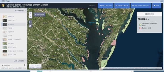 Beginning February 15, 2019, Coastal Barrier Resources System (CBRS) boundaries will no longer be depicted on static Flood Insurance Rate Maps (FIRM) issued by the FEMA. This change to the FIRM will not impact CBRS property determinations nor any applicable prohibitions. FEMA and the U.S. Fish and Wildlife Service (USFWS) are working together to update how users can access the most up-to-date information on CBRS boundaries.
The Coastal Barrier Resources Act (CBRA) was passed by Congress in 1982 to encourage conservation of hurricane-prone, biologically-rich coastal barriers. CBRA prohibits most new Federal expenditures that encourage development or modification of coastal barriers. Therefore, most new or substantially improved residences, businesses, or other developments in the CBRS are not eligible for certain Federal funding and financial assistance, including coverage under the National Flood Insurance Program (NFIP).
FEMA has historically shown CBRS boundaries on coastal FIRM. Many coastal communities use the FIRM to locate CBRS boundaries in addition to understanding information about flood zones. However, FEMA does not maintain the official CBRS maps and is therefore not the most up-to-date source of information about them. The authoritative source for CBRS boundaries is USFWS. A static, legacy FIRM should not be used to make determination decisions regarding CBRS boundaries. Using out-of-date information to find out whether a property is eligible for flood insurance under the NFIP could potentially have serious financial impacts.
Property owners are generally made aware of the CBRS designation affecting their property when they obtain a mortgage that requires flood insurance. However, there is no Federal mandate for the disclosure of a CBRS designation by State and/or local officials or realtors at the time of purchase or construction. FEMA and USFWS encourage Federal, State, and local officials to integrate CBRS data into their GIS platforms and other information systems so it is readily available to community officials, developers, property owners, prospective buyers, and others.
The official CBRS maps may be downloaded on the USFWS website at https://fws.gov/cbra/maps/index.html.
The most up-to-date CBRS boundaries can be found via the USFWS’s online CBRS Mapper tool at https://fws.gov/cbra/maps/Mapper.html.

On November 19, 2018, FEMA’s Recovery Support Function Leadership Group (RSFLG), the Program Management Office (PMO), and External Affairs launched https://recovery.fema.gov/. This interactive website was created to display and track Federal interagency supplemental disaster funding for recent hurricanes (Harvey, Irma, Maria) as well as the California wildfires that occurred in 2017.
This new website allows users to view which Federal agencies received disaster funding from Congress and how they spend those funds on recovery activities. There are four different pages on the website:
- The Spending Explorer page allows users to get a better sense of how Congress distributes funding to agencies and how agencies spend that funding on activities that fulfill their missions.
- The State Profiles page allows users to gain insight into disaster funding that falls within certain States or territories to better understand historical flood risks and financial impacts.
- The Funding in Action page highlights real stories about how Americans are working to build resiliency after devastating events through an active Federal interagency and a whole-community approach.
- Finally, the Glossary page contains an alphabetized list of terms and definitions related to recovery and supplemental disaster funding, which is helpful as users navigate the site.
Visit FEMA’s new website today to learn more about recovery activities and Federal disaster funding!
|
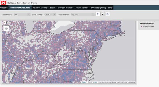
In January 2019, the U.S. Army Corps of Engineers (USACE) released an update to the National Inventory of Dams. The 2018 National Inventory of Dams (NID) is now available here.
The NID was populated using 116th Congressional District information. State and Federal dam regulators provided their data from May to November 2018 for inclusion in the 2018 database, which includes more than 90,000 dams nationwide. Major changes to the 2018 NID include allowing users to download or export certain NID data and to view the hazard potential classification.
 The NID consists of dams meeting at least one of the following criteria:
- High hazard potential classification - loss of human life is likely if the dam fails
- Significant hazard potential classification - no probable loss of human life due to dam failure but can cause economic loss, environmental damage, disruption of lifeline facilities, or other concerns
- Equals or exceeds 25 feet in height and 15 acre-feet in storage
- Equals or exceeds 50 acre-feet storage and 6 feet in height
Congress first authorized the USACE to inventory dams in the United States with the National Dam Inspection Act of 1972. The NID was first published in 1975, with several updates as resources permitted over the next ten years. In subsequent years, the Water Resources Development Act, National Dam Safety and Security Act, Dam Safety Program, and the Water Resources Reform and Development Act provided various authorizations allowing USACE to maintain and periodically publish an updated NID. USACE also began close collaboration with the Federal Emergency Management Agency (FEMA) and State regulatory offices to obtain more accurate and complete information. To learn about dams in your community and to view the updated NID inventory, please visit http://nid.usace.army.mil.
The Delaware Department of Natural Resources and Environmental Control (DNREC) has introduced a new tool called the Delaware Living Shorelines Monitoring Framework to help landowners, professionals, and scientists develop plans to gauge the success of living shoreline projects installed throughout the State. Living shorelines are a shoreline stabilization technique to counter the effects of erosion, while creating additional coastal habitats and improving water quality in the process. The living shorelines approach is regarded as a natural, “soft” alternative to previously used “hard” shoreline stabilization techniques and yields greater environmental benefits.
 DNREC’s Division of Watershed Stewardship, in partnership with public and private environmental organizations, created this step-by-step framework in an effort to outline identification and prioritization guidelines for living shorelines project goals. The monitoring framework will help to assess if a living shorelines project is progressing to meet development goals, and the framework will suggest specific approaches to increase the performance of a living shorelines project if it is falling short of development goals. The Delaware Living Shorelines Committee also offers trainings and workshops, including two online trainings for property owners and professionals.
In a press release from DNREC and the State of Delaware, DNREC Secretary Shawn M. Garvin stated:
“Living shorelines are the foundation of a unique, natural environmental strategy to counter erosion. As the strategy for installing these evolves, the monitoring methodology created by the Delaware Living Shorelines Committee will help ensure the creation of more effective and resilient shorelines in the future.”
The Living Shorelines Monitoring Framework can be found on DNREC’s website and is built for a wide range of users and projects, with the goal of creating custom monitoring plans for each living shorelines project.

The District of Columbia is a national leader in many areas related to resiliency and planning. In past issues of the Resilience Report, we covered innovative flood studies and initiatives led by the DC Silver Jackets and highlighted green stormwater infrastructure projects undertaken by DC Water. In this issue of the Resilience Report, we had a conversation with Kevin Bush, Chief Resilience Officer, about his role to keep resiliency and changing future conditions at the forefront of local projects and decision-making in the District. We also had a chance to discuss the development of the DC Resilience Strategy, which was just released on April 29 and is available at resilient.dc.gov.
Q: Could you tell us about your position, Resilient DC, and how both were created?
Kevin: Mayor Bowser applied to join The Rockefeller Foundation’s 100 Resilient Cities program in 2016. DC beat out 1,000 cities worldwide and, as a result, the Chief Resilience Officer position and Resilient DC were both created. The program was created in the aftermath of Hurricane Sandy and reacted to how cities globally were experiencing a number of major new changes and threats, such as more severe and extreme weather events. 100 Resilient Cities is dedicated to helping cities around the world become more resilient to the physical, social, and economic challenges that are a growing part of the 21st century, which is crucial as we are all more interconnected than ever before.
100 Resilient Cities provided funding for the Chief Resilience Officer position. I entered this role in 2017 after leading the U.S. Department of Housing and Urban Development’s (HUD) climate adaptation work. In this role, I serve as a central advisor in the Mayor’s office and work with the District’s various departments and agencies to make sure that we do everything we can to strengthen our city’s immune system and make us better prepared. Many organizations or government agencies have the tendency to operate in silos, but my role is to ensure that the agencies and departments of the District are coordinating on resilience initiatives whenever possible. Our aim is to design projects that address multiple objectives. This allows for a more efficient use of resources and opens up the opportunity to combine multiple sources of funds, like FEMA PDM and HUD CDBG.
Q: The District’s Resilience Strategy was released on April 29, 2019. Could you tell us about the process you used to develop this strategy?
Kevin: As I mentioned earlier, resilience is like the immune system of the city. If our city is healthy, then it will be better able to withstand a major shock. Our first step was to better understand DC’s unique challenges and opportunities for building resilience. We catalogued existing plans and work, from the All-Hazard Mitigation Plan to Climate Ready DC. We asked community leaders and government agencies where they saw room for improvement. Then, we identified five big, probing questions about the District, such as: “How can we institutionalize climate action?”; and “How can we continue to grow economically but use growth to address existing inequality?” We organized multi-sector groups to focus on each of the five questions to identify best practices, conduct additional studies and literature reviews, and assess ways we can build resilience. We then took these findings, went back to our stakeholders and came up with a broad vision for resilience. Our mission, to thrive in the face of change, led us to a set of goals and objectives that are organized around being resilient to different types of change, including: growth, climate change, and digitization. We then sought public input throughout this stage, held workshops in all eight wards, and received comments from over 1,000 people online. We ultimately cross-referenced goals, objectives, and actions with other plans to identify overlap and solidify our strategy.
Q: What are some of DC’s high priority issues or actions identified in the Resilience Strategy?
Kevin: The Resilience Strategy has four goals that set generational ambition. All are oriented around change. The goals are related to inclusive economic and population growth, climate action, technological change, and health and safety. In terms of technology, workforce automatization, cyber security, autonomous vehicles, and transportation network companies are all topics we consider when thinking about the District’s future.
For an example of an action, we are developing a data-driven approach to target investments in areas where the urban heat island effect is most intense. This may include a variety of projects, such as green stormwater infrastructure improvements, green roofs, and cooling centers with public drinking fountains. We are also developing a $5 million integrated flood model for the District which will help us better understand pluvial, riverine, and coastal flooding. FEMA’s flood maps give us an understanding of coastal and riverine flooding, but interior flooding in the District is very complex. We plan to incorporate a wide range of data sources into the model, such as information on stormwater infrastructure and pipe diameters, which will enable us to run very detailed scenarios. For example, we could examine how sea level rise could cause a blockage in a storm drain outlet – then determine which neighborhood would flood as a result.
Q: The Resilience Strategy was informed by many other plans and studies. How will the Resilience Strategy be integrated into other strategies and planning processes?
Kevin: We plan to integrate the Resilience Strategy into other plans and programs where appropriate, particularly if it could lead to funding. The State Transportation Improvement Program and the All-Hazards Mitigation Plan are examples of this. Our unique status as both a state and a city provide us access to pots of funding that you normally wouldn’t associate with a city. For example, we have a Wildlife Action Plan that enables us to receive certain federal funds. We could incorporate aspects of the Resilience Strategy into that plan. Each of our plans has the potential to unlock additional sources of funding that could be layered, so we will look for key opportunities where integrating the Resilience Strategy could provide a benefit.
Q: What advice would you give to other local leaders that are trying to make their communities more resilient to natural or human-made hazards?
Kevin: My biggest tip would be that communities really need to take a holistic approach to addressing issues surrounding resilience and not work in silos. Not only can this provide cost efficiencies and open doors to additional funding, but it also increases our capability to address and deal with these issues. Emergency management departments shouldn’t be the only organization in a community focused on changing future conditions and their potential impacts.
Note: The interview above has been edited for length.
|
Links, programs, or other information provided in the newsletter are not necessarily endorsed by FEMA and FEMA is not responsible for the accuracy of any links or information provided.
|