|
Don't let the shorter days and longer nights keep you in - it's even more important to get out for some fresh air. Wrap up warm, go for a stroll on the path and enjoy those glowing winter sunsets. Views from the path during autumn and winter just hit different. Read on for ideas on where to walk during the festive holidays and useful resources to help you plan your next Wales Coast Path ramble. 🎄
 |
|
A simpler way to travel between North and South West Wales. The TaithCymru bus service starts on 25th October from Bangor in the north to Carmarthen in the south west. Stops include Caernarfon, Porthmadog, Aberystwyth and Aberaeron - coastal towns with onward public transport links and great places to explore on the path. |
Feed your Wales Coast Path obsession....choose from official guidebooks and maps to help you plan your walk, path inspired accessories, stylish organic cotton t-shirts and warm cosy hoodies for those colder walks - we've got you covered.
Our best sellers? The official completion certificates and badges - they're the perfect memento of your journey on the path. Browse the shop today for that perfect festive present for your hiking partner or a treat for yourself!
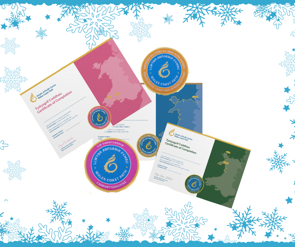 completion certificates and badges
Looking for somewhere on the path that's a bit easier to walk on, less muddy option when the weather's been horrible, or somewhere with a buggy or mobility equipment? Try the north Wales section between the seaside town of Prestatyn and Llanfairfechan (about 40 miles/67 kms altogether). Following mainly boardwalks, promenade, sealed surfaces and shallow gradients, this section of path offers plenty of coastal views and cafe stops. Here's our suggestions:
-
Prestatyn to Gronant Dunes - 4 miles / 7km of boardwalk, footpaths and some sandy areas. Great for birdwatching, bring binoculars if you have them.
-
Colwyn Bay to Llandudno - 6 miles / 9 km passing through the seafronts of Colwyn Bay, Rhos on Sea and Penrhyn Bay with plenty of places to eat and drink along the way.
TOP TIP: Use the interactive map to see where the path is near you (follow the purple line) and use Google Street View to check what the path looks like before you go.
 Prestatyn seafront
Here's a round up of what's available to help you plan your walk on the path:
- Interactive map - See where the path goes, plot your route to measure how far it is in miles and kilometeres.
- Distance tables - Check how far it is between major towns and villages to plan any rest stops ovr overnight stays.
- Wales Coast Path app - Download the app to help navigate the path without getting lost, record your walks and see how much you've walked and use it to plan the rest of your walks.
- Temporary path diversions - Check for latest news on which sections are closed and the alternative routes.
- Official guidebooks - Choose from 7 guidebooks to rearch your next section to walk. Welsh language guidebooks are also available for the Llyn Peninsula and Pembrokeshire sections.
The seal pupping season (when seals are born) is between August and December. It's likely you'll see them on the beaches, feeding and resting whilst their mother is in sea, but still keeping a watchful eye on her pup. If you see them when you're on the on the path, the best thing you can do is give them space and keep dogs on a lead.

Looking for a circular walk near you? We got you. Our circular walks start and end in the same place - where there's suitable parking or with public transport options. Why not try these out for the festive period ahead with friends and family - ideal for getting some fresh air at the seaside, in between the turkey and the tinsel! Watch this Porthcawl video for inspiration, or this one in Llanelli in Carmarthenshire.
 Millenium Coastal Path, Llanelli, Carmarthenshire
Looking to use up some holiday before your leave year ends? Check out these multi day walks - ideal as part of a long weekend away this autumn or ready for when the weather gets better. Here's some ideas to whet your appetite:
- 25 mile walk between Valley and Four Mile Bridge, Anglesey. Highlights include South Stack lighthouse, Holyhead maritime museum and the sea arches Bwa Gwyn and Bwa Ddu.
- 31 miles between Pwllheli to Aberdaron on the Llyn Peninsula. Highlights include quieter walking route, cliff top terrain, sandy beaches and Plas Glyn y Weddw art centre.
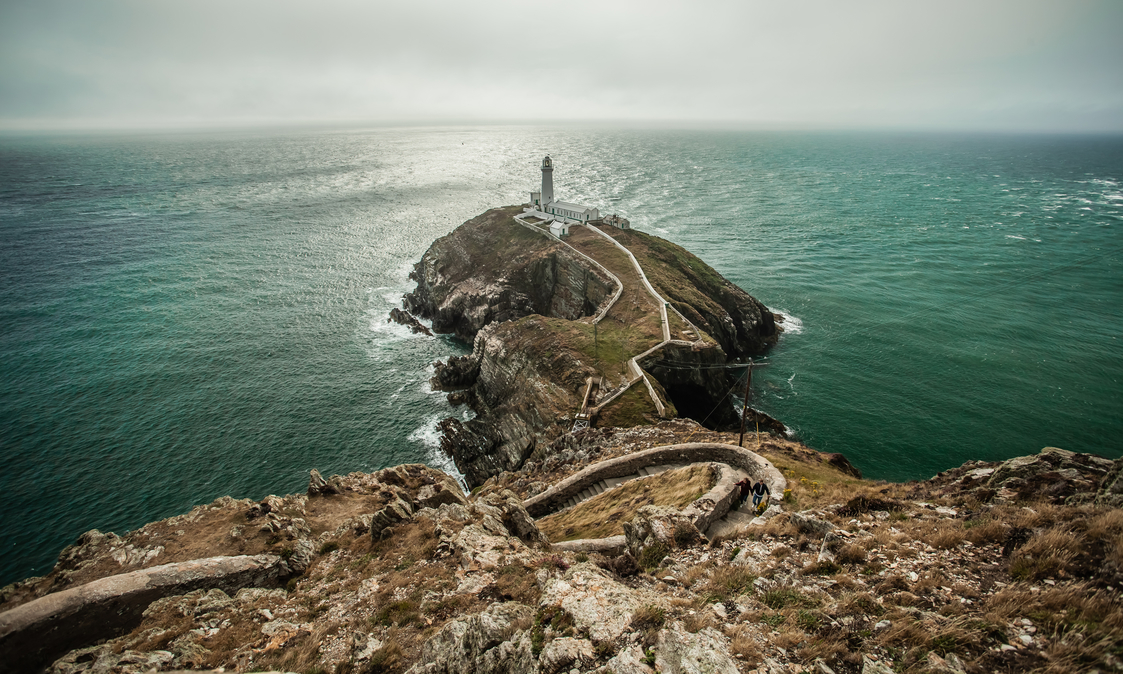 South Stack lighthouse, Anglesey

Want to learn more about the area around you?
The Wales Ambassador Scheme is free online course designed to learn more about the unique characteristics of Wales. It's a great way to learn about where you live with interesting facts about the path along the coast. Open to everyone and free to sign up, you can work through the course at your own pace. You'll be flying the flag for Cymru with your newly found knowledge!
|

Coming soon...Where you can walk nearly 100 miles of the path using the train.
Use the Cambrian Rail line between Pwllheli and Aberystwyth to walk nearly 100 miles of the path. In our next newsletter, we'll give a breakdown of how it can be done.
|
We welcome any feedback on these newsletters, good or bad. Tell us where we can improve them for you! Contact Us
Subscribe to business bulletins by going to “Projects” and tick the box for "Wales Coast Path".
They are open to all sectors: hospitality, tourism, accomodation providers, public sector and any business interested in the path and the National Trails in Wales (Offa's Dyke Path, Glyndŵr's Way and Pembrokeshire Coast Path).
Expect easy and practical ideas aimed at maximising business opportunities on the path, with free downloadable partner marketing materials, alongside top tips to increase your online profile to let customers you're here for all their hiking needs!
|
 |
|
Events See what’s happening on the path with our online events calendar.
Have you got an event on or near the Wales Coast Path? Submit a Suggest an Event form to us and we’ll promote it on on our website (subject to approval).
|
|