|
Spring has arrived, despite a rainy and stormy start. May is National Walking Month - we love the better weather (fingers crossed!), the longer daylight hours and listening and seeing nature waking up from it's winter slumber. Here's some practical info to make the most of your time on the path. Tie up your boots, fill your backpack with drinks and snacks and let's get walking!
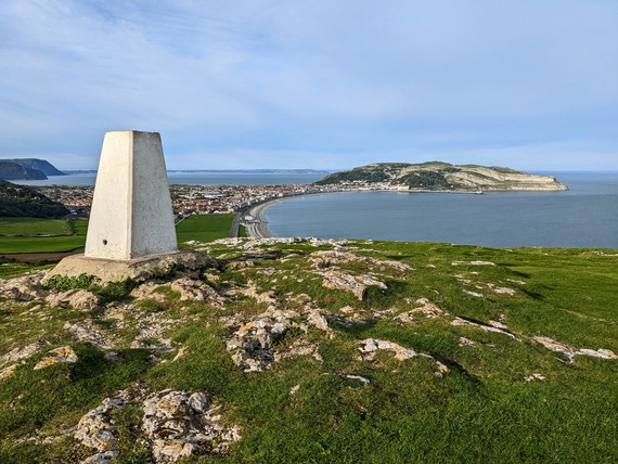 Little Orme overlooking Great Orme, Llandudno, North Wales
Sometimes, it's good to go round in circles! We've created over 30 new circular walks as a way to experience the Welsh coastline, providing inspiring views and new perspectives without having to double back or use public transport. They often take in coastal towns, villages and places of interest you may not experience while walking the main path.
We've also teamed up with Ordnance Survey, Great Britain's national mapping agency to put them literally on the map. With a OS account (free sign up), you'll be able to:
- See the route on an OS interactive map
- Check the route profile for elevation gain
- Save routes for later
- Export a GPX file
We've also put together information on other circular walks on Anglesey, Pembrokeshire and the Llyn Peninsula and Ceredigion sections of the path. There's plenty to choose from!
 Train in Criccieth (Transport for Wales)
Parts of the path can easily be explored using trains and buses without the hassle of parking your car.
By Train
-
Walk 100 miles between Pwllheli and Aberystwyth using the train by using the Cambrian Line (operated by Transport for Wales) - the perfect way to explore this section of path without the hassle of parking cars. Find out more about the Cambrian Line
-
Rail to Trail - Leave your car behind and check out our list of train stations along the coast (operated byTransport for Wales) and get directions from the train station to the path. Find out trains stations along the path
By Bus
 The official Wales Coast Path app tracks your walking adventures in one place. Coming soon! The new app features include:
- Add retrospective walks - add your walks you've done in the past into the app.
- Transfer your walking data from one phone to another (useful if you've changed mobile phones!).
- Saves on battery - you can track your walk and use your phone at the same time.
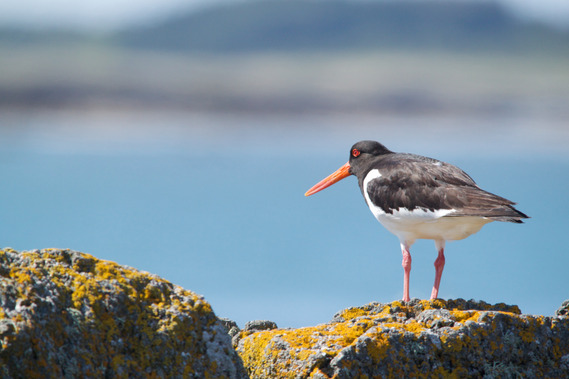 Oystercatcher (credit Tom Hibbert)
The birds and butterflies can be your best walking buddies. The Dee Estuary in north Wales is one of the best places to watch birdwatch along the path between Chester and Point of Ayr (Talacre lighthouse). Our guest blog by Our Dee Estuary Partnership gives you a fascinating insight into the birds you can see and hear along this section of the path during springtime.
Calling all businesses and organisations
If you're located near the Wales Coast Path or National Trails in Wales (Glyndŵrs Way, Pembrokeshire Coast National Trail and Offa's Dyke Path), this survey is for you. We want to understand what businesses and organisations need, to make the most of their location and the opportunities that the path and the National Trails provide.
 |
|
Events See what’s happening on the path with our online events calendar.
Have you got an event on or near the Wales Coast Path? Submit a Suggest an Event form to us and we’ll promote it on on our website (subject to approval).
|
|