|
|
Welcome to Issue #3 of the New LIFE for Welsh Raised Bogs Project Newsletter. In this issue we will share project success stories with you and the work we're doing across Wales.
|
|
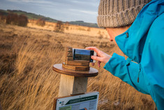
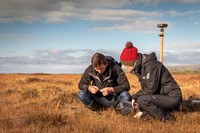
The LIFE Welsh Raised Bogs Project is asking visitors to become citizen scientists and take part in real scientific research.
We have now started restoration work on two important raised bogs in Ceredigion - Cors Caron National Nature Reserve (NNR) and Cors Fochno, which is part of the Dyfi NNR.
The project wants visitors to record these restoration changes by taking a photo from one of two Picture Posts on each site and share them with the project.
The photos will be used to create a time-lapse film to show the changes that take place on these important sites.
To read the press release in full click on this link.
|
|
|
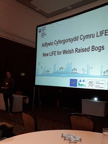
In October we attended the 2019 IUCN UK Peatland Programme Conference in Belfast.
The conference is a partnership with the DAERA, Pennine PeatLIFE and Northern Ireland Water . The event provided a forum for policy makers, scientists, land managers, practitioners, businesses and communicators to connect and share their knowledge, expertise and enthusiasm for peatlands.
Jack Simpson who is LIFE Welsh Raised Bogs Project Officer presented on the third day. His presentation discussed the use of our new wetland harvester as a restoration tool in controlling Molinia (purple moor grass), which fits part of a wider programme of work on our seven project sites.
If you would like to find out more about the presentations from the conference please visit the website.
|
|
|
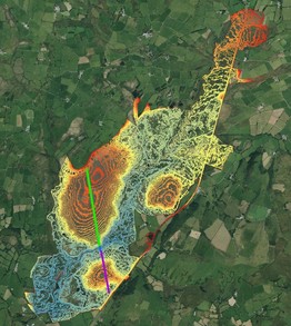
Light Detection and Ranging (LiDAR) is an airborne mapping technique, which uses a laser to measure the distance between the aircraft and the ground.
Up to 100,000 measurements per second are made of the ground, allowing highly detailed surface and terrain models to be generated at different spatial resolutions.
The image on the left shows the contour lines (provided by LiDAR data) of all three raised bog domes on Cors Caron National Nature Reserve (NNR).
We use these types of images to provide us with information about the sites so that we are able to create a plan of targeted restoration work on specific areas.
The blue shades show low land and in particular the path of the river Teifi running through the reserve. The orange and red contour lines show the higher land.
The largest raised bog dome (the West bog) on Cors Caron is approx. 280 hectares in size, the two smaller domes are about 96 hectares (south east – bottom) and 97 hectares (north east – middle right) in size. The whole reserve is 800 hectares.
The second image (below) of the graph shows a cross section of the west and south east bog domes, and the difference in height between both.
|
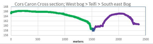 On the LiDAR image there is a straight green, blue and purple line and in the graph you can also see these coloured lines. The green line shows the height of the west bog dome being approx. 166 metres above sea level, then as it goes down towards the Teifi, noted by the blue colour, it is approx. 158 meters above sea level. The purple line crosses the south east bog dome and rises to 165 metres above sea level in height again. The height of both domes can be seen from this graph.
These images are a bit like fingerprints, an impression left on the land as its formed over thousands of years. Each dome creats its own unique identity as it rises gradually from the surrounding land and river.
LiDAR data is freely available on the Lle Geo-Portal for Wales
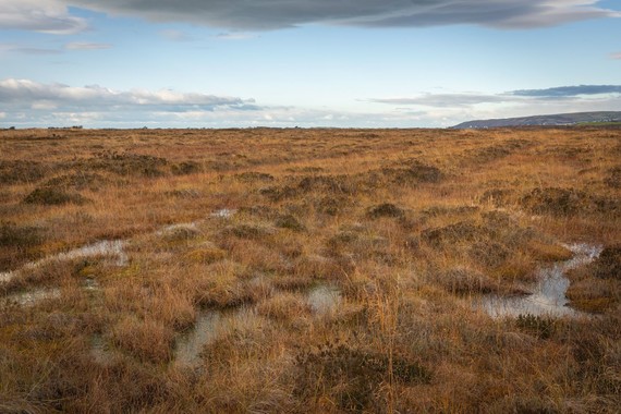
In November we commissioned multi award winning UK landscape and wildlife professional photographer Drew Buckley to take photos of Cors Fochno near Borth.
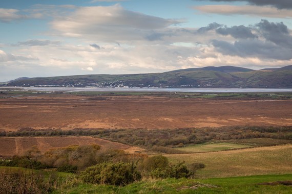 We were very lucky to have good weather and fantastic light on the day, and above and below is a selection of the images that were taken. Thank you to Drew for his patience and help, we are delighted with the images.
In the New Year we will be out and about on Cors Caron with Drew taking some more photos, and we'll share these with you here when we have them.
 If you have any images of any of our sites and would like to share them with us please send them to LIFEraisedbogs@cyfoethnaturiolcymru.gov.uk
We have a vacancy in the team for a LIFE Assistant Project Officer based in Ynyslas near Borth.
As a member of the team you will help us deliver the ambitious programme of practical peatland restoration, monitoring and stakeholder engagement work.
This is an excellent opportunity for someone looking to start their career in conservation. Deadline is 9 February 2020. Good luck!
|
BORTH: Join us and Cletwr to celebrate World Wetlands Day on Sunday 2 February from 10am to 5pm. The free event will be in the Cletwr café in Tre’r-ddol near Talybont. Find out more here |
|
 |
 |
|
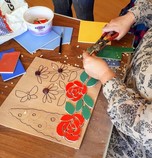
TREGARON: Come and create Cors Caron bog art with us on 18 and 20 February between 10am and 3pm in Tregaron Family Centre and Tregaron Memorial Hall. Find out more by visiting our Facebook and Twitter pages. |
|
|
|
You have received this newsletter because you have previously subscribed to one of our services.
If you no longer wish to receive newsletters from us, you can unsubscribe at any time.
If you would like to receive the next LIFE Welsh Raised Bog newsletter in Welsh, please subscribe to this newsletter again, selecting ‘Welsh’.
If you are happy to receive further LIFE Welsh Raised Bog newsletters from us, then you don’t have to do anything.
|
|
|
|