| March is Flood Insurance Awareness Month in Oklahoma. The OWRB encourages all Oklahomans to learn more about floodplain development regulations and make informed decisions about flood insurance and flood preparation. Get prepared before a flood occurs: (1) determine if you live in or near a floodplain, (2) check flood insurance status, and (3) make a plan for what to do in the event of a flood. More resources can be found on the OWRB's Drought and Flooding web page.
Water use report forms for 2023 have been mailed to all water permit holders in the state. OWRB staff has been busy processing fee payments and reports that are arriving in bulk by mail and in person to meet the March 15 deadline. The information on each report includes both the amount of water used the previous year and the purpose of the water use (beneficial use). This information provides a valuable resource for local, regional, and state water planning activities, such as tracking supply and demand from state water resources and determining trends for industry water use.
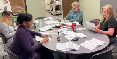 OWRB staff process water use reports and fee payments for 2023.
As part of the CWSRF's strategic planning efforts and to ensure adequate funding for Oklahoma's wastewater infrastructure, the OWRB is issuing a call for eligible wastewater projects and other pollution control/water quality activities that may require funding between State Fiscal Years (SFY) 2025 and 2029. Interested entities can place eligible projects onto the CWSRF Project Priority List (PPL). Learn more.
The Oklahoma Comprehensive Water Plan (OCWP) team completed its second round of public meetings in December. Over the coming year, the OCWP team will follow up on discussion items from the meetings, explore other priority topics, present data and findings from technical studies, and discuss recommendations to include in the OCWP. Learn more.
OWRB monitoring staff were highlighted in a recent article by the Environmental Monitor, an online publication for environmental professionals. The article focuses on ongoing data collection by the OWRB's monitoring teams that allows them to support various studies and spot trends. Sara Dexter, OWRB Environmental Programs Manager, discusses the agency's stormwater monitoring project with the city of Norman, as well as the OWRB's partnership with the Grand River Dam Authority to monitor dissolved oxygen downstream of Pensacola dam to meet federal guidelines. Read the full article.
Posted to Faceboook on March 11, 2024
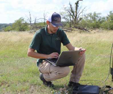
Celebrate National Groundwater Awareness Week! Jon Sanford, OWRB Hydrogeologist, collects water level data in the Elk City Sandstone aquifer in west-central Oklahoma. Hydrologic investigations are conducted by the OWRB to determine the amount of fresh groundwater available for appropriation and track changes in the state's aquifers over time.
 Posted to Facebook on March 7, 2024
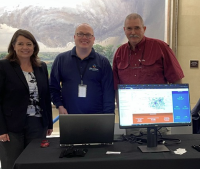
Today we had the opportunity to showcase our GIS products during GIS Day at the Capitol. Our Interactive Maps web page features ArcGIS Viewers, Dashboards, and StoryMaps designed to help users drill down to the water information they need and build customized maps or data collections to view or export. Our latest offering is a dashboard that shows infrastructure needs by legislative district. The data on this viewer were collected via the Oklahoma State Flood Plan, Oklahoma Comprehensive Water Plan (OCWP) Clean Water Needs Survey, and OCWP Water Supply Infrastructure Needs Survey. The maps show projects such as dams, levees, storm drains, and other vital infrastructure. Julie Cunningham, Derrick Stark, and Scott Roberson (pictured left to right) were on hand during the event to talk about these tools and the importance of mapping the state's water resources activities and infrastructure.
 Posted to Facebook on March 4, 2024 (condensed)
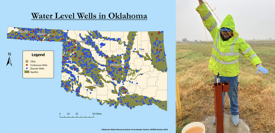
The OWRB Groundwater Section leads a comprehensive water level surveillance network that spans decades and miles across Oklahoma. The Discrete Network contains water level data dating back to the 1960s! With nearly 850 wells spanning major and minor aquifers, our annual check unveils insights into long-term changes and trends. Our Continuous Network is our eye on the present and future. With 46 wells monitored hourly in 22 major Oklahoma Aquifers, this near-real-time data equips us with information to ensure sustainable water practices and make informed decisions that benefit our communities. Visit our data hub to explore our data and maps.
 Posted to Facebook on March 1, 2024
The OWRB initiated the Water System Infrastructure Mapping Program in 2015. This program allows OWRB staff to work with water system managers to map the water, wastewater, storm water, and water reuse infrastructure utilized by cities and rural water systems serving populations of 3,300 or less. OWRB personnel work with water system employees to collect locations and other pertinent information about all water and wastewater infrastructure such as valves, meters, water hydrants, and wastewater access (manholes, etc.). Infrastructure is mapped using Trimble GPS data loggers with sub foot accuracy. Benefits include the following:
- Preservation of infrastructure location knowledge over time
- More efficient location of infrastructure during line break events
- Increased efficiency of water line leak detection and/or wastewater line inspection
- Accurate information for planning for future system needs
- Accurate information for determining water/wastewater service availability for new customers
 Posted to Instagram on February 29, 2024
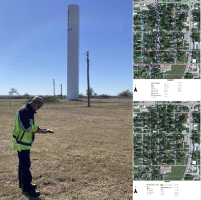
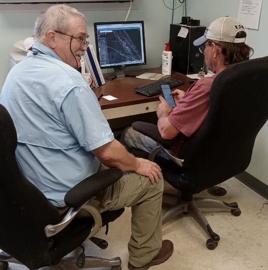
OWRB GIS Manager Scott Roberson with Cody Benge, System Manager for Logan County Rural Water District 2. Scott is delivering the system's new map and training staff on its use. The district, located south of Crescent, serves 1500 citizens through 600 active meters. The new digital map will help preserve infrastructure location knowledge over time, facilitate efficient location of infrastructure during line break events, facilitate efficient water line leak detection, provide accurate information for planning for future system needs, and provide accurate information for determining water service availability for new customers.
 Posted to Instagram on February 27, 2024
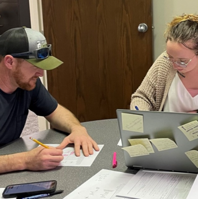
OWRB permitting specialist Carissa Walker assists a western Oklahoma irrigator with a permit application. Schedule your one-on-one appointment at WaterPermitting@owrb.ok.gov.
 Posted to Instagram on February 27, 2024
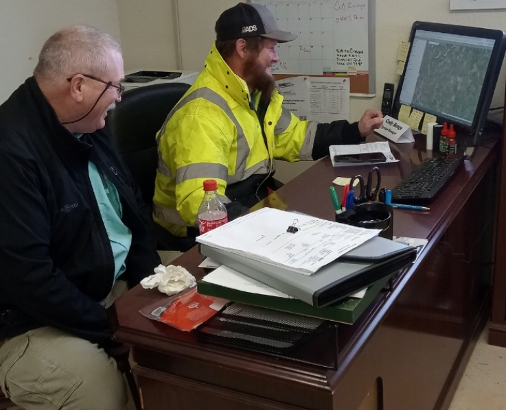
OWRB GIS Manager Scott Roberson delivers a digital water system map to Wagoner Co. RWD #7 and trains employees on using both the desktop version and the mobile app. Read more about the OWRB's Water System Infrastructure Mapping Program.
 Posted to Facebook on February 23, 2024
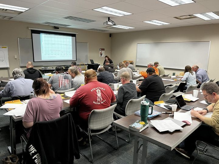
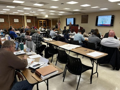
This week was the start of our monthly Floodplain Management courses being taught all across the state for the remainder of the year. If you are a floodplain administrator for a community, surveyor, realtor, engineer, emergency management, or anything in between in need of training, please join us for a day full of learning about different topics in Floodplain Management, whether that is in our 101, 202, or an OFMA Special Topics Course! Sign up today.
 Posted to Facebook on February 14, 2024
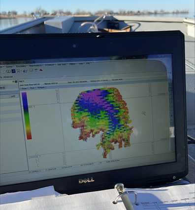
OWRB Lake Monitoring staff are conducting a bathymetric survey on Lake Hefner. Bathymetric surveys help determine water depth and topography of the bottom of reservoirs.
This information is critical to accurately determine sedimentation rates, water and flood storage, dependable yield for water users, and maximum quantity of water available during drought.
 Posted to Facebook on February 13, 2024
OWRB Floodplain Management and FEMA are hosting their annual FEMA L-273 course this week in OKC. Floodplain administrators, engineers, and others are gathering to learn the intricacies of floodplain management. The course provides comprehensive and structured training to individuals with limited floodplain management experience.
 Posted to Facebook on January 29, 2024
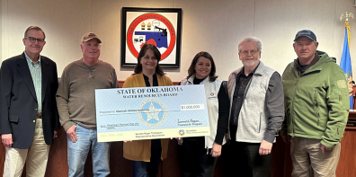
Senator Roger Thompson and Representative David Smith joined Julie Cunningham and Joe Freeman to present a ceremonial check for a $1,000,000 American Rescue Plan Act (ARPA) grant to Okemah Utilities Authority (UA) for water system improvements. Appearing in the photo (left to right) are Joe Freeman (OWRB), Ronnie Lucas (Okemah UA), Kirsty Lesley (Okemah UA), Julie Cunningham (OWRB), Senator Roger Thompson, and Representative David Smith.
 Posted to Facebook on January 17, 2024
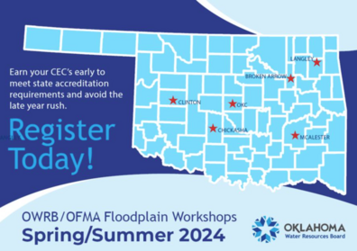
Floodplain Administrator Training classes for 2024 have been posted on the OWRB website! According to Oklahoma's accreditation requirements, floodplain administrators are required to obtain 6 Continuing Education Credits (CECs) per year. Find a class near you and register today!

The monthly Oklahoma Water Resources Bulletin, a summary of current conditions related to drought and flooding, was published on March 14. Highlights included the following:
- All climate divisions received less than 50% of normal rainfall for the past 30-day period (2/13-3/13/2024). The Panhandle was the lowest at 13% of normal rainfall.
- According to the drought monitor, 70,900 Oklahoma residents are in drought (3.82% of the state in area).
- The Palmer Drought Severity Index (PDSI) and Standardized Precipitation Index (SPI) show all OK climate regions are near normal or wetter.
- No burn bans are in effect as of March 3, 2024.
|
For more information, visit Drought.ok.gov.
|