|
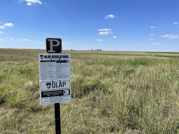
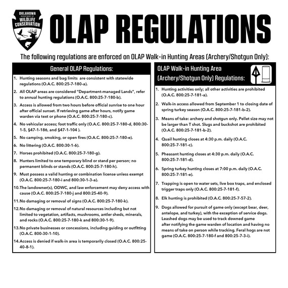 Please review the 2023-2024 Oklahoma Hunting and Fishing Regulations (pages 30-31) before entering OLAP Walk-in Areas. Regulations signs (above) are posted at parking/entrance areas. It is the hunter's responsibility to consult regulations prior to use.

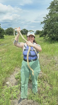
I wanted to introduce myself to everyone now that I have taken over as the Biologist for the OLAP. My name is Joshua Luft and I started with the ODWC in April 2022 as the NW Technician with the OLAP. I took over as the Biologist in February 2024, and I am looking forward to continuing the vision of the program.
I have been hunting and fishing my whole life and I have a 9-year-old Fox-Red Pointing Lab named Buster. I love taking him out to Duck, Pheasant, and Quail hunt, but I also really enjoy Deer and Turkey hunting. Over the last 10 years, I started to hunt public lands almost exclusively. This has given me a great appreciation for the resource and benefit that public lands can provide to hunters. As a public land hunter, I look forward to working on the OLAP and I am excited to help provide hunters more opportunity.
|
We have a new technician who will start working for the OLAP and ODWC on April 15. She will be stationed in the NW around the Woodward area and will be responsible for maintaining and managing the OLAP properties in the NW region of the state.
Here is a little more about her:
"My name is Mona Meiser, I grew up in Norman Oklahoma on a farm where I learned to appreciate nature and wildlife. I furthered my education at Oklahoma State University obtaining my bachelors in May of 2023 in Natural Resources Ecology and Management, with a focus on wildlife ecology and management. Since May, I've traveled working for wildlife in different agencies through Texas and Kansas. I'm so excited to be back in Oklahoma and also to be advancing my career further working for the ODWC."
|
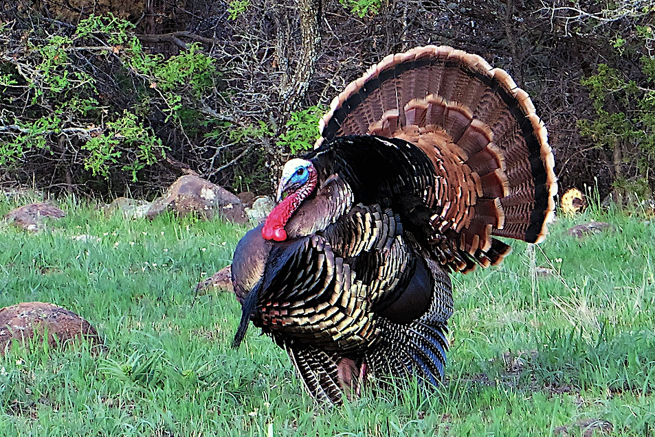
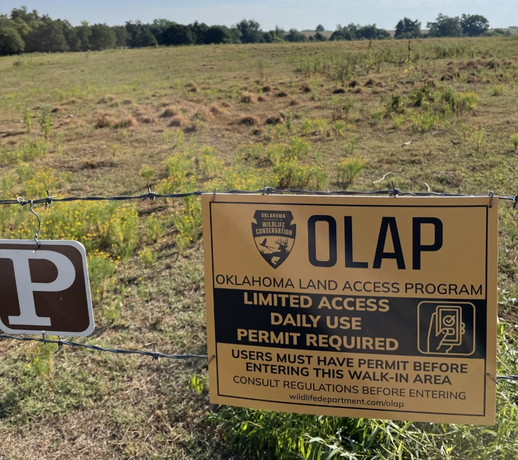 Photo: Jeff Tibbits
OLAP Limited Access offers archery/shotgun only opportunities for close-to-metro and wetland walk-in areas. Currently, all Limited Access walk-in areas are subject to the same regulations as Archery/Shotgun Only walk-in areas.
A hunter can reserve an open "seat" at a location on a given date, and the hunter can bring one guest. Once you select a location/date, please complete the check-in information form. The entire check-in process is done within Go Outdoors Oklahoma; no additional paper sign-in is required at the Walk-in Area. Being checked in on Go Outdoors Oklahoma generates the digital "Daily Use Permit" that game wardens can automatically access. When your hunt is over, log back in to Go Outdoors Oklahoma to check-out. You cannot reserve another seat until you've checked out.
NOTE: Check-in is only required at Limited Access areas, i.e., "yellow signs", not all of OLAP.
How it works:
- Limited Access is now a daily check-in (no more drawings) on a first-come, first-serve basis.
- Check-in for a specific day opens 2 days before that day at 8:00 am.
- The number of available seats will shift according to the hunting season. For example, a walk-in area might allow more hunters on the tract during dove season in September versus duck season in December.
Click the link below to watch a YouTube tutorial on OLAP Limited Access Check-in
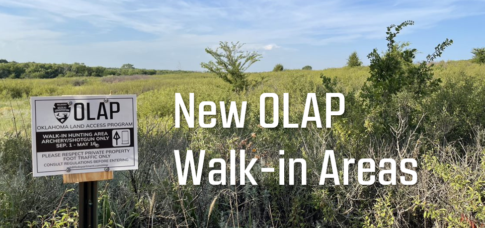 New OLAP Walk-in Hunting Areas (Archery/Shotgun Only):
 |
|
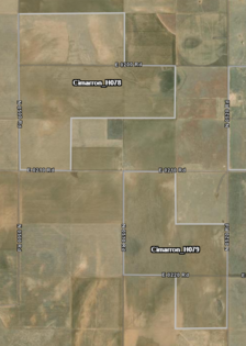
Cimarron_H078: 960 acres
Walk-in Hunting Access: Archery/Shotgun Only
Crops and Playa Wetland. Playa is enrolled in the CRP-SAFE (Wetland) program.
Cimarron_H079: 640 acres
Walk-in Hunting Access: Archery/Shotgun Only
Crops and Playa Wetland. Playa is enrolled in the CRP-SAFE (Wetland) program.
MAP LINK
.
|
 |
|
Multiple properties in Cimarron, Texas, Noble, Pawnee, and Kay counties have been removed from the OLAP. Please consult the OLAP Map Directory to access the 2023-2024 maps.
NOTE: The OLAP map is always up-to-date.
|
|
|
|
The ODWC has recently succeeded in changing the regulations to how hunting licenses work in the state. Many licenses/tags have been consolidated into one singular tag. For example, the annual hunting license was previously $32, and to archery hunt for deer, you had to pay an additional $20 per deer tag (6 total, 2 bucks, 4 does for a total of $120 if you harvest all six deer). The new system will be $36 for an annual hunting license and $36 for an archery permit. This new permit will include all of the deer you are legally allowed to harvest in the year (6 total, 2 bucks, 4 does) with a bow. Click here for more information on the Wildlife License Modernization Act
Along with this license change, comes a change to the regulations for all OLAP properties. All OLAP users will now require an annual Land Access Permit to access OLAP properties. The closer we get to the 2024-2025 hunting season, the more details we will have about the new access permit. We will keep you up to date as the regulations change and we find out more details on how the new system will work.
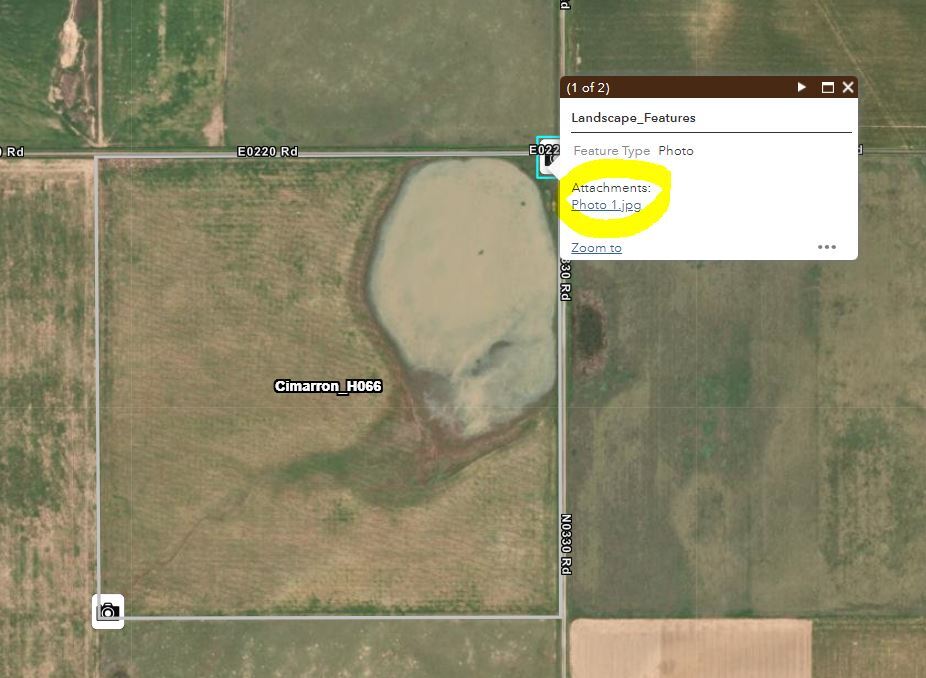 The OLAP Maps now have photos! Click on the camera icon to bring up the attribute table and then click on the attachment (see above, circled in yellow). This works on both desktop and the mobile Field Maps app.
|
|
|
Remember to click on walk-in areas and icons to bring up more information, including access types, dates, habitat information, specific comments/instructions, and photos. This function is available when accessing maps on a computer or via the mobile app (ArcGIS Fields Maps).
An advantage of using the Fields Maps app is that it shows the user's location on the map (desktop version does not). Additionally, users can drop map pins to assist with navigation.
|
Review the maps before entering the walk-in area. Get a good feel for the property boundaries, topography, changes in land use (farming or ranching), etc.
Boundaries may consist of a change from grassland to agriculture, a mowed strip, etc. Some walk-in areas may not have fences for OLAP boundary signs, and it's the responsibility of hunters to know their location and the walk-in area's boundaries.
Use the free ArcGIS Field Maps App to bring the OLAP Walk-in Areas to your mobile device (data signal required). Once the app is installed on your device, search the Maps for "OLAP" and select "ODWC OLAP Web Map 2023-2024". Also of note, you can search for "ODWC WMA" to view WMA maps in this app as well.
Click below to download the ArcGIS Field Maps App on your Apple or Android mobile device.
|
|
|
|
|