|
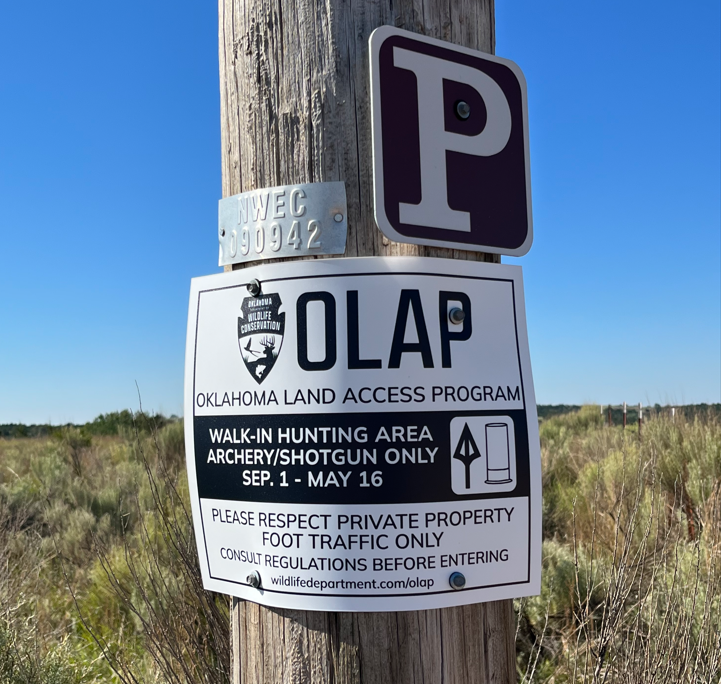 Photo: Joshua Luft
|
|
OLAP signs have been updated to reflect the new ODWC logo and updated access dates (Sep. 1 - May 16). Older signs will be replaced throughout the 2022-2023 season. |
|
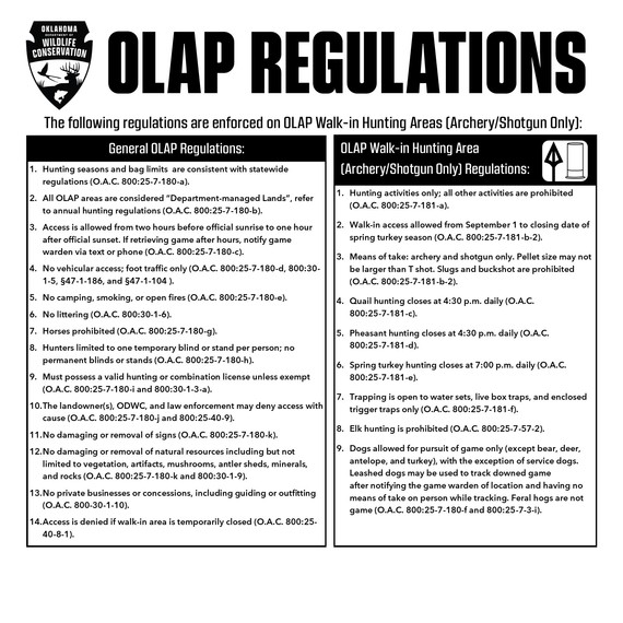 Please review the 2022-2023 Oklahoma Hunting and Fishing Regulations (pages 30-31) before entering OLAP Walk-in Areas. Regulations signs (above) are posted at parking/entrance areas. It is the hunter's responsibility to consult regulations prior to use.
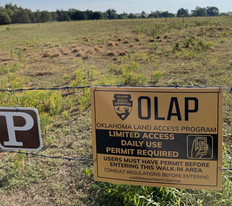 Photo: Jeff Tibbits
OLAP Limited Access will open to the public by October 1, 2022. A newsletter update will be emailed once registration for daily permits is made available on the OLAP webpage.
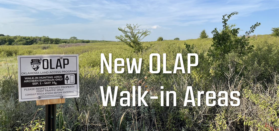 New OLAP Walk-in Hunting Areas (Archery/Shotgun Only):
 |
|
Multiple tracts of CRP grassland added in Texas county, totaling 3,200 acres.
Walk-in Hunting Access: Archery/Shotgun Only
MAP LINK
Texas_H023, Texas_H024,
Texas_H030, Texas_H031,
Texas_H032, Texas_H033,
Texas_H034, Texas_H035,
Texas_H036, Texas_H037,
Texas_H039, Texas_H040
|
 |
|
Woodward_H010: 202 acres
Woodward_H011: 3,100 acres
Walk-in Hunting Access: Archery/Shotgun Only
MAP LINK
Native grass with creeks, canyons, and shrub thickets.
|
 |
|
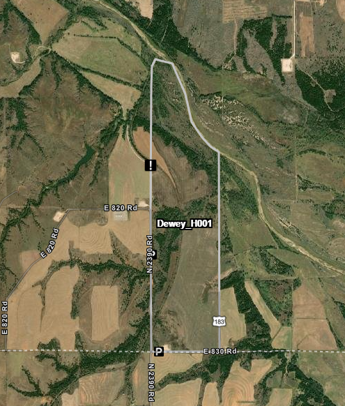
Dewey_H001: 515 acres
Walk-in Hunting Access: Archery/Shotgun Only
MAP LINK
Cotton field with wooded edges and river bottom.
|
 |
|
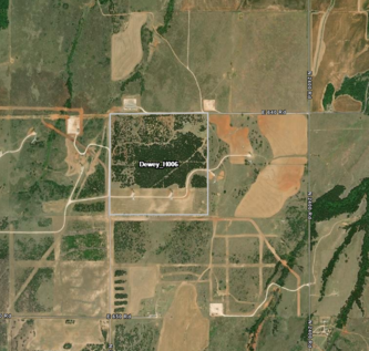
Dewey_H006: 160 acres
Walk-in Hunting Access: Archery/Shotgun Only
MAP LINK
Native grassland w/cedar and woody cover.
|
 |
|
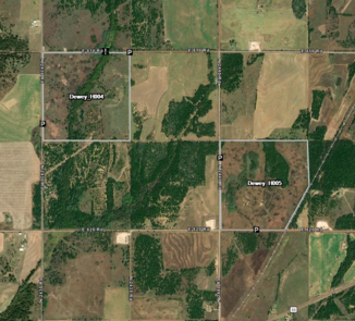
Dewey_H004: 160 acres
Dewey_H005: 150 acres
Walk-in Hunting Access: Archery/Shotgun Only
MAP LINK
Native grassland with plum thickets and deciduous tree cover.
|
 |
|
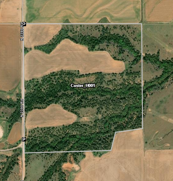
Custer_H001: 160 acres
Walk-in Hunting Access: Archery/Shotgun Only
MAP LINK
Fallow cotton field with wooded canyons.
|
 |
|
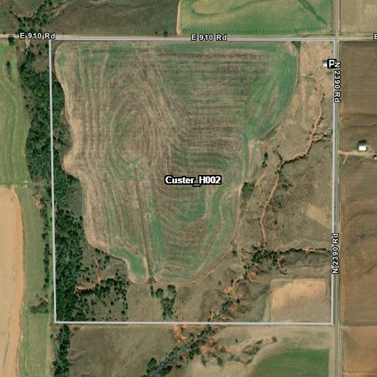
Custer_H002: 160 acres
Walk-in Hunting Access: Archery/Shotgun Only
MAP LINK
Milo ag field with native grass rangeland and wooded creek.
|
 |
|
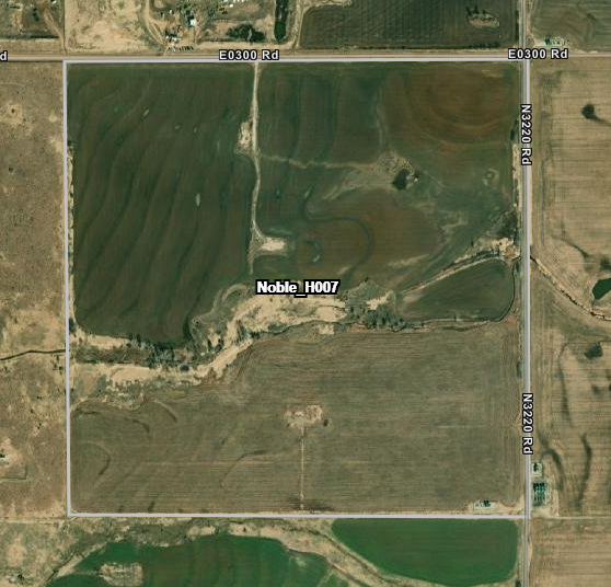
Noble_H007: 160 acres
Walk-in Hunting Access: Archery/Shotgun Only
MAP LINK
Milo ag field with native grass rangeland and wooded creek.
|
 |
|
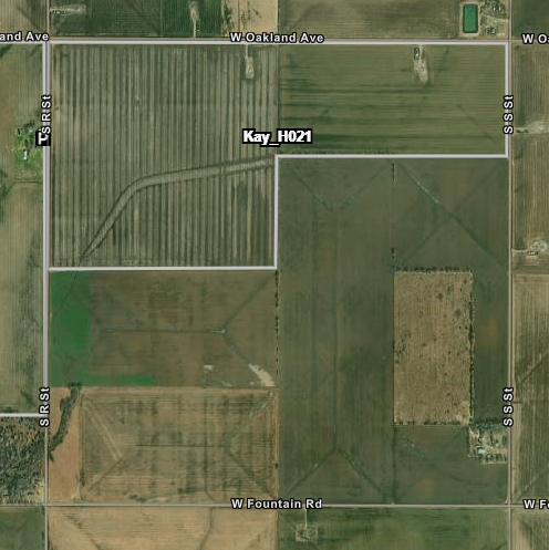
Kay_H021: 160 acres
Walk-in Hunting Access: Archery/Shotgun Only
MAP LINK
Cropland with wooded edges.
|
 |
|
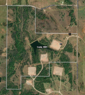
Grady_H001: 180 acres
Walk-in Hunting Access: Archery/Shotgun Only
MAP LINK
Native grassland with shrub thickets, wooded creeks, and ponds.
Note: Park at the northeast corner of the oil pad, as noted on the map. No other parking or road access is allowed.
|
 |
|
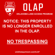
Multiple properties in Cimarron, Noble, and Kay counties have been removed from the OLAP. Please consult the OLAP Map Directory to access the 2022-2023 maps. |
|
|
|
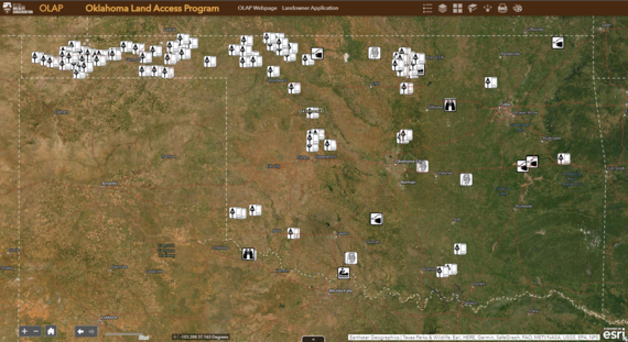
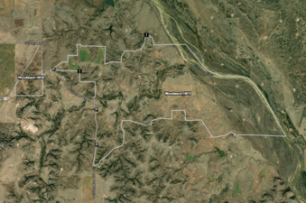
Remember to click on walk-in areas to bring up more information, including access types, dates, habitat information, specific comments/instructions, and photos. This function is available when accessing maps on a computer or via the mobile app (Explorer for ArcGIS).
|
Review the maps before entering the walk-in area. Get a good feel for the property boundaries, topography, changes in land use (farming or ranching), etc.
Boundaries may consist of a change from grassland to agriculture, a mowed strip, etc. Some walk-in areas may not have fences for OLAP boundary signs, and it's the responsibility of hunters to know their location and the walk-in area's boundaries.
Use the free ArcGIS Explorer App to bring the OLAP Walk-in Areas to your mobile device (data signal required). Once the app is installed on your device, search the Maps for "OLAP" and select "ODWC OLAP Web Map 2021-2022".
Click below to download the ArcGIS Explorer App on your Apple or Android mobile device.
|
|
|
|