
May 2025 Blue Thumb Newsletter
Oklahoma Conservation Commission sent this bulletin at 05/09/2025 01:58 PM CDT
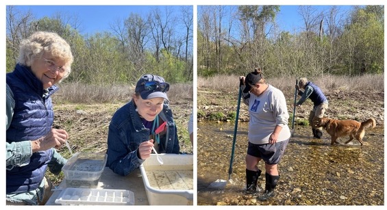
From the Volunteer CoordinatorWhat is bankfull? When you see a stream with water up to the tops of the banks, that is often thought of as a “bankfull” condition. However, in stream science, "bankfull" is usually defined a bit lower—at the normal high water line, often marked by where well-established perennial vegetation begins. So, when a stream is full to the brim, it may even be past bankfull! This is a timely subject for lots of places in Oklahoma as this, for many, has been a wet spring. I have particularly been watching Polecat Creek in south Tulsa County. The stream I monitor, Coal Creek, between Jenks and Glenpool, flows into Polecat Creek and Polecat flows into the Arkansas River. Yesterday I did my stream monitoring, and Coal Creek at Morris Park was about two feet from being completely full. My monitoring location has an almost 90 degree bank on the left, then a gentle slope on the right, so as I made my way to the stream, I had to stop short of the normal monitoring spot by around seven feet. There was NO WAY to safely monitor at the beginning of my riffle*, so I did what Blue Thumb protocol asks us to do in a high water situation. I monitored from where I could safely reach the water. Because it was still raining, I did what had to be done outdoors and then I took the sample inside for completion. I made it a point to drive past Polecat Creek going home, and I slowed down to check it out. Polecat Creek was at or over bankfull. Another few drops of water and Polecat would have been out of its banks. Apparently that did not happen, as I heard nothing of flood watches for yesterday evening, and there have been plenty of flood watches during April. It is a sight to see when a stream is carrying all the water it possibly can as it moves toward where it will empty into another stream or river. The typical April in Tulsa County sees 3.6 inches of rain. April of 2025 received 10.99 inches of rain – much more than normal! Because I am interested in rocks, I will be slinking about the banks of Coal Creek once the waters submerge – because lots of things will have moved about during the high flow. *My riffle did not exist anyway in the massive amount of water. Shrumming Up the Net It is fun to have a job with variety. I have had my seines in the back of the truck for a few days and laid them out in the sun to dry and air out. Sometimes seines can take on an unpleasant odor. Seines that have been allowed to airdry have a kind of nice, outdoorsy odor. I had used my seines at “Watercress Fest” in south Delaware County on 4/26. I was invited to this event with the specific request to introduce attendees to the creatures that live in the headwaters of Snake Creek. To successfully do this, I needed seines for fish and a kicknet for the bugs. I had helpers for pulling the seine. It is necessary to have help, although I did once catch a green sunfish and a mosquitofish when doing this alone, but that story is for another day. My take from the creek was small – four redbelly dace and two orangethroat darters, both males in breeding colors. And we caught a large crawdad and several other aquatic larval insects with the kicknet. It was enough to have an interesting display of life in the creek. Many visitors came by, and many enjoyed meeting the fish and the creek bugs. I too had a very good day. Back to the dry nets – I took these from their places around the state truck and began the task of “shrumming” up the nets. This is simply the piling of one piece of seine over the nearest pole, over and over again until both poles are together and the net can be carried without wrapping around the carrier’s feet. I can never shrum up a seine without pausing to appreciate the many tasks I do that keep my job from being humdrum or routine. Cheryl Cheadle
|
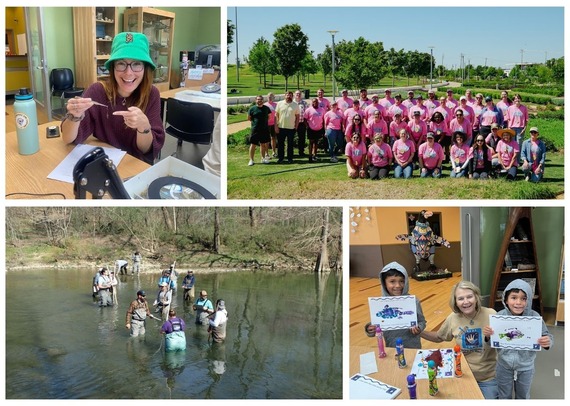
From the QA OfficerFish Collections! It is nearing summer which means FISH COLLECTIONS!!!!!! We will be fishing in the Central Irregular Plains Ecoregion this summer: east Tulsa, Claremore, Bartlesville areas. If you’d like to join us on a fish collection, please contact me. I plan to start scheduling these soon and I can keep you in the loop if you have a particular day(s) or site you’d like to help with. Our timeframe is June 1 - mid October, but we usually try and end before college starts so we can utilize our summer intern. Here is a list of sites we have in mind to fish this summer:
Rain and Water Quantity in Watersheds With ALL this rain a lot of the state has been receiving, be safe when monitoring. Know what is upstream of you, land use and watershed size. Maybe where you monitor hasn’t received much rain but upstream in the watershed has. If you monitor in a big watershed and in the middle or towards the end of that watershed, there might be a lot of water coming into that creek. If the land use is more impervious surfaces (city), then the creek level is usually more flashy, quick rise and quick fall. If you monitor in a more rural area, then the creek might keep rising for many hours or day(s) as it takes longer for rainwater to move through the ground and feed back into the nearest creek. Be mindful of this, watch/tune-in to the weather a couple hours and/or days before you monitor. We’d like you to monitor during rain events, see what non-point source pollution you might be able to detect, but most importantly we want you to be safe while monitoring. Kim Shaw
|

How Do Streams and Rivers Get Their Names?
How do streams and rivers get their names? Well, it depends. I poked around on the internet a bit to find out how some of Oklahoma’s streams and rivers got their names. In some cases, the source of the name is obvious because the name describes the stream or river. Examples include the Muddy Boggy, the Salt Fork and the Red River. Several streams in Oklahoma have Native American names. An example is the Neosho River, which is probably derived from an Osage word and means “clear, cold water.” The Medicine Lodge River is named for a large hut built by the Kiowa people who valued the river for its healing properties. Winter Camp Creek is named for a Cheyanne and Arapaho settlement that was located on its banks. Some streams are named after individuals. I assume James Fork, Lee Creek, Joe Creek and Fred Creek are all named after individuals, although some of their stories may be lost to time. We also have creeks in Oklahoma with French names, like Fourche Maline, which means “treacherous fork” and “Poteau,” which is the French word for “post.” Many rivers and streams are named after animals: Cow Creek, Bird Creek, Wolf Creek, Beaver River, Elk River, and Turkey Creek to name a few. Sometimes creeks are named after an event. According to Wikipedia, Skeleton Creek got its name in 1867 when settlers found the bones of Wichita Indians who had died in a cholera outbreak. Sometimes rivers are named according to where they originate, a place they flow through, or where they join another water body. The headwaters of the Arkansas River are in Colorado. The river flows through Kansas, Oklahoma, and Arkansas before its confluence with the Mississippi River. Intuitively, there is an Illinois River in Illinois, but the Illinois River in Oklahoma is apparently named after the Illinois Indians, even though the Illinois Indians were not regular inhabitants of the area. Rather than originating in Illinois, our Illinois River originates in northwest Arkansas. Some creek names sound like a story begging to be told. For instance, I would love to hear how Dirty Butter Creek got its name. Do you know how your creek was named?
Happy monitoring!
Rebecca Bond
Blue Thumb Director

Join us for a whole watershed experience in the beautiful Illinois River watershed near Tahlequah. We will travel through the entire watershed to learn how we impact our waters all while gaining valuable new resources for the classroom. Educators will receive 24 hours of professional development, new tools for the classroom, and an experience like no other! For questions, contact Jeri Fleming or Jacklyn Smittle. To register, click here and scroll down to select Riverology.
|
|


| Stay Connected with Oklahoma Blue Thumb: | ||||
 |
||||
|
SUBSCRIBER SERVICES: |
||||