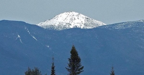
Photo of Mount Marcy courtesy of Tom Lake
In this issue:
We entered Spring this week thought the Vernal Equinox, an astronomical moment that has played a major role in the birth and evolution of the Hudson River Almanac.
3/20 – Essex County, HRM 302: Thirty-two years ago today, at the Adirondack Park Visitors Information Center in Newcomb, the Hudson River Almanac was born. Why did we choose the Vernal Equinox? It seemed to us that the Vernal Equinox was the first day of a natural year. What better day to have an anniversary than the first day of Spring?
Sandra Bureau was the VIC’s manager; Mike Corey was the Educator, Interpreter, Biologist, and all-around Scientist. Mike became the first contributor to the Almanac with his stories of encounters with the magical, memorable wildlife of Arbutus Lake, Rich Lake, Huntington Wildlife Forest, and Goodnow Mountain.
- Tom Lake
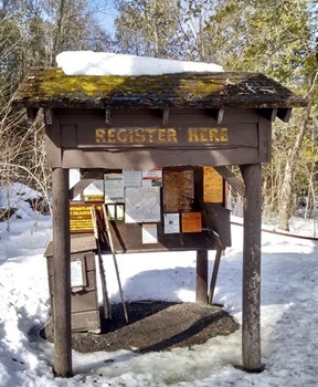
Photo of trail to Mount Marcy
3/7 – Millbrook, HRM 82: Hundreds, probably a thousand black birds were foraging in the newly exposed grassy fields now that the snow had melted. It was their spring surge. In addition to red-winged blackbirds and common grackles, the flocks included brown-headed cowbirds and starlings — “blackbirds” all. We could also hear the constant chatter of recently returned red-winged blackbirds (Kon-ker-ree) in nearby wetlands. It was full-on spring.
- Tom Lake
3/7 – Orange County, HRM 41-44: Right on cue, our first snow geese arrived at the Black Dirt on their journey north from their DelMarVa wintering home. By evening, Linda Scrima and Travis Rubio reported the flock had grown to 500 birds including one Ross’s goose. They also found eleven tundra swans at the Wallkill River National Wildlife Refuge’s Liberty Loop and a greater white-fronted goose at the Camel Farm.
- Matt Zeitler
[By the time I arrived the next morning (3/8), I estimated there were now more than 1,200 snow geese. Matt Zeitler]
[Tundra swans (Cygnus columbianus) are often called “America’s native swan.” Their common name refers to their summer nesting range north of Hudson Bay in the Arctic tundra. They can usually be heard calling long before they are seen, which leads to another frequently used colloquial name, “whistling swan.” David Sibley remarks that distant flocks sound like “baying hounds.” Tundra swans are occasional visitors to the Hudson Valley during late winter-spring and fall migrations. Tom Lake]
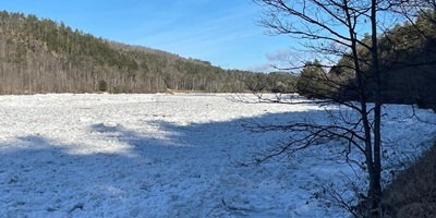
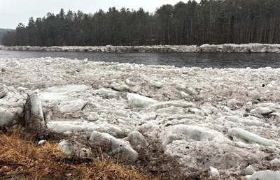
3/13 – Warren County, HRM 245: I was hiking around with a group of other folks on Friday the 13th along the Hudson River’s Ice Meadows. For a mile or two south of The Glen (Route 28 bridge) the river was open but bordered by fifteen-foot ice cliffs. Downstream the river was choked with frazil ice, backed up nearly to the road. The scene was breath-taking.
- Mike Corey
[The Ice Meadows is a natural grassland that is presumably made possible by ice and water-scouring of the cobbles and edges that kills or at least flattens shrubs and trees. This results in the ground being open to the sun all summer, unlike in the nearby forest, and a wide variety of plants can grow in different habitats. Among these plants are uncommon to rare boreal species such as the sticky tofieldia (Triantha glutinosa), an endangered species in New York.
These habitats include cool and moist areas of late-lasting ice banks, hot and dry gravel and cobbles, acid, seepy areas, calcareous wet and dry places, and crevices in acid and calcareous ledges. Their north-facing undercut banks often cling to their ice well into spring. [Naturalist James Briggs related a story to me from 30 years ago, when the last fist-size piece of ice, almost like permafrost, melted on Memorial Day. Tom Lake]
Photo of The Ice Meadows courtesy of Mike Corey
3/13 – Croton-on-Hudson, HRM 34: Four days ago, I was tickled to see a half-dozen tree swallows skimming the Croton River at its confluence with the Hudson. This morning, in a sleety rain, more than a hundred were looking for a meal. Welcome back!
- Christopher Letts
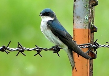
[The tree swallow (Tachycineta bicolor) is found across North America, and they winter as far south as Panama. They eat mostly insects, with some mollusks, spiders, and fruit. Flies make up 40% of the diet, many caught in flight, supplemented with beetles and ants (A. Turner 2000).
Photo of tree swallow courtesy of Brad Imhoff
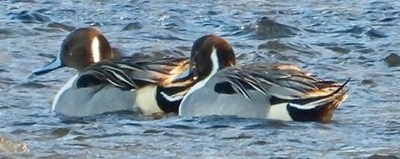
3/14 – Saratoga County, HRM 173: I had a great morning at Wright’s Loop off Route 4 in the Town of Stillwater, a very special birding spot along the Hudson River. Today’s visit featured black ducks, northern pintails, common wigeons, wood ducks, Canada geese, and a white-fronted goose.
- Katrina Van Tassel
Photo of Northern pintail courtesy of Katrina Van Tassell
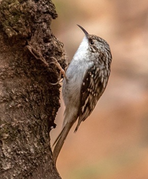
3/15 – Orange County, HRM 42: This morning I took a couple of short hikes; I was hoping for red crossbills, but I came up empty. I headed to the Middletown Reservoir Trails for the first time (thanks to Ronnie DiLorenzo for the tip). I enjoyed walking a three mile loop; my best bird was red-breasted nuthatch. I was also able to get a few shots of an accommodating brown creeper.
- Matt Zeitler
Photo of brown creeper courtesy of Matt Zeitler
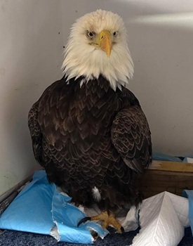
3/16 – Manhattan, HRM 2.2: I was on Little Island this morning near midday (14th Street and the West Side Highway) when I spotted an adult bald eagle sitting on an ice floe in the Hudson River. As I watched, I thought it was quite odd that it did not attempt to fly away.
It was not until days later, when I learned of the successful bald eagle rescue from the icy river on February 17, that I made the connection.
- Susan Hereth
[Susan’s tip and her photo verified her observation suggesting that the male bald eagle (W73) was, for no less than two days and nights in below freezing temperatures, marooned and incapable of flight while being pushed and pulled by the river’s tides. In a bit of serendipitous timing, the NYPD Harbor Unit’s rescue on February 17 occurred at the exact start of the ebb current (0932), a current that could have carried the eagle on the ice out through The Narrows to be lost at sea. Tom Lake]
Photo of bald eagle (W73) courtesy of Kristi Ward
3/17 – Hudson River Estuary: James Boyle of the Atlantic States Marine Fisheries Commission (ASMFC) issued their second weekly report of the season for East Coast River Herring (blueback herring and alewives). These are both river herring, primarily adults, returning, heading up the coast from their wintering waters.
The first report (10,585 blueback herring) came from the St. Stephen fish lift in the Santee River at St. Stephen, SC. This week’s report notes the first 19 alewives (Alosa pseudoharengus) of the season from Bride Brook, East Lyme, CT. As the river herring move north, many will pare off into the Hudson River while others will move on north into New England waters.
- Tom Lake
Photo of alewife courtesy of Tom Lake
3/18 – Manhattan, HRM 1-2: Hudson River Park’s River Project staff checked our research gear (pots and traps) today that we deploy from floating docks on the south-side of Piers 26 and 40. The 2026 season marks the beginning of our 37th year of the Hudson River Park’s ongoing fish ecology survey.
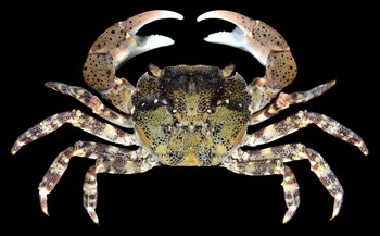
While fish remained absent from our traps, today’s catch featured crabs including fourteen (10-30 millimeter) Pacific shore crabs (Hemigrapsus sanguineus), one common spider crab (10 mm), as well as several mud crabs and grass shrimp. The traps were also covered with many amphipods, which we hope will attract some additional organisms to our gear in the coming weeks.
-Toland Kister, Renee Mariner, Hudson River Park CUNY Interns
[Crab measurements (size) are calculated in millimeters (mm) point-to-point across their carapace. Tom Lake]
[Note: One-inch equals 25.4 millimeters (mm). Tom Lake]
Photo of Pacific shore crab courtesy of NOAA
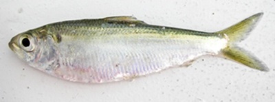
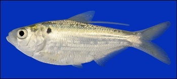
3/19 – Hudson River Watershed: Fish-of-the-Week for Week 358 is the gizzard shad, Dorosoma cepedianum (Lesueur, 1818), number 30 (of 240) on our watershed list of fishes. If you would like a copy of our list, e-mail - trlake7@aol.com.
The gizzard shad was formerly one of nine herrings (Clupeidae) in our watershed and the only true freshwater herring. In a taxonomic reassessment of the herrings, the nine species were scattered into four families: Alosidae (shads), Clupeidae (herrings, sardines, menhadens), Dussumieriidae (round herrings), and Dorosomatidae (gizzard shads and sardinellas). Our gizzard shad was relegated to the latter family along with the Atlantic thread herring (Opisthonema oglinum).
Adult gizzard shad can reach 22-inches and weigh 5 lbs. They are found in many East Coast watersheds and have been introduced throughout much of the Midwest via the Mississippi River watershed. The gizzard shad is nonnative in our watershed and believed to have made its way into the estuary decades ago via the Intra-coastal Waterway from Delaware Bay or points south, or through the New York State canal system from Lake Erie (CL Smith 1985). J.R. Greeley, in his A Biological Survey of the Lower Hudson Watershed (1937), could not find gizzard shad in the lower Hudson. Their Type Site is Chesapeake Bay from where Charles-Alexandre Lesueur first described the gizzard shad to science.
Their peculiar common name comes from their stomach that is not unlike the gizzard of certain birds, as well an epibranchial pouch near their gills that serves as a food storage organ (CL Smith 1985).
In April, when Hudson Valley bald eagle nests swell with nestlings and there is an added urgency for food, the river is conveniently filled with fish. Gizzard shad are a winter favorite of bald eagles due to their vulnerability to the rigors of a northern winter, frequently succumbing to a phenomenon known as “winter kill” (hypoxia). Studies have shown (Jester and Jensen 1972) “high mortality rates at water temperatures below 2.2 degrees Celsius (C), or 35.96 degrees Fahrenheit (F).” Eagles find them floating belly-up and unresponsive in the river and they make for an easy catch.
- Tom Lake
Photo of gizzard shad courtesy of NJ DEP
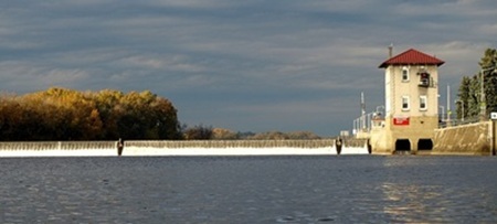
3/20 – Green Island, HRM 153: The first moment of spring arrived at 10:46 a.m. and we were at the head-of-tide, 160 miles inland from the sea, watching the river tumble over the Federal Dam at Troy. The ebb current was running, and it was still two hours from low tide.
An immature bald eagle made a low pass over the plunge pool at the foot of the dam. Within weeks, the pool will be teeming with river herring in from the sea seeking their headwaters spawning grounds. Many will pass upriver through the dam’s lock, the first of many locks to come, and eventually swim out into the Mohawk River.
- Tom Lake, Phyllis Lake, Tommy Jackson, Benjamin Jackson
Photo of Federal Dam at Green Island courtesy of Tom Lake
3/20 – Warren County, HRM 245-251: We made it to the Ice Meadows where the Hudson River begins its climb up to the High Peaks of the Adirondacks. It was shortly after Spring had arrived and we were in a driving rain. The river was open and flowing to the sea, as it ran through 10-foot-high walls of frazil ice on either side (one week ago the cliffs were 15-feet high).
We have on occasion walked across the river on the Vernal Equinox, a crunchy but otherwise silent trek but not one to be taken without first assessing the strength of the ice. All the while, no less than 12 feet below our boots the river was racing seaward. It was reminiscent of walking on a glacier.
- Tom Lake, Phyllis Lake, Tommy Jackson, Benjamin Jackson
[The sculptor of the Ice Meadows is frazil ice. It forms in parts with tiny frozen balls of ice that build up in supercooled and turbulent water every winter in deposits up to 20-feet-thick. Evelyn Greene calls the ice balls “Wonderful,” perhaps as much for their mystery as their sparkling appearance. “They are solid ice all the way through, translucent ice but when the sun hits them they are a brilliant white.” Tom Lake]
Photo of The Ice Meadows courtesy of Tom Lake
3/20 – Hudson River Watershed: With direction from Fran Dunwell, the Hudson River Almanac began on the Vernal Equinox of 1994 and has been an ongoing forum for capturing defining moments of the seasons. For the first eight years (1994-2002), the Almanac was a yearly printed volume published by Purple Mountain Press. In the years since, the Almanac has been a free weekly DEC natural history journal distributed via e-mail.
The scope of the Almanac is such that defining its role in the public discourse has never been simple. Perhaps our original definition was best: The Almanac seeks to capture the spirit, magic, and science of the Hudson River Valley from the High Peaks of the Adirondacks, 320 miles to the sea. Adding a bit more detail:
The Almanac has as its primary focus in science and education. It documents in chronological fashion (i.e., field notes from a journal), the seasonal phenology of natural history through personal contributions from a vast corps of volunteers.
Our Almanac represents an opportunity to forge a process whereby we can “check the pulse” of the watershed, not just what lives in the valley, but what they are up to. Much of these data are anecdotal and would otherwise be lost, and with their loss would go their value as a teaching medium.
- Lavett Smith, in Fish Watching (1994), suggests that “... one key to enjoying any kind of natural history is to keep note on your observations and refer to them frequently.” Edward Abbey, in The Journey Home, observed that “... any good poet in our age at least, must begin with the scientific view of the world, and any scientist worth listening to must be something of a poet, must possess the ability to communicate to the rest of us their sense of love and wonder at what their work discovers. ”
Participating in the Almanac is fun, a life-enriching experience, a forum for sharing special moments with others. It does, however, require some self-discipline.
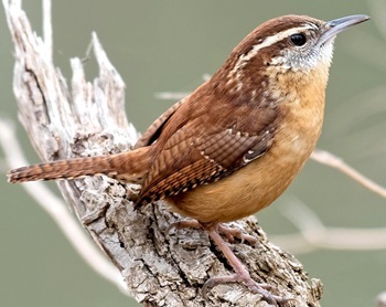
Photo of Carolina wren courtesy of Don Danko
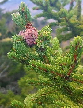
Can you study the night sky, a sunrise, a sunset, a clear pool of spawning alewives, a raft of canvasbacks bobbing among ice floes, a bald eagle nesting in a white pine? Can you find magic in the blooming of a wildflower, hear the song of a Carolina Wren at dawn (Teakettle, Teakettle, Teakettle, Tea), feel the mournful sound of winter wind blowing through conifers, appreciate the symmetry of birds in flight, smell the salt of the sea, absorb the fragrance of Balsam Fir on an Adirondack Mountain trail?
Aldo Leopold in his Sand County Almanac (1949), describes a ceremony of rising at 3:30 a.m. each morning to record the awakening of his “tenants,” the songbirds in the vicinity of his cabin in Wisconsin. With coffee, cup, notebook, and pen, he would sit outside at a bench and record the sequence of songs as each species awoke to proclaim the sovereignty of their territory.
Henry David Thoreau was a self-appointed “Inspector of Snowstorms.” John Muir liked to experience violent storms from the swaying tops of tall Douglas firs. I can think of no better endorsement of such frivolous activities in discovering the enduring, but ever-changing definition of our Hudson River Watershed.
– Tom Lake
Photo of Balsam fir courtesy of Tom Lake
3/20 – Yonkers, HRM 18: Our research and education team at the Sarah Lawrence Center for the Urban River at Beczak began our third week of late-winter surveying for fishes, primarily American eels, migrating in from the sea. Four days this week we set our fyke net overnight in the Beczak Tidemarsh and the net of our catch included 44 “glass” eels, with a high count of 36 today on the Vernal Equinox, the first day of spring. Additionally, we caught two mummichogs (killifish).
Water temperature across the four days ranged from 38-43 degrees Fahrenheit, salinity moved from 2.2 to 4.8 parts-per-thousand, and the dissolved oxygen rose from 13.6 to 14.3 parts-per-million.
- Jason Muller, Christina Tobitsch, Gabrielle Gomez, Hamima Hossain, Stella Sturgill, Vivian Marko, Katie Lamboy, and the EELS Team of Yonkers High Schol students
Science Saturday at Norrie Point Environmental Center
Join us for our monthly Science Saturday programs and explore Norrie Point. Check out our series by visiting the Hudson River website. Events are free and open to the public. Registration is not required. All programs meet at the Norrie Point Environmental Center, 256 Norrie Point Way, Staatsburg NY 12580. Dress for the weather and being outside! Otherwise, no special equipment is needed.
The upcoming Science Saturday programs are:
- Rebecca Houser, Education and Outreach Specialist, HREP and NEIWPCC
Snapshot NY
The NYSDEC, in collaboration with the New York Cooperative Fish and Wildlife Research Unit at Cornell University, has launched Snapshot NY, a citizen science program that allows the public to participate in wildlife monitoring through the deployment of trail cameras. The project will help improve the way DEC monitors and manages more than a dozen wildlife species. For more information on Snapshot NY and how to participate, visit the Snapshot NY website.
Hudson River Lesson Plans
Explore our collection of Hudson River lesson plans, videos and online activities to support hand on investigations of the Hudson River in your classroom.
Hudson River: Striped Bass Cooperative Angler Program
You can share your fishing trip information and help biologists understand and manage our Hudson River striped bass fishery.
Here’s how it works: Fill out a logbook provided by us whenever you fish on the Hudson River (by boat or from shore). You can also use our survey123 app and record your trips using a smart phone or computer.
Record general location, time, gear used, what you caught (or if you didn’t catch anything) and return the logbook when you are done fishing for the season. You’ll receive an annual newsletter summarizing the information in addition to the latest news regarding regulations and the river. Whether you catch-and-release or take home a keeper, you can be part of the Cooperative Angler Program. Online logbook instructions (PDF)
Join today by contacting: hudsonangler@dec.ny.gov
- Jessica Best
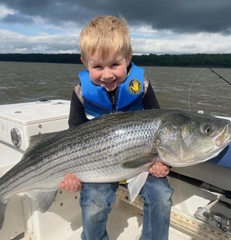
Photo of DEC Angler Program courtesy of Jess Best
Hudson River Miles
The Hudson is measured north from Hudson River Mile 0 at the Battery at the southern tip of Manhattan. The George Washington Bridge is at HRM 12, the Tappan Zee 28, Bear Mountain 47, Beacon-Newburgh 62, Mid-Hudson 75, Kingston-Rhinecliff 95, Rip Van Winkle 114, and the Federal Dam at Troy, the head of tidewater, at 153. The tidal section of the Hudson constitutes a bit less than half the total distance—315 miles—from Lake Tear of the Clouds to the Battery. Entries from points east and west in the watershed reference the corresponding river mile on the mainstem.
To Contribute Your Observations
The Hudson River Almanac is compiled and edited by Tom Lake and emailed weekly by DEC's Hudson River Estuary Program. Share your observations by e-mailing them to trlake7@aol.com.
Was this Newsletter Forwarded to You?
Subscribe today to DEC Delivers Hudson River Almanac topic for weekly natural history journal that covers the Hudson from the High Peaks of the Adirondacks to New York Harbor.
Helpful Resources
National Oceanic and Atmospheric Administration online tide and tidal current predictions are invaluable when planning Hudson River field trips. For real-time information on Hudson River tides, weather, and water conditions from sixteen monitoring stations, visit the Hudson River Environmental Conditions Observing System website.
DEC's Smartphone app for iPhone and Android is now available at New York Fishing, Hunting, and Wildlife App.
|