March 2018
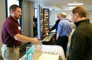
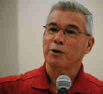 Excess nitrogen in surface waters is not only about fertilizer management, it's also about water management, says Dr. Jerry Hatfield, director of the National Laboratory for Agriculture and the Environment in Ames, IA. Hatfield spoke to a large turnout including many area farmers at the Hawk Creek Watershed Project annual meeting Feb. 28 in Renville. Research accumulating since the 1930s shows that changes in cropping systems away from hay and small grain to intensively-row cropped corn, soybeans, and sugar beets has "changed the whole dynamics" of agriculture and the environment, Hatfield says. (Photo by Tom Cherveny, West Central Tribune-Willmar)
"The loss of nitrogen is basically the loss of money. We need land use changes across the U.S. We need small grains, hay and cover crops." Improving soil organic matter is key. "A lot of things change when we change the soil." It's the foundation of practices that control water in the fields and downstream, he says. "We're losing 1,000 lbs. of carbon per acre per year. That's not sustainable. We need more vegetation and less tillage." Changing as little as 10 percent of the cropped acres in targeted areas would have a significant impact, he says, and simply to reduce the amount of nitrogen fertilizer without better water and crop management is not realistic. All the data and tools can be found online in the Agricultural Conservation Planning Framework. According to the MPCA Nutrient Reduction Strategy, in Minnesota 11.2 million acres would benefit by following U of M recommended
fertilizer rates, watch placement and timing of application, and use N
inhibitors. The Dept. of Agriculture's proposed nitrogen rule, would regulate fertilizer
management for nitrogen in groundwater-sensitive areas. (See article below: "Gov. Dayton proposes groundwater protection measure to reduce elevated nitrate levels in drinking water.")
Other speakers at the annual meeting included Dale Setterholm, Minnesota Geological Survey on groundwater; Forrest Peterson, MPCA, on Hawk Creek headwaters-Willmar chain of lakes; and Wendy Caldwell, Monarch Joint Venture, on monarch butterflies. Watershed project coordinator Heidi Rauenhorst and field technician Dean Dambroten gave updates on grants and implementation projects.
Back to top
|
The North
Fork Crow River One Watershed, One Plan is available for public
review and comment through March 31. Comments on the plan should be sent
to both: Diane Sander, Watershed Coordinator, Crow River Organization of Water,
311 Brighton Ave., Suite C, Buffalo, MN 55313, diane.sander@mn.nacdnet.net;
and Steve Christopher, Board Conservationist, Board of Water and Soil
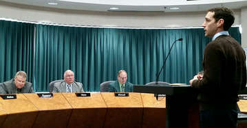
Resources, 520 Lafayette Rd. N., St. Paul, MN 55155, steve.christopher@state.mn.us. Photo: Steve Christopher gives a plan overview at the Kandiyohi County Board meeting March 6.
A public information meeting is scheduled for Thursday, March 15, 5-6 p.m. at the Middle Fork Crow River Watershed District office, County Road 8 NE, Spicer. A public hearing is scheduled for Monday, April 16, 5:30-6:30 p.m. at the Meeker County Courthouse, 325 N. Sibley Ave., Litchfield.
The One Watershed, One Plan vision is to align
local water planning on major watershed boundaries with state strategies
towards prioritized, targeted, and measurable implementation plans. It builds
on existing local water management plans and priorities, existing and new
studies and data, Watershed Restoration and Protection Strategies (WRAPS) and
other related plans from state agencies.
Examples of these statewide plans include: Dept. of Agriculture Nitrogen Management Plan, Pollution Control Agency Nutrient Reduction Strategy, Dept. of Natural Resources Prairie Conservation Plan, Dept. of Health Wellhead Protection plans, and
the Metropolitan Council 2040 Water Resources Management
Policy Plan.
The North Fork Crow River Water Planning
Partnership includes of six counties, six Soil and Water Conservation
Districts, two watershed districts, and a joint powers board. The North
Fork Crow River watershed drains 1,483 square miles of predominantly
agricultural land in parts of Pope (3.7%), Stearns (16%), Kandiyohi (16%),
Meeker (28.4%), Wright (31.7%), Hennepin (3%), Carver (0.1%), and McLeod (1%)
counties. The North Fork Crow River Watershed District, Middle Fork Crow
Watershed District and the Crow River Organization of Water (CROW) are also
located within plan boundaries.
Back to top
|
The Redwood-Cottonwood Rivers
Control Area (RCRCA) will be hosting an information meeting March 19 for officials from eight counties that will be involved in the Cottonwood
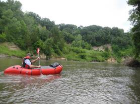
and Redwood rivers Watershed Restoration and Protection Strategy (WRAPS). Photo: RCRCA hosted a paddle trip on the Cottonwood in June 2017.
Public information meetings
will be scheduled in each of the watersheds in later July: Lake
Benton, Marshall and Redwood Falls for the Redwood River; and Walnut Grove and
Sleepy Eye for the Cottonwood River. Local Work Groups felt it
was important to not only explain how the WRAPS and Total Maximum Daily Load (TMDL) fit into the water
planning scenario, but to also share some preliminary monitoring data that was
obtained in 2017 and will continue in 2018.
RCRCA is currently collecting
water chemistry samples from 24 stream sites and nine lakes through the Surface
Water Assessment Grant program. MPCA collects samples from the
larger lakes (more than 500 acres in size) while DNR collects biology, hydrology,
geomorphology, and connectivity information; much of this information is used
for the Watershed Characterization report and stressor identification report. Wenck Associates, Inc. has been
subcontracted for the facilitating, analysis and writing of the WRAPS and TMDL
documents. For more information, contact
Kerry Netzke at RCRCA at kerry.netzke@rcrca.com
or (507) 537-1325.
Back to top
|
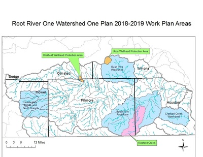
After
several years in the works, the Root River watershed-based plan in
southeastern Minnesota is moving forward with a two-year budget and list of
projects. Root River One Watershed, One
Plan (1W1P), one of five pilot projects launched in 2014 by BWSR, will receive $851,301 for a 2018-2019 budget and work plan
addressing groundwater, surface water, social capacity, and
administration.
Root River 1W1P’s local government units include
Dodge, Fillmore (administrative lead), Mower, Olmsted, Houston and Winona
(fiscal agent) counties along with their respective SWCDs. Root River SWCD
represents Houston County. Crooked Creek Watershed District in Houston County
also is among them.
A four-page summary document about the Root River
1W1P plan and priorities is available to the public, including online on
the Mower SWCD homepage at: www.mowerswcd.org. The Root River 1W1P plan
and other related documents are available on Fillmore SWCD’s website at: www.fillmoreswcd.org/rootRiverWatershed.html.
BWSR has led the statewide 1W1P program aiming to
reduce Minnesota’s more than 200 water-management plans based on political
boundaries to less than 100 plans created on watershed boundaries.
Watershed-based plans have the potential to allow for streamlined funding and
administration to maximize efficiency, minimize redundancy and prevent
duplication of efforts both on the local and state levels. - Mower SWCD news release.
Back to top
|
 Groundwater quantity and quality issues are surfacing in various arenas around the state. While the Dept. of Agriculture's nitrogen fertilizer rule has been in the spotlight (news release below), the Dept. of Natural Resources is hosting local meetings about groundwater resources, particularly among agricultural producers using more than a
million gallons of groundwater each year. Any user at that amount is
required to have an appropriation permit and report their usage.
At the
first public meeting March 2 in Willmar, Kandiyohi County feedlot
operators also learned about the Community-based Aquifer Management
Partnership (CAMP) as an option for groundwater users to
co-manage shared aquifers. CAMP works best when users know each other and
share their water use information, says Tim Gieseke, DNR groundwater specialist. A second Feedlot-CAMP public
meeting is scheduled for March 15 in Fairmont for Martin County feedlot operators.
In recent years observation wells are showing declines in aquifer levels. Due to geography and geology, groundwater resources are highly variable. In rural areas, livestock operations and irrigation draw the most groundwater. In the DNR Southern Region about 20 percent of the livestock operations use more than 61 percent of the total amount of groundwater used by all livestock operations, according to Anne Nelson, DNR district appropriation hydrologist.
DNR hydrologist Ethan Jenzen encouraged livestock producers to determine if they need a water appropriation permit, and if so apply online. "Water use is part of the economic growth in the county, and we want to make sure water use is sustainable," Jenzen says. Photo: Ethan Jenzen, left, demonstrates the groundwater model at the Kandiyohi County meeting March 2.
Gov. Dayton proposes groundwater protection
measure to reduce elevated nitrate levels in drinking water
March 6 news release: Following 17 public meetings engaging more than
1,500 farmers, landowners, and other Minnesotans, Gov. Mark Dayton and Agriculture Commissioner Dave
Frederickson proposed a new groundwater protection measure. It would apply to vulnerable areas and areas with
high nitrate levels in public drinking waters. It also would create a system of
voluntary and mandatory mitigation practices in areas with high nitrate
concentrations in the public water supplies. The Dept. of Agriculture expects the rule to be
published for formal comment in mid-to-late May with hearings to be held this
summer and final adoption in late 2018. Map depicting vulnerable areas (shown in
purple and green) where nitrogen fertilizer application would be
limited during the fall to protect groundwater from contamination. More information is available on the MDA nitrogen fertilizer rule webpage.
Back to top
|
1. Only 1 percent of the water on Earth is useable, 99 percent of which is groundwater.
2. The U.S. uses 349 billion gallons of fresh water every day.
3. Groundwater is 20 to 30 times greater than all U.S. lakes, streams, and rivers combined.
4. Groundwater supplies 33 percent of all water used by municipalities in the U.S.
5. 44 percent of U.S. population relies on groundwater for drinking.
6. More than 13.2 million households representing 34 million people have their own well.
7. Agriculture irrigation uses 53.5 billion gallons of groundwater daily; in 1950 it was 2.2 billion.
8. Ogallala, the largest U.S. aquifer underlying 250,000 square miles would need 6,000 years to refill.
9. California pumps 10.7 billion gallons daily, a third more than the next highest state, Texas.
10. The world's most extracted raw material, groundwater use is estimated at 259 trillion gallons per year.
In the news: Kansas Farmers Cut Ogallala Water Use – And Still Make Money
Water & Food News, 3/6/18
Back to top

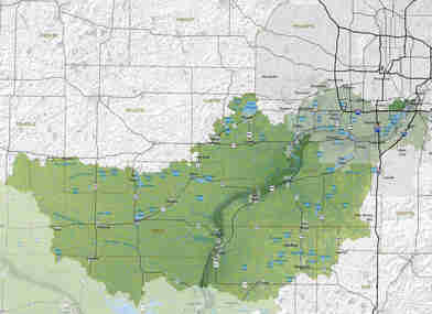
Water quality in the Lower Minnesota River Watershed has
persistent problems with excess phosphorus, sediment, bacteria, and other
contaminants, according to a 2017 report by the Minnesota Pollution Control
Agency (MPCA). The watershed covers 1,835 square miles of south-central
Minnesota and includes 87 miles of the Minnesota River, from just north of St.
Peter, to its confluence with the Mississippi River. The watershed comprises
the Minnesota Valley National Wildlife Refuge, 133 lakes larger than 10 acres,
2,482 miles of tributaries to the Minnesota River, and the cities of
Bloomington, Prior Lake, Winthrop, Waconia, New Prague, and Le Sueur. (Map: Minnesota River Basin Data Center, Minnesota State University Water Resources Center).
As part of its regular water-monitoring cycle, the MPCA
assessed water quality at more than 200 sites and found violations of state
water quality standards throughout the watershed. Elevated levels of phosphorus
are fueling nuisance algae blooms, which can deter recreation and create public
health hazards. Sediment is clouding the water in lakes and streams and can
harm habitat for fish and other aquatic life. The bacteria contamination detected
could pose human health risks.
Despite the problems, the MPCA’s report also noted some good
news. Four lakes in the watershed — Crystal, McMahon, Mitchell, and Bryant —
are now meeting water quality standards that they failed to meet previously.
The improvements are the result of successful restoration efforts by local organizations.
Local and state entities have made major efforts toward
restoring and protecting the Lower Minnesota Watershed’s water quality. But dramatic
improvements on the landscape are still needed to meet water quality standards
in the watershed’s lakes, rivers, and streams.
The
next step in the MPCA’s watershed management process will be to identify
“stressors” — the conditions contributing to water quality problems in the
watershed. To see the full monitoring and assessment report on the Lower
Minnesota River Watershed, visit the MPCA web site at: https://www.pca.state.mn.us/sites/default/files/wq-ws3-07020012b.pdf.
Back to top
|
Pomme de Terre seeks seasonal worker
Applications are due 4 p.m. March 22 for a part-time seasonal water quality technician for the Pomme de Terre River Association, 20 hours per week from May 1 to Sept. 26. The technician will be
responsible for collecting and reporting on a variety of lake and stream water
quality parameters throughout the watershed to be used in the
Watershed Restoration and
Protection Strategy and Total Daily
Maximum Load analysis. Send cover letter, resume, and two references to: Stephanie
Adams, Project Coordinator, Pomme de
Terre River Association, 12 Hwy 28
East, Suite 2, Morris, MN
56267, Email to stephanie.adams@pdtriver.org. Phone: (320) 589-4886 ext. 109.
EPA approves TMDL reports for Zumbro, Missouri basin rivers
On Feb. 22 the U.S. EPA approved the Zumbro River Watershed Total Maximum Daily Load report. The final TMDL is posted on the Zumbro River
Watershed web page along with the EPA approval letter and decision
document.
On Feb. 15 the U.S. EPA approved the TMDL reports for four watershed in the Missouri River basin. The final TMDL and the EPA
approval letter and decision document are posted on the four watershed web
pages in this basin.
- Upper
Big Sioux River Watershed web page
- Lower
Big Sioux River Watershed web page
- Rock River
Watershed web page
- Little
Sioux River Watershed web page
The Approved WRAPS/TMDLs web page has also been updated.
10th Minnesota River Congress May 17 in Mankato
The
10th Minnesota River Congress is scheduled for Thursday, May 17 at the Kato Ballrooom in Mankato.
About 75 people attended the
ninth Congress Nov. 16 at Jordan, reviewing progress on resolutions,
interest network teams and board activities. The next board meeting, which is open to everyone, is scheduled for 1 p.m. Tuesday, March 27 in Henderson at
the Community Center. Resolutions
approved at previous meetings include: Building soil organic matter, flow
control in streams, connecting waterways, funding Minnesota River Basin
Data Center, civic engagement, Granite Falls fish passage and whitewater
park, state river trails, and paddler access. For more information contact
Scott Sparlin, sesparlin@gmail.com,
507-276-2280.
MASWCD President joins the NACD Soil
Health Champions Network
Minnesota Association of Soil and Water Conservation Districts president Kurt Beckstrom has joined the NACD Soil Health Champions
Network. The goal of this initiative is to raise awareness and
increase the adoption of soil health systems by landowners and managers across
the country. NACD will use this initiative to increase the visibility of
conservation districts’ leadership in locally led conservation. Beckstrom is a Mille Lacs SWCD supervisor.
Back to top
The Board
of Water and Soil Resources has completed a feasibility study and plan for a Working Lands Watershed Restoration Program.
It would provide incentives for landowners to plant perennial and cover crops
that will improve water quality. The report includes an overview of promising
crops and livestock enterprises, including perennial grasses and winter annual
cover crops that keep roots in the soil and vegetation on the land throughout
the year, improving soil health and wildlife habitat, storing carbon, and
capturing excess nitrogen. Many of these crops can be grown for food or
beverage production, grazed, used for livestock feed and bedding, or processed
for applications such as bio-jet fuel, bio-based packaging, and renewable
chemicals.
The study was directed by the 2016 Minnesota Legislature (Laws 2016, c. 189, s. 4) with the goal of
improving water quality by increasing living cover on the landscape at a
watershed scale. BWSR coordinated this effort with stakeholders and other
state agencies, including agricultural and resource conservation interests,
commodity groups, watershed districts, soil and water conservation districts,
the biofuels industry, landowners, researchers at the U of M, and the
departments of Agriculture, Natural Resources, Health, and Pollution Control
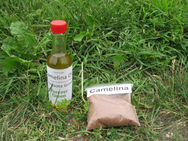
Agency. Photo: Samples of products from camelina, an alternative crop
cultivated for oil, as demonstrated at the U of M-Morris.
Back to top
|
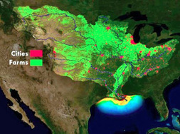
Gulf of Mexico Hypoxia Task Force
The rewards and challenges of nitrogen in agriculture drew
attention at a number of recent conferences, scaling from crops, to fields, to
watersheds, to the entire Mississippi River basin. Representatives from
Minnesota joined other states attending the Gulf of Mexico Hypoxia Task Force public
meeting Jan. 31-Feb. 1 in Arlington, VA. States reported on progress of their
nutrient reduction strategies, with the goal of reducing the size of the Gulf
hypoxic zone. The largest occurred last year due to high river flows in
spring. Minnesota issued its interagency Nutrient Reduction Strategy in 2014, with a
five-year review and update due in 2019.
4th annual nitrogen conference
At the fourth annual nitrogen conference Feb. 6 in
St. Cloud, experts from Illinois and Iowa touched on the Nitrogen Reduction
Strategy in their states. Calling it a 'nitrogen loss reduction strategy', Dr. Howard Brown of
the University of Illinois said agriculture must be proactive and make progress
on voluntary action to reduce nitrogen loss into waters. He said the lawsuit in
Iowa pitting Des Moines drinking water against upstream watersheds was a
'calling card'. Dr. Matt Helmers of Iowa State University said the lawsuit was
dismissed because the city sued the wrong entity, not because of the science.
The goal of a 45 percent reduction in nitrogen loss to waters remains lofty
with only in-field management. Cover crops, drainage management, wetlands and
water storage must be increased. They cited helpful websites: Nu-tracker
is a program in Illinois that engages high school students to learn about
nutrient stewardship.
Illinois Fertilizer and Chemical Association. 10 ways to reduce nitrogen loads from drained wetlands in
the Midwest.
Independent crop consultants association
convention
Speaking at the winter education meeting of the Minnesota Independent
Crop Consultants Association Feb. 15 in Hutchinson, Dr. Yuxin Miao
described new research on the potential of precision nitrogen
management. Combining soil, landscape, and yield data can create
site-specific seed hybrid and nitrogen management. Dr. Miao, a research
specialist at the U of M Precision Agriculture Center, described
his vision for nitrogen research: Watershed target areas, zone-based precision
nitrogen management, nitrogen stresses vs. other stresses, nitrogen management
algorithms and strategies for Minnesota, and combine remote sensing and crop
growth management. He said Minnesota should establish a conference on precision
agriculture. Such a conference was held Feb. 27 in Aberdeen, SD.
Back to top
|
|