January 2017
 Join Governor Mark Dayton and Lt. Governor Tina Smith for a Town
Hall Water Summit Friday,
Jan. 27, 9:45 a.m.-4 p.m., at the University of Minnesota, Morris. Registration
opens Jan. 6 and the full program is to be announced on that date.
Despite the state’s
abundance of lakes, rivers, groundwater and streams, more than 40 percent of
Minnesota’s waters are currently listed as impaired or polluted. Governor
Dayton and Lt. Governor Tina Smith have declared a Year of Water Action to focus on
improving access to clean water across Minnesota.
Governor Dayton
and Lt. Governor Smith encourage all Minnesotans to take a role in protecting
our state's most precious resource for future generations. Learn more about the
Year of Water Action here.
Back to top
|
 The 9th annual Crop Nutrient Management
Conference, will be held on Feb. 7, from 9 a.m.-4 p.m. at River’s Edge
Convention Center in St. Cloud. The conference program will focus on nitrogen
and phosphorus management with significant emphasis on water quality and
economics.
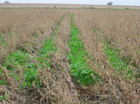
In addition to economics and crop production,
nutrient management can also have a major benefit for water quality. It is a major part of
Minnesota’s Nutrient Reduction Strategy, which was introduced at the 2014
Nutrient Management conference in Mankato. More recently, cover crops
and building soil health are receiving greater attention, both for water
quality and production benefits. Photo: Cover crop in Renville County soybeans.
The conference is hosted by the
Minnesota Agricultural Water Resource Center (MAWRC) with primary sponsorship
from the Minnesota Department of Agriculture. The conference will highlight
recent advances in effective and economical nutrient management presented by
University of Minnesota researchers, fertilizer industry experts and state agency
officials.
Farmers, crop advisors and other
nutrient management professionals are encouraged and invited to attend. The
ongoing importance of efficient use of applied crop nutrients relating to farm
profitability and food production economics combines with growing interest in
the environment.
Back to top
|
The Minnesota Pollution Control
Agency (MPCA) is seeking applications for projects that will reduce nonpoint
source pollution in Minnesota’s lakes, rivers, and streams. Funding for
selected projects will be provided by the Federal Clean Water Act Section 319
(Section 319) grant funds. The MPCA will accept applications through
Feb. 3. The MPCA anticipates about $2.5
million will be available this year, contingent upon Congressional
appropriation.
Only Total Maximum Daily Load
(TMDL) and Watershed Restoration and Protection Strategies (WRAPS)
implementation projects will be funded. Eligible applicants must have a TMDL study, TMDL
implementation plan, and WRAPS approved by the MPCA by Dec. 31, 2016.
No nonpoint source development, education or applied research projects (DER)
projects will be funded this year.
Changes this year include a
minimum grant request of $50,000. Grant funds are limited and MPCA
urges proposers to request only those funds needed to complete a project by
Aug. 31, 2021. The complete Request for Grant
Application, application form, and other information is available on the MPCA website.
Back to top
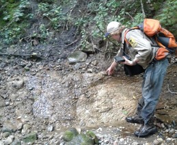 If you know of springs in your neighborhood or elsewhere,
please let the DNR. The DNR has developed a Springs Reporting App to
expand the current knowledge of springs. It is gathering information from
various agency records and searching public lands, but we need the help of
private citizens to make the inventory more comprehensive. The DNR is currently
only aware of approximately 5,000 of the possible 22,000 springs statewide.
You can add to inventory using the Minnesota DNR Statewide
Spring Inventory App from your mobile device in the field, or from your home
computer based on map location or aerial imagery. Spring locations will be
available on a Spring Inventory Map after verification by the DNR.
The spring inventory project has developed the procedures
and methods for conducting spring mapping statewide. Existing spring
information from various agency records is being collected for inclusion in the
statewide spring database. The database will contain both reported and verified
spring location information and physical, chemical, and historical data for
spring sites if available.
Springs have their own aesthetic and historical value that
creates a special “sense of place” for local residents and visitors. Preserving
springs contributes to a love of the land and an environmental ethic that helps
create a Minnesota quality of life. You can’t protect something if there is no
public or government awareness of its existence. - Greg Brick, DNR.
Back to top
|
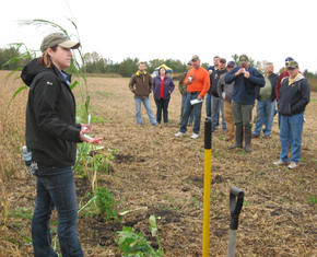 Reported by Tom Cherveny, West Central Tribune: Winter can come hard to the Minnesota prairie, but never so early that cover crops cannot be used to improve and protect the soil. "We do have the potential here,'' said Holly Hatlewick, district manager with the Renville County Soil and Water Conservation District. "It is not just something that grows further south. We have that potential to have that living root on the landscape.'' Photo: Holly Hatlewick at the Renville County cover crop field day Sept. 23.
Hatlewick spoke at the Hawk Creek Watershed Project meeting in December in Clara City. She shared the results of the second year of cover crop test plots in Renville County. The Renville County Soil and Water Conservation District and the Hawk Creek Watershed Project have been working with cooperating farmers.
Along with sponsoring test plots for research, the Renville County SWCD offers a cost-share program to encourage farmers to experiment with cover crops on their own. This year roughly 1,100 acres were seeded. Hatlewick is hoping the conservation district and watershed project can continue a third year of test plots in 2017. Along with answering the economic questions surrounding cover crops, the test plots are helping acquaint staff and local farmers with the real-life challenges that need to be overcome. Full story in West Central Tribune, Dec. 14.
Back to top
|
Using complex models to create various scenarios for watershed planning is no longer the exclusive domain of engineers and other experts. Scenario Application Manager is a new tool that allows watershed staff and involved citizens to use HSPF models without having to manipulate its inner workings. With a Clean Water Legacy grant administered by the MPCA, RESPEC Engineering created the watershed-scale decision support tool to facilitate prioritization and placement of best management practices (BMPs) needed to achieve the necessary reductions identified by various watershed management programs.
SAM consists of a Geographic Information System (GIS) for site selection, and Hydrological Simulation Program – Fortran (HSPF) model application to simulate the transport of pollutants. SAM provides decision makers with a user friendly, comprehensive approach to achieve water quality improvement goals with the greatest water-quality benefits for dollar invested. Training sessions have been under way in several watersheds, including the Yellow Medicine..... SAM video on YouTube.
Back to top
 Friends of
the Minnesota Valley is planning to launch a River Watch program in the
Minnesota River Basin. River Watch monitoring will take place on the main
channel and the tributary rivers and streams of the basin. The planned
River Watch program is modeled after a very successful program based in the Red
River Valley and operated by the International Water Institute. To learn
more about the River Watch Program on the Red River, go to http://www.iwinst.org/education/participate
Back to top
|
 Lanesboro
is the next stop for the Smithsonian Water/Ways
travelling exhibit Jan. 7 through Feb. 19. Lanesboro Arts, Commonweal Theatre
Company, Eagle Bluff Environmental Learning Center, Lanesboro Museum, and
Friends of the Root River are partnering to develop and present dynamic local
programs and engagement initiatives that will bring together the storyline of
the Root River Watershed. These activities will run concurrently with the
exhibits from the Smithsonian Institute and the Minnesota Humanities Center.
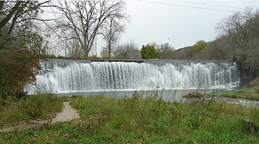
Opening
day Jan. 7 begins with a “water blessing” ceremony at 3 p.m. at the Lanesboro
Dam (photo), followed by a 4 p.m. reception at the Lanesboro Arts Exhibition Gallery.
The opening ceremony and ribbon-cutting will be at 7:30 p.m. at Commonweal
Theater. A host of special events are scheduled through Feb. 19, such as: Jan.
19-fish snow sculpture, Jan. 21-candlelight snowshoe, Feb. 4-family sled dog
day, and Feb. 16-18-H2O Ten, eight short plays about water. The entire list is
available on the Minnesota Humanities Center-Lanesboro Arts webpage. See a collection of
Lanesboro water stories on the We Are Water: Lanesboro webpage.
Water/Ways is a
traveling exhibition and community engagement initiative of the Smithsonian
Institution’s Museum on Main Street program. In Minnesota, Water/Ways is
led by the Minnesota Humanities Center in partnership with MPCA, Minnesota a
Historical Society, Minnesota Department of Health, Minnesota Section of the
American Water Works Association. Previously, the exhibit visited New
London-Spicer, St. Peter, Red Wing, and Sandstone. The tour concludes Feb.
25-April 9 at Detroit Lakes.
Back to top
|
BWSR approves comprehenive watershed plans for Yellow Medicine and Root rivers
Marking a new era in Minnesota water planning, on Dec. 14 the Minnesota Board of Water and Soil Resources (BWSR) approved comprehensive watershed management plans for the Root and the Yellow Medicine rivers. These are the first two plans completed through BWSR’s One Watershed, One Plan program. The initiative brings together a partnership of counties, Soil and Water Conservation Districts, and watershed districts to create a shared action plan for water management.
The roots of the program were conceived by a consortium of local governments seeking to streamline water planning requirements in Minnesota. More information about the One Watershed One Plan program, including its guiding principles and plan outcomes, as well as a map of the participating watersheds, can be found at BWSR’s website: www.bwsr.state.mn.us. Read full news release.
Yellow Medicine SWCD seeks district manager
The Yellow Medicine SWCD office in Clarkfield is accepting applications for district manager until Jan. 31. This position requires a strong managerial and administrative background and reports to the Yellow Medicine Soil and Water Conservation District Board. Performs
management functions for the district and ensures program
implementation. For more information check out the job announcement.
RFP for research on ag conservation practices to reduce nutrient loss
The Dept. of Agriculture announces a request for proposals for
research to quantify agricultural conservation practice effectiveness related
to nutrient source reduction, off-movement, and treatment. Applications must be submitted using the format prescribed
in the proposal instructions. To request proposal instructions and to receive
application materials, please e-mail for the full RFP, which will be
sent free of charge to interested parties. Contact: Heidi
Peterson, Impaired Waters Technical Coordinator, 625 Robert Street N., St. Paul, MN 55155-2538; Email: Heidi.Peterson@state.mn.us.
Additional information, including research priorities, is
available in the Jan. 3,
2017 State Register (see
page 846 or 22).
Back to top
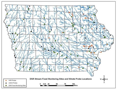 DES MOINES -- A 2016
report of Iowa’s water monitoring efforts for nutrients highlights both the
complexity and long-term value of evaluating nutrient levels in Iowa’s lakes,
streams and rivers.
Developed jointly by the
Iowa Department of Agriculture and Land Stewardship and Iowa Department of
Natural Resources, with the support of Iowa State University and the University
of Iowa IIHR—Hydroscience and Engineering Center, the report is the first of
its kind in Iowa and includes a comprehensive list of surface water monitoring
efforts specific to nutrients.
The report was developed in support of the Iowa Nutrient Reduction
Strategy and is available at www.nutrientstrategy.iastate.edu/documents underneath
the heading "Supplemental Documents." More.
Back to top
|
|