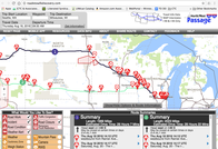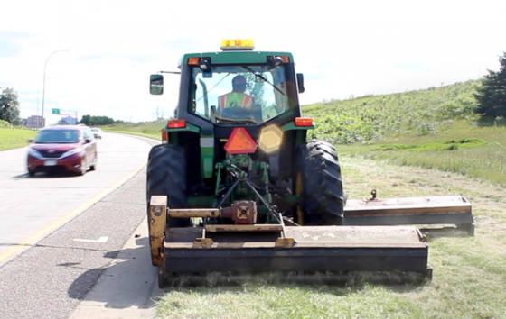
More than 45 Metro District tractors have been outfitted with automated vehicle location technology, which enables maintenance crews to keep tabs on operators in real-time, automatically report where mowing has been completed and and map the location of noxious weeds.
“We’re really hoping it will reduce the amount of herbicide that we’re putting on our roadways by 50 percent,” Trisha Stefanski, MnDOT Metro District asset management
Watch a video of the GPS-equipped mowers.
 Minnesota Dry Swale Calculator Validates Lower-Cost Pollution Prevention
Grassed swales, such as roadside drainage ditches, are an inexpensive and effective way to handle stormwater that might otherwise carry pollutants from the road into a nearby stream or lake. A newly developed calculator helps show that grass swales can do its job without a more expensive strategy like a filtration basin.
These findings will be shared with the American Association of State Highway and Transportation Officials (AASHTO) Stormwater Working Group to give agencies nationwide the benefit of MnDOT’s work.
Technical Summary 2016-15
|
New Method for Determine Impervious Area Saves Time and Money
Another calculator, funded by the Minnesota Local Road Research Board, developed a practical method to determine the effective impervious area of a watershed using readily available data instead of more time-consuming and expensive methods, enabling more accurate stormwater modeling and cost-effective investments.
Past methods of estimating impervious areas have included more area than necessary— surfaces leading directly to the storm system (the effective impervious area) as well as nearby impervious surfaces (the total impervious area).
Investigators developed a method for accurately estimating only the effective area and showed that the calculations enabled by this method closely matched actual rainfall runoff data from 40 gauged watersheds. This could make new stormwater management projects less costly without sacrificing the environment.
Technical Summary 2015-41
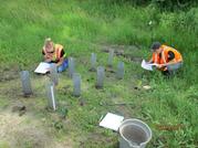
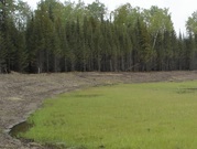 When road construction impacts wetlands, the Minnesota Wetland Conservation Act requires certain activities to mitigate these effects. Creating wetlands in new sites gives only partial mitigation credit because it may not adequately replace what was lost. Using new research, the project team created wetlands in abandoned gravel pits to see if they would be as successful as restoring wetlands drained during construction or other activity.
Results were mixed: Most of the 14 sites monitored for this project had good water level characteristics and ample native plant populations, but several had high levels of invasive species that reduced their potential as mitigation sites. This research clarified certain lessons in how to manage such a wetland: implement early invasive species control, plant trees on drier areas and respond quickly to changes in site conditions as the wetland develops.
Technical Summary 2016-11
|
Most weigh-in-motion systems utilize crystalline quartz piezoelectric sensors, which provide good quality data but at a high cost—about $27,000 per lane. Piezoelectric polymer film sensors, also known as brass linguini (BL) sensors, cost only $2,000 per lane to install and have a longer working life due to their installation method. BL sensors, however, are sensitive to temperature.
Investigators developed a mathematical approach to correct BL senso weight measurements based on pavement temperature. While probably not accurate enough for weight enforcement applications, the BL sensor could significantly increase the amount of traffic data available for planning purposes at the same cost.
Technical Summary 2016-10
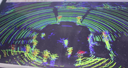 LiDAR, or light detection and ranging (like radar but with light), is a new technology that can produce 3-D images of both stationary and moving objects. Workshops in February showed off some of the newer applications of this technology, and MnDOT and local agencies are considering which applications could be most useful.
For example, a portable LiDAR system can analyze intersection traffic, displaying the position and speed of moving vehicles on a 3-D map. Units can range from $9,000 to $80,000 (the unit used in the workshops) to multi-corridor mapping systems that can cost $1 million. More work is needed to improve the accuracy of intersection modeling and to find hardware and software solutions that will cost less.
To learn more about LiDAR applications, check out our video.
Technical Summary 2016-19
|
Transportation Research Syntheses (TRSs) are short-term research reports that summarize research activity or state of practice for a topic. They can include interviews and surveys.
To view TRSs or request one to address your research need, visit mndot.gov/research/transportation-research-syntheses.html.
11/1
Transportation Research Investment Group meeting, Arden Hills
11/3
Center for Transportation Studies Research Conference, Minneapolis
11/17-18
APWA-MN Fall Conference, Brooklyn Center
|