|
August 2023
This staff newsletter provides information and updates on the department's Strategic Land Asset Management (SLAM) program.
In this issue:
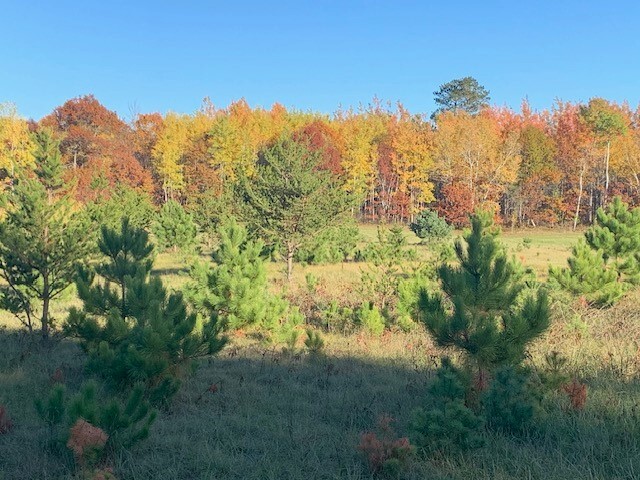
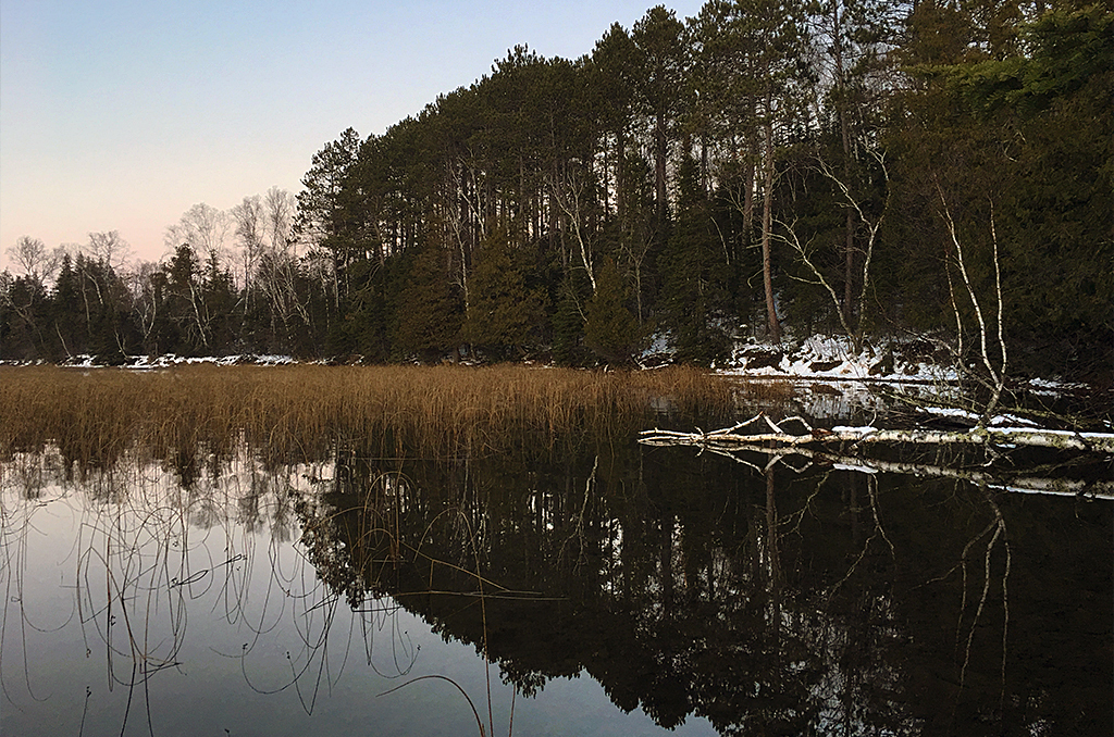 Deer Lake shoreline in Wabu Woods. MN DNR, Kelly Randall
Written by Mollie Gudim, information officer, Lands and Minerals Division
Minnesota boasts some of earth’s most renowned wild spaces, like north of Grand Rapids where large tracts of red oak-basswood forest, white pines, and an occasional yellow birch surround lake-dotted landscape, punctuated by hillocks and knolls. This relatively undisturbed native environment once belonged to Abby Weed Grey, a passionate creative who wanted to preserve nature’s artistry.
In an act akin to giving a gift of fine art, Abby donated her land to The Nature Conservancy, which in turn gifted the land to the DNR. Abby’s treasured woodlands, now called Wabu Woods Scientific and Natural Area, are safeguarded for generations of nature lovers and conservationists to enjoy and in some cases, help protect these designated lands.
The department’s SNA Site Stewards program offers opportunities for people with hearts for wild areas to keep a close eye on Scientific and Natural Areas, often assisting SNA staff with protection and management of the site they choose to monitor.
In Itasca County, Wabu Woods SNA is regularly visited by site stewards who are also members of the Deer Lake Association. In joint purpose, the lake association made an impassioned plea to the DNR about an add-on acquisition that would preserve natural shoreline in a quiet bay of Deer Lake and strengthen the protective power of Wabu Woods SNA.
Deer Lake is a substantial waterbody, and as more people desire living near great fishing spots and crystal-clear waters, increased development can threaten the health of its small watershed. For example, algae blooms began appearing, which can harm the lake’s water quality and local ecology.
“This acquisition is critical to buffer Deer Lake’s water quality,” said regional director, Shelly Patten. “The wider preservative boundary also protects a native plant community and ensures the longevity of the mature forestlands.”
Often, the key to a successful land acquisition is strong community partnerships. “We certainly harnessed the energy of the Deer Lake Association’s push to protect this land by adding to Wabu Woods SNA,” said Darrell Schindler, regional manager of Ecological Water Resources Division. “It was important for the lake association to stand with us at county board meetings, helping us advocate for keeping natural places pristine.”
When the department proposes a new or additional land acquisition, good old-fashioned persistence is essential too. The team of SNA staff and lake association members went before the Itasca County Board not once, but twice to advocate for greater protection of Deer Lake and the surrounding ecosystem.
“The first time we went to the county board, COVID-19 protocols kept us from engaging with board members in person, so I was just a disembodied voice on the phone,” said Regional SNA Specialist AmberBeth VanNingen. “A year later, we were able to be in the room with the Deer Lake Association, appealing directly to the board, which made a tangible difference.”
The Deer Lake Association eventually bought and donated the parcels to the DNR.
The completion of this add-on acquisition marked the continuation of Abby Weed Grey’s wish to preserve wildlands for wildlife and nature lovers alike, including Abby Weed Grey’s niece and namesake, Abby Marier. Abby and her family visit Wabu Woods SNA in summertime, when the nostalgia of Deer Lake, nearby bogs, and lush forests is the strongest – and so is her aunt’s calling to appreciate the beauty of the natural world.
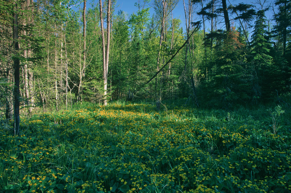 Marsh marigold blooming in small hardwood swamp. © ColdSnap Photography
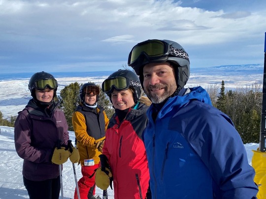 Josh Kelly and family on a ski adventure
Written by Mollie Gudim, information officer, Lands and Minerals Division
If you’re on the highway and pull up next to a car with a kayak or mountain bike strapped to the roof while sounds of the rock band the Grateful Dead pours from the car windows, it could be Josh Kelly looking for his next adventure. While his self-proclaimed Deadhead status is fairly new, his appreciation for outdoor recreation is long-lived.
Growing up in North Carolina, with mountains in the west and beaches in the east, he loved being outside. As a grad student in Montana, his adventurous spirit called him to pick up mountain biking and backpacking. He’s pedaled and hiked through scenic spaces like the Appalachian Trail, Blue Ridge Mountains, and Smoky Mountains.
“I’ve always been intrigued by outdoor life, I’m a hopeful adventurist,” said Kelly, who came to Minnesota with his wife and kids, ready to explore the Land of 10.000 Lakes. “I love living here, where there’s strong enthusiasm for outdoor recreation, and equal dedication to conservation and protecting the lands we enjoy.”
An interest in nature conservation is what drew Kelly to his new position as appraisal consultant for the Lands and Minerals Division. When DNR acquires land, fee title or easements, the transaction requires a market value appraisal. Kelly describes his job as “quality control” to ensure that the appraisals the department receives meet state laws and regulations.
Kelly comes to DNR with more than 17 years of rural and commercial real estate appraisal experience. Most recently, he served the US Department of Interior as a review appraiser, focusing on acquisitions for US Fish and Wildlife Service in Minnesota and Iowa. Kelly’s also been a review appraiser at MNDOT. “The appraisal world's not the most exciting, flashy thing, but it's certainly an important part of responsibly managing public lands for the betterment of the state and for the enjoyment of everyone who lives or visits here,” he said.
His life so far in Minnesota is marked by plenty of moments enjoying the state’s public recreation areas, including Cuyuna Mountain Bike Trail. Annually, Kelly and his son tackle the red soil routes of the 50-mile-long mountain bike trail system. On a solo challenge, Kelly took third place in a 48-mile kayak race on the Mississippi River. His sights are already set on next year’s 150-mile race.
“I believe in the power of mental toughness and tenacity,” he said. “If you’ve got a goal, and your mind is in the right place, you can achieve it.”
The attitude Kelly has toward outdoor adventure is the same persistence he brings to his career. “Appraisal review takes mental creativity and teamwork,” he said. “I've got a lot of real estate appraisal experience under my belt, but the role that DNR plays in managing land for conservation and recreation is a completely different niche to learn.” On the way to finding his footing at DNR, the most comfortable place for Kelly is outside, actively connecting with nature – and probably listening to the Grateful Dead.
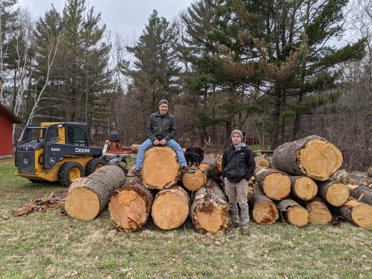 Severt's Woods sustainable timber operation
Written by Mollie Gudim, information officer, Lands and Minerals Division
There’s a special place near South Long Lake in Brainerd Minnesota called Severt’s Woods. The terrestrial landscape here is marked by lush oak, maple, and aspen forests and dotted with rolling hills left behind by glaciers. The region’s fertile soils, ideal for farming, pushed Severt Aarhus to settle here more than 100 years ago.
A century later, Severt’s Woods are still providing for the family founded on these lands. Every spring, the trunks of 200 trees are tapped for maple syrup and others sustainably harvested for timber. Ten kilometers of the property have been cleared and maintained for skiing, snowshoeing, and hiking.
“For one reason or another, every member of our family shares a tie to this land, as well as a genuine concern for its well-being,” said Kent Montgomery, current owner of Severt’s Wood, alongside his wife Paula. “This land has given our family so much over the years, and it was important to us and our children to protect Severt’s Woods, adding to its legacy.”
In December 2021, Kent and Paula partnered with the DNR’s Forestry Division to place 270 acres of their cherished woodlands into a conservation easement. “We’re protecting the land from any future development forever,” Montgomery said.
The Montgomery’s are one example of how the Forest Legacy Program has worked for more than two decades to protect privately owned forestlands through conservation easements. The program has ushered multiple families into forestland protection and conservation, preserving more than 145,665 acres of environmentally important forestlands.
Forestlands surround the chain of Brainerd Lakes with majestic crowns of mature trees hugging the shorelines. The beauty and necessity of the area’s woodlands has never been lost on Jeff Laurel, whose young love of the outdoors grew into a lifelong conservation career. He works with the Whitefish Area Property Owner's Association, the DNR, and the local soil and water conservation district to protect forests that offer significant benefits to lakes.
“Maintaining healthy woodlands around a lake is critical to its water quality. The woods act as a natural sponge absorbing phosphorus that could run directly into lakes, depleting oxygen and increasing algae blooms. We must protect woodlands in order to keep the lakes we all enjoy,” Laurel said.
While exploring some backroads close to shorelands and near their home in 2011, Laurel and his wife came upon a For Sale sign posted in the middle of open meadows and tall tracts of thick forests. They bought the 140-acre property without hesitation. “We were afraid that this beautiful place would succumb to heavy development pressure, and we couldn’t let that happen.”
Eventually, the family decided to permanently protect their woodlands with a conservation easement in the Forest Legacy Program.
“Protecting these woods is indeed a great legacy for our children and grandchildren who appreciate natural things,” Laurel said. “Now and into the future, generations of nature lovers can come to the lake and stay for the woods.”
The Forestry Division also administers the Forests for the Future program, established by the state legislature in 2008 to protect and conserve private forests from the threat of conversion to non-forest uses. Together with families like the Montgomerys and Laurels, the DNR is able to protect and conserve 366,991 acres of forests so all Minnesotans can reap the economic, environmental, and social benefits of these lands.
You can explore all the forests conserved by Minnesotans with these DNR programs by visiting the Forest Legacy Interactive Map.
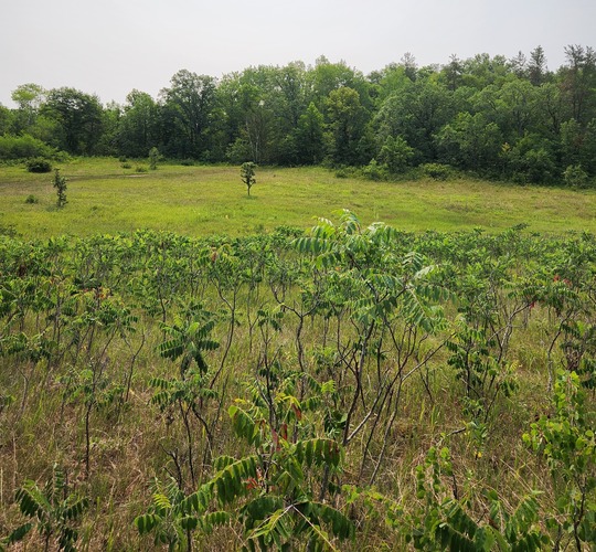
 Jeff Laurel's conservation easement land
 Photo from the Office of School Trust Lands
Written by Mollie Gudim, information officer, Lands and Minerals Division
The Office of School Trust Lands (OSTL) has been working in conjunction with the Department of Natural Resources to develop an Asset Management Plan to serve as a 25-year framework for school trust lands management, as required by state law.
Phase One of the Plan was completed earlier this year and consisted of foundational information about school trust lands, proposed systems to improve strategic decision-making and facilitate robust management, a situational and risk analysis, and independent third-party recommendations designed to strengthen the asset portfolio and increase net proceeds deposited into the Permanent School Fund.
Moving forward, Phase Two of the Plan will assess options to capture the full costs of managing school trust lands and determine the resources needed to collect and synthesize data to develop performance metrics. These steps are intended to lead to implementing a methodology and systems to:
- Fully identify, routinely compile, and consistently track all revenues, expenses, management costs, and appropriations for school trust lands management.
- Measure financial as well as natural resource-related performance.
Phase Two will also evaluate will evaluate whether to develop and utilize three proposed systems intended to make better informed school trust land management decisions. These systems include classifying school trust land parcels into asset classes that align with current sources of revenue, adopting a tiered ranking system to classify parcels by productivity, and developing asset class business plans for each asset class and type.
The Plan intentionally focuses on bolstering existing revenue-generating activities including mineral development, forest management, and real estate transactions while identifying potential opportunities to generate revenue from additional assets to ensure the Permanent School Fund will continue to grow. When it’s completed, the Plan will become a decision-making tool to guide management of the state’s school trust lands and increase transparency of school trust lands management and performance.
 Chengwatana SFT land acquisition phase 2, photo by Troy Holcomb
Written by Genna Souffle, Forestry State Lands Outreach Specialist, Forestry Division
Since last year, the Minnesota Department of Natural Resources has received 970 acres from the Trust for Public Land (TPL), to be managed as part of Chengwatana State Forest.
The donated land includes forests, grassland, and several creeks, streams, and ponds. Donating the land to the DNR safeguards the diversity of native ecosystems, improves connectivity between natural lands, protects drinking water, and provides public access for recreational activities.
But what does it take for such a wonderful donation to happen?
As you might guess, it involves a lot of work, agility, cooperation – and luck.
“These parcels that come up for sale are spontaneous and opportunistic, and this one is a great example,” said Jeff Busse, the Forestry Lands Program Consultant for DNR.
Unlike the rigorous study and process that goes into a new Scientific and Natural Area, acquisitions like this one arise when a parcel comes up for sale and partners like TPL react swiftly.
This specific land was owned by Xcel Energy and its predecessor for nearly a century. When the opportunity arose to purchase it, TPL led the effort using a grant funded by the Minnesota Outdoor Heritage Fund, part of the Clean Water, Land, and Legacy amendment passed in 2008.
One of the things that made this parcel so special was that it was closed to the public for so long, said Molly Willing, acquisition project manager for the division of Lands and Minerals. “It's really important that we keep creating more outdoor spaces, like Chengwatana, for people to form their own personal connections to nature,” she said.
Due to its large size, Willing said the title work on the parcel was particularly intense. A few agreements had to be worked out with owners of neighboring properties, including moving some fence lines. Other steps included appraisal, environmental site assessment, contracting debris removal, and recording the deed. Along the way, TPL also coordinated with Chisago County and Chengwatana Township to communicate the project process and goals and maintain their support.
The end result is more public land with valuable benefits to people and the environment.
Three rivers flow through Chengwatana State Forest – the Kettle, Snake, and St. Croix. The donated land includes portions in the St. Croix National Scenic Riverway, a federally protected 252-mile system of riverways located in eastern Minnesota and northwestern Wisconsin, so the project also included collaboration with the National Park Service.
Protecting and managing this parcel means ensuring continued water quality benefits, along with providing public recreation opportunities like hiking and deer and turkey hunting. It’s a great example of how coordination between many partners can help protect our natural resources for generations to come.
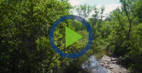
Take a virtual tour of the 729-acre land donation from Trust for Public Land to the DNR as part of the Chengwatana State Forest.
 For two weeks last July, DNR offered 10 surplus rural and lakeshore properties for sale in Clearwater, Itasca, and Wadena counties. Anyone looking for land could place an online bid through MinnBid, Minnesota’s Surplus Services online auction website. At the close of the public auction on Monday, July 24, four properties received winning bids. All properties offered at the July auction are school trust lands. Unsold properties from this auction are not eligible for over-the-counter sale. DNR may offer unsold trust lands at a future auction.
The complete July auction results are on the Land Sale webpage.
DNR land sales help to:
- Enhance the state’s public land values and benefits, especially maximizing outdoor recreation spaces
- Restore and grow diverse habitats for fish and wildlife by connecting larger areas of land that are ecologically diverse so that native plants and wildlife can thrive
- Maintain sustainable natural resources for economic purposes, like timber harvesting
- Generate revenue for the Permanent School Fund, which benefits every K through 12 school district in the state
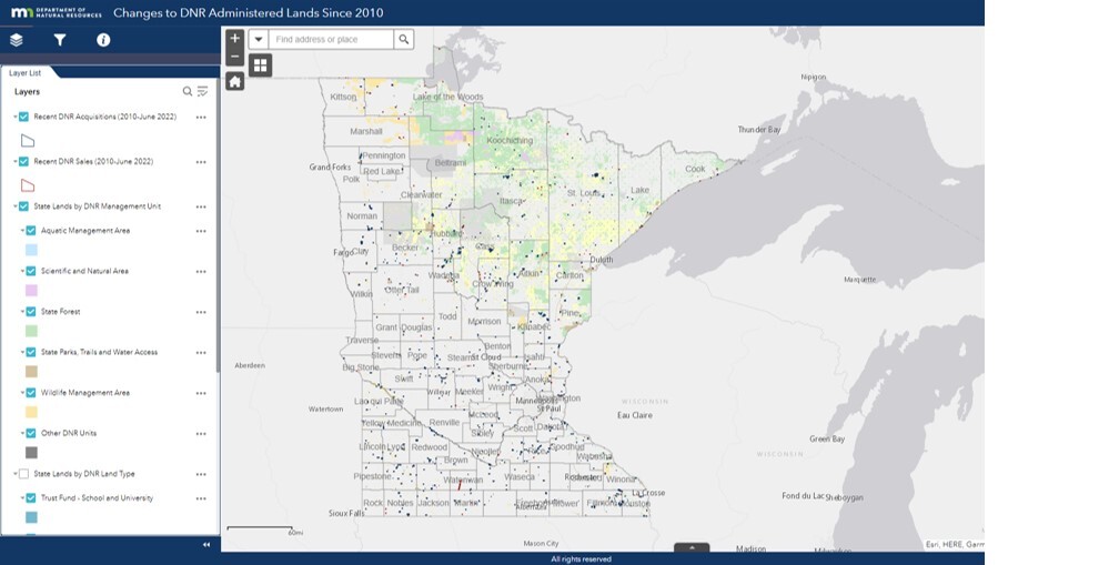 The new DNR-administered lands web map is the result of DNR’s work to provide timely, relevant information about the department’s land portfolio for Tribal Nations, local governments, the public and partners.
The map displays a statewide view of DNR acquisitions and DNR sales from 2010 through 2023. The map also shows the current State-owned, DNR managed land portfolio and State-owned, County managed Tax Forfeit land. State lands can be displayed by the DNR Administer or DNR Land Type.
All properties are mapped to the public land survey 40 or government lot. The entire 40 acres or gov’t lot is shown whether the state owns it in entirety or just a small portion. Select properties in the map to view actual acreage.
County Administered Tax Forfeit lands data is not the most current information and is used for illustrative purposes only. Contact the county for the most recent and accurate data.
Minnesota DNR committed to public engagement in transfer of Upper Sioux Agency State Park to tribal ownership
West Central Tribune, March 30 2023
Minnesota DNR seeks to acquire part of Ramsey Mill Pond north of Austin
KAALTV, April 27, 2023
Minnesota poised to close state park, return land to Dakota tribe
Star Tribune, May 11, 2023
|
