|
November 2022
Middle-Snake-Tamarac River Watershed District helps Newfolden tackle city floodplain designation
The city of Newfolden has been thriving in recent years, and has plans for future growth associated with the economic development in nearby Thief River Falls. But plans for the city’s future took an unexpected turn when the Federal Emergency Management Agency (FEMA) developed a draft floodplain map for Newfolden in 2015. While most jurisdictions had floodplain maps developed by FEMA decades ago, Newfolden had not. The newly created floodplain map showed that two-thirds of the town was within the 100-year floodplain!
The city now faced many problematic consequences of this designation - property owners now needed expensive flood insurance, property values were negatively affected, buyers would not want to purchase homes in a floodplain, and the city was now required to develop a Floodplain Ordinance. Another consequence, the main area mapped as floodplain is the east side of town where they have a lot of older residents (seniors on fixed incomes) and a site they had slated for new housing.
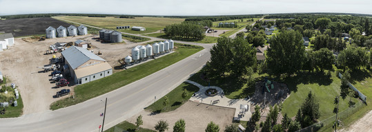 View of area east of Newfolden and U.S. Hwy. 59 impacted by the floodplain designation. Photo by Janet Nelson.
“Growth is essential to our community,” said Tammy Hansen, Newfolden city administrator. “This uncertainty can stall development projects and lead people to choose to live in other communities instead of ours.”
In 2016, the city reached out to the Middle-Snake-Tamarac River Watershed District (MSTRWD), who Hansen calls the “heroes.”
“We weren’t sure what to do, so we called MSTRWD for help,” Hansen said. “They listened and championed a plan.”
MSTRWD had the expertise and resources to figure out solutions, whereas the city did not. Using funding provided by the Flood Damage Reduction Workgroup, the MSTRWD established a Project Work Team, and their consulting engineers, HDR, developed a plan to lower the elevation of flood waters to reduce the area mapped as 100-year floodplain. The FEMA designation was finalized in 2021 and Hansen is thankful they had a plan in place.
The district looked at several project alternatives before settling on a combination of an improved river crossing that can pass more water at the current “bottleneck” and an off-channel impoundment to store water during floods. The impoundment will help to reduce overland “breakouts” that come from the Judicial Ditch 21 system north of town and will store up to 2,200 acre-feet of water*.
 The Canadian Pacific Railroad crossing at the Middle River will be replaced and enlarged to eliminate a bottleneck that contributes to flooding. Photo by Janet Nelson.
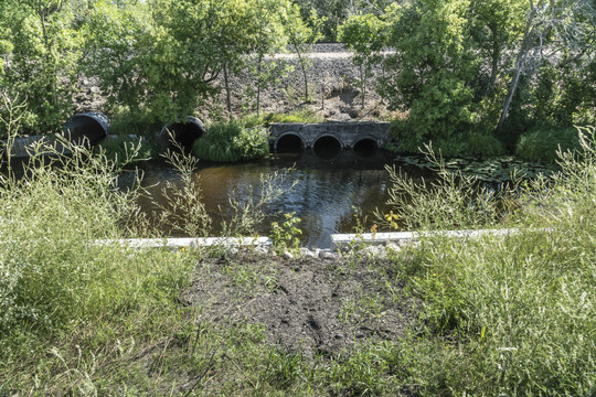
 The U. S. Hwy. 59 crossing of the Middle River with new, larger culverts installed by MnDOT in 2020. Photo by Janet Nelson.
MSTRWD Administrator Morteza (Mori) Maher came on board in 2021 and began navigating the permitting and funding for the project, as well as its coordination.
“There are many dynamics in developing projects like this,” said Maher. “It’s an intricate puzzle.”
For example, the state can contribute funding for the impoundment that will be constructed on land either acquired in fee or by easement by the city, but the railroad bridge is privately owned by Canadian Pacific Railroad and state funds cannot be used for that, said Maher. Other puzzle pieces included the COVID pandemic, inflation and the complicated negotiations with landowners to lease or buy their property.
Construction on the railroad crossing over the Middle River is set to begin in the spring of 2023. The impoundment that will go just north of the city will follow, once permits and funding have been obtained.
Hansen is extremely thankful to the MSTRWD and Maher’s incredible efficiency working through many challenges. The project will put Newfolden on a firm footing to execute its growth plans in the years ahead.
Black River Impoundment project provides critical flood storage, maintains landowner hunting opportunities
Ron, Mark and Scott Sorvig have farmed and hunted the family land near St. Hilaire in Pennington County, MN their entire lives. The land has been in their family for 125 years. When Scott’s sons left his farm and he neared retirement age, he began to explore options for what he would do with his portion of the family land. It just so happens that brother Ron used to work for a watershed district further north and was very familiar with flood-damage reduction projects in the Red River Basin (RRB). So when the Red Lake Watershed District (RLWD) came calling about the possibility of building a flood storage project on his land, Scott listened.
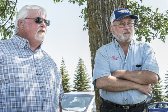 Ron (left) and Mark (right) Sorvig tell the story of how their brother Scott worked with the Red Lake Watershed District to enable construction of an impoundment on his land. Photo by Janet Nelson.
At the time, the RLWD had been investigating how to reduce high flows on the Black River and the Red Lake River downstream through construction of a new impoundment to provide temporary water storage. The district had identified four alternative sites for an off-channel impoundment in the Black River watershed, including a site on Scott Sorvig’s land. Along with his brothers, Scott wanted to retain the right to hunt on the land. The district made a deal with Scott that preserved his ownership of the land and enabled the family to continue using the property for hunting.
The agreement allowed the district to purchase fee title only for the essential parts of the land where the embankments would be built, while the rest remained in Scott’s ownership. The district also purchased an easement to allow flood water to be stored on Scott’s remaining land inside the embankments when flood waters rise in the Black River watershed.
The project can store more than 4,000 acre-feet* of water, meaning 3.5 inches of runoff from the 17 square-mile drainage area can be kept out of the Black River until the flood waters recede and the stored water can be safely released.
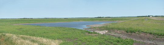 Black River impoundment site on Scott Sorvig's property. The site also provides hunting opportunities for the Sorvig brothers. Photo by Janet Nelson.
Myron Jesme, RLWD administrator, said they were very fortunate to have the new impoundment in place during the spring flood of 2022.
“We were able to store flood water at a time when the City of Crookston was experiencing a record flood,” said Jesme. “The floodwater in the city would have been much higher if not for the Black River impoundment.”
He added that the pre-existing Schirrick Dam located on the Black River itself is very sensitive to rapid changes in stream flow and reached near-capacity during the 2022 flood. He believes the new impoundment played a role in averting the need to open Schirrick Dam’s emergency spillway, which could have posed additional risks for the city of Crookston. “No dam operator wants to use their emergency spillway unless absolutely necessary,” he said.
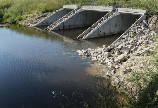
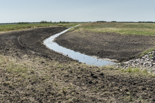 The northeast corner of the Black River impoundment showing the inlet entering the impoundment. Photo by Janet Nelson.
Installing the Black River impoundment also enabled the district to improve drainage upstream of the site, helping farmers in that area get the most productivity from their land. In the RRB, high water has different effects on the hillier areas east of the beach ridges, from the flatter lowlands to the west.
“A project like this is high value,” said Jesme. “It helps both groups of landowners and it makes it a lot easier to implement when there is all-around support.”
* One acre-foot is the volume of water held on an acre of land to a depth of one foot. This is about 325,000 gallons and is similar to the amount that could be stored to a depth of one foot on a 100-yard football field.
FDRWG Announcements
- This is the first issue of the FDRWG Currents newsletter. If you have questions or comments, please direct them to the Red River Basin Coordinator using the contact information at the bottom of the page.
- The FDRWG will hold its final meeting of the year on Wednesday, December 7, 2022, from 10:00 a.m. to noon. This will be concurrent with the Prairie Grains Conference at the Alerus Center in Grand Forks, ND and will provide an opportunity to share information on the FDRWG’s recent and upcoming activities to interested members of the agricultural community who are attending the conference.
- The FDRWG and the Red River Watershed Management Board (RRWMB) will hold their annual joint conference February 21-22, 2023 in Moorhead, MN. Those interested in attending who are not already on one of the organizations’ mailing lists can obtain registration information from the Red River Basin Coordinator or the RRWMB office in Ada, MN.
- The FDRWG’s Annual Report for the fiscal year that ended on June 30, 2022 is available at the FDRWG web site listed below. The report describes the Work Group’s activities and accomplishments, lists the current membership, and details the use of State funding in the fiscal year.
|