A Far North Adventure Photo Essay
Kelly Randall, SNA Outreach Coordinator
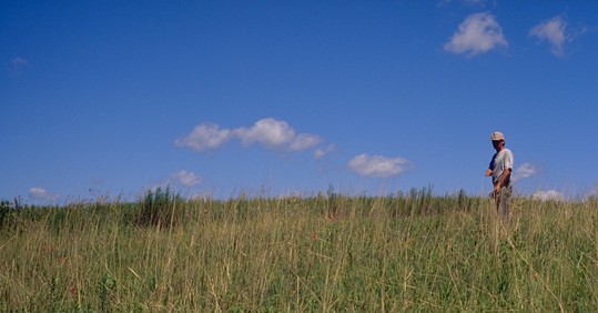
Last year, in the midst of the pandemic, I took time off to do a solo adventure trip across the northern reaches of Minnesota. The goal was to visit and take photos/videos of Scientific and Natural Areas (SNAs) and to get way out into nature after several months of not getting out much at all. In about two weeks, I explored 24 different SNAs, traveled about 1,500 miles, and took over 1,000 photos and 100 videos. The following photo essay is a tiny sampling of that adventure.
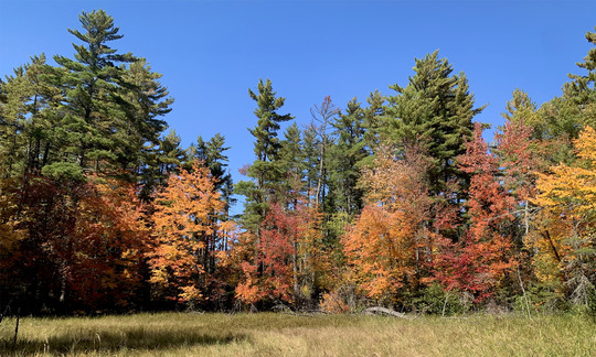
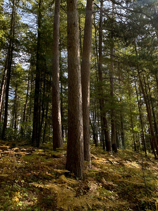 Sept 18, 2020 @ Lost 40: There is a reason the Lost 40 is one of the most popular Scientific and Natural Areas in Minnesota. The trails here lead you into a fine example of old growth white pine – red pine forest. The story behind the name will intrigue you too. On this day, the golden-hued bracken ferns at the feet of these giants signaled the fall colors to come.
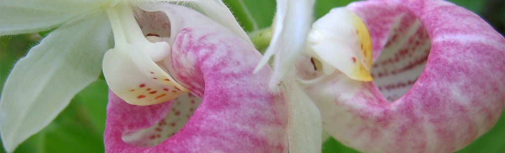
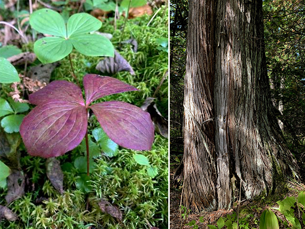 Sept 19, 2020 @ Ladies Tresses Swamp: A burgundy-tinged bunchberry (left) was another sign of fall. I would only recommend a visit here to those of you who really enjoy long hikes just so you can get your feet wet slogging through tangled alders. Some impressively large white cedar (right) will be your reward! Be sure you have a compass/GPS, and an impeccable sense of direction.
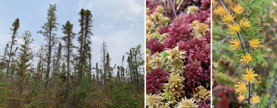 Sept 20, 2020 @ Myrtle Lake Peatland: This is where the adventure began. Preparing for this trip, I knew l’d need options to get near some SNA boundaries. My small car wasn’t fit for some “roads” I would encounter, so I enlisted my trusty mountain bike. It was a fun adventure riding my bike 4.5 miles (one-way) on an old, often wet, road grade to the western boundary of this SNA. Photos left to right: Northern white cedar, tamarack and black spruce; sphagnum moss; tamarack branch with golden needles.
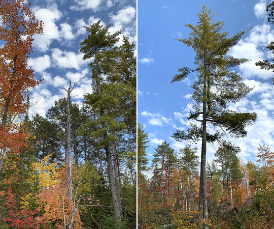 Sept 21, 2020 @ Purvis Lake-Ober Foundation: Fiery maples, birch and aspen mingled with the pines at this second oldest SNA in the state. A strong storm had toppled trees here and left significant gaps in the canopy. This made for, in places, a scramble similar to your local playground’s jungle gym and less of a hike. Lost Lake Peatland was earlier in the day.
 Sept 22, 2020 @ Kawishiwi Pines: This was what you would call an idyllic fall day in the north woods. A small wetland provided a perfect spot to capture the brilliant colors with a backdrop of old growth white pine. Local SNA staff guided the way to this remote site, making it an easy day navigating and enjoying the site once there.
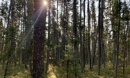 Sept 23, 2020 @ East Rat Root River Peatland and West Rat Root River Peatland: A relatively short drive from the Woodenfrog State Forest Campground allowed for early hikes into both peatland SNAs. I felt cold morning air draining into West Rat Root River Peatland starting at a warmer rocky outcrop, through lowland white cedars, and into the black spruce dominated peatland. Photo: Morning light streams though mature black spruce at West Rat Root River Peatland SNA.
 Sept 23, 2020 @ Watrous Island: You might say I used the term “visited” loosely at this SNA. Recent logging on county land made for easy access to the south bank of the Rainy River across from the Watrous Island, and very near the Canadian border. I got right down to the river edge, where this photo was taken. Close enough to say I’ve been there?
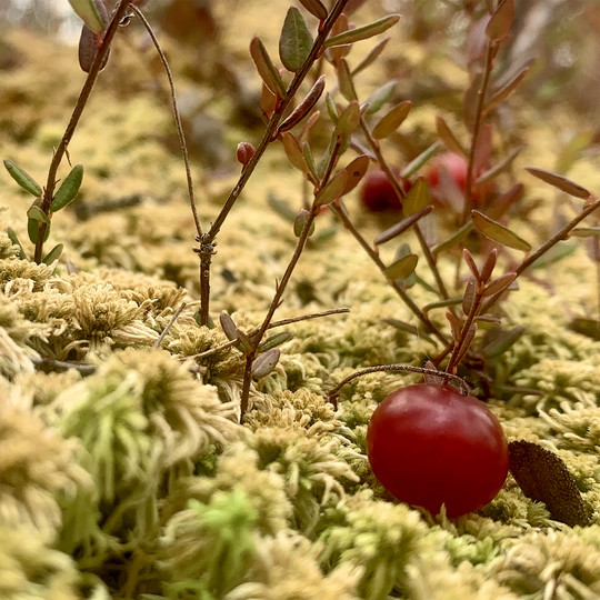 Sept 23, 2020 @ North Black River Peatland: This was another case where logging near the SNA proved helpful for access. A staging area just south of the SNA provided a parking spot off the road, and a direct hike through state land to the site. My notes on this site; “lots of cranberries.” Photo: The bright red of large cranberry pops out against the gray-green of sphagnum moss.
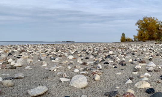 Sept 24, 2020 @ Pine and Curry Island: The island and point here are closed April 1 through September 1 to protect nesting shore birds, in particular the state endangered piping plover. I was happy my timing allowed me to visit. One word describes walking the sandy, sometimes rock strewn beaches at Morris Point in the hours before and after sunset… awesome! First stop of this day was to view the tall white pines at Gustafson's Camp.
 Sept 25, 2020 @ Winter Road Lake Peatland: The Roosevelt-Norris Road bisects this SNA, where I stopped at the road edge and walked into the peatland to snap a few moody photographs. Later in the day a challenging mile-long ditch trek with two crossings (including a water-filled rubber boot) were all part of the adventure to reach Norris Camp Peatland.
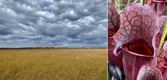 Sept 26, 2020 @ Luxemberg Peatland: I had been lucky enough to stay a couple of nights at Norris Camp, centrally located to multiple peatland SNAs. Luxemburg Peatland was the last one in the area to go see. I had intended to get out to the peatland features know as strings and flarks, but the half-mile trek out through a very wet sedge mat wore me down. I turned back not far after reaching the SNA boundary. Photos left to right: For a moment the sun brightens the Luxemburg Peatland fen; a pitcher plant that has turned red in the fall.
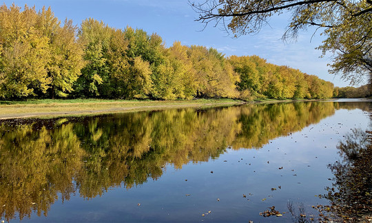
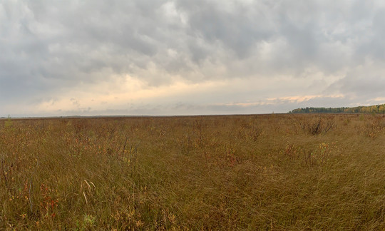
 Sept 27, 2020 @ Lake Bronson Parkland: You’ve heard the statement ”Now that’s different!” The tallgrass aspen parkland certainly felt different from the many peatlands I had been visiting. The aspen parkland landscape is a mosaic of prairies, aspen woodlands, with wet prairies, meadows, fens in low areas. I would recommend a fall walk in this landscape when the aspen turn golden. I also stopped at Sprague Creek Peatland earlier in the day.
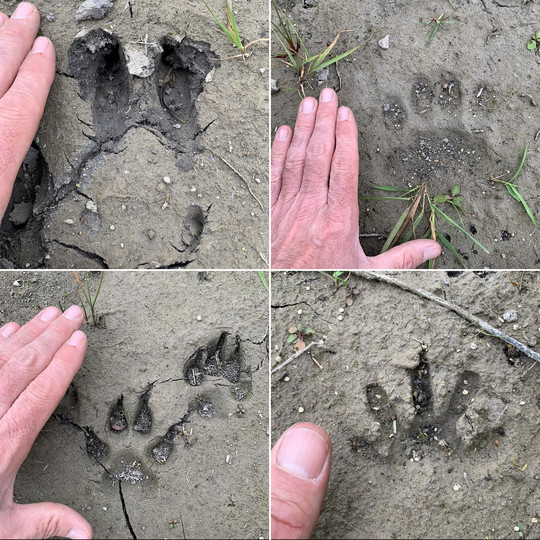 Sept 28, 2020 @ Two Rivers Aspen Parkland: A highlight came while walking back to the car in the road ditch that delineates the eastern boundary of this SNA. Within about a half-mile stretch I saw elk (upper left), bear (upper right), coyote (lower left), raccoon (lower right), deer, and human (my own) tracks. You’d think I was on an interstate highway for mammals!
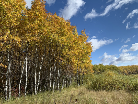
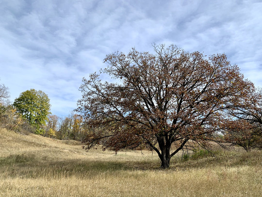 Sept 29, 2020 @ Agassiz Dunes and Prairie Smoke Dunes: Here, as in the aspen parkland landscape, you’d enjoy a fall savanna hike. The large oaks surrounded by prairie offer a muted palette of browns. Subtle. Relaxing. Photo: A large bur oak with prairie at Prairie Smoke Dunes. This day included Santee Prairie and LaSalle Lake stops.
The finish. After a few days visiting family, I traveled to the massive 87,580 acre Red Lake Peatland and adjacent Big Bog State Recreation Area. I’d highly recommend the Big Bog’s boardwalk, where you’ll see unique plant life with the added bonus of dry feet!
The final SNA came on the drive home. Lester Lake rounded out my far north adventure. I certainly met my goal of getting way out into nature on this trip. The amazing fall colors, interesting natural features, and the challenge of getting to some of the most remote SNAs in Minnesota made memories for a lifetime.
Back to top
Donate now to preserve Minnesota’s unique nature! ❤︎
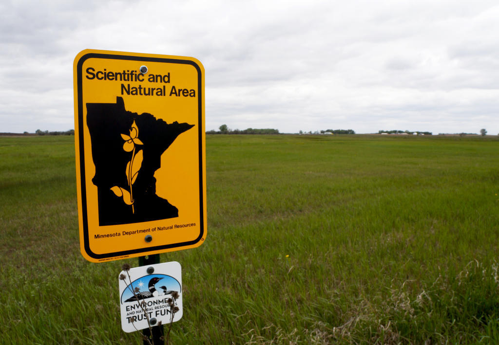
The Scientific and Natural Area Program works to protect the last remaining habitat for Minnesota’s rarest plants and animals. You can help sustain these habitats with a one-time or reoccurring donation online or by check. Visit our donation portal and remember the SNA program this giving season!

Site Highlight: Burntside Islands SNA
Ashley Rezachek, SNA Communications Outreach Specialist
Get ready to visit Burntside Islands Scientific and Natural Area this winter!
In a few months, snow will blanket Minnesota’s frozen lakes and outdoor lovers will dust off their skis and snowshoes in preparation for the season. While a boat is typically needed to access Burntside Islands Scientific and Natural Area (SNA), visitors can ski, hike and snowshoe across the frozen lake during the frosty months.
|
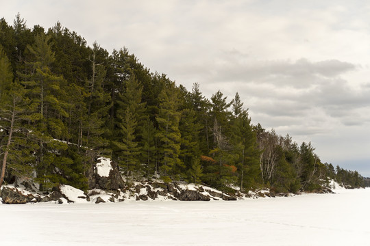 A conifer forest stands out against the backdrop of white clouds at Burntside Islands SNA. When Burntside Lake is frozen and covered in snow explorers may trek across the lake to visit the islands and their impressive forests.
Burntside Islands SNA is a collection of a small undeveloped islands in the southwest part of Burntside Lake, home to more than 100 islands. The SNA sits just across the lake from Sigurd Olson’s private cabin retreat, Listening Point [video]. Olson was a writer, environmentalist and protector of wilderness. He was also involved in the early protection and management of the site by The Nature Conservancy.
Today the 71-acre SNA protects wildlife habitat and features diverse forest types. Pine Island is home to a rare remnant of old-growth red and white pine forest with no known logging history. Snellman Island was logged for pine in 1905, and is now home to a mature second growth forests of pines, spruce, firs, aspen, and birches. Gaul Island, also known as Hayes Island, is home to a mixed forest, including white cedars.
Additionally, the chain of islands protects suitable nesting habitat for Minnesota's state bird, the common loon. Burntside Lake is a recognized breeding area for the special species.
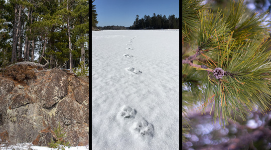 Caption: Burntside Islands SNA features rock outcrops (left) and an impressive red and white pines (right). Gray wolf prints in the snow on Burntside Lake (center).
Not planning to travel in the winter, but want still want to check it out? Make a virtual visit to the SNA and get a slice of that north woods charm. Or wait for the warmer months, when Burntside Islands SNA showcases an assortment of wildflowers or it’s variety of trees.
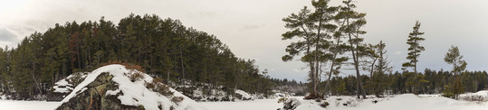 Caption: A panorama of a snowy Burntside Islands SNA. The SNA consists of a handful of small undeveloped islands.
A few facts about Burntside Islands SNA
- According to a 1981 management plan, based on a 1974 survey, the oldest red pine on Pine Island is estimated to be 300 years old.
- A number of adult loons from territories adjacent to the SNA islands were marked by United States Geological Survey scientists using geo-tags and radio-telemetry in 2011-2013.
- Burntside Islands has its own page in the SNA coloring book.
Back to top

Notes from Site Stewards
Site stewards monitor SNAs across Minnesota. Their observations provide valuable information to the SNA Program. Here are some interesting notes from recent reports.
- Jack Norland, Karensa Short, and the North Dakota State University’s Natural Resource Management club, the Site Stewards for Felton Prairie SNA, visited the site’s Dakota Skipper unit on August 4th. They were visiting as part of the interpretive event series, Wednesdays in the Wild. They saw some great prairie wildflowers and wildlife, including leadplant, blazing star, mountain mint, jumping mice, and white-tailed deer. Karensa even found some sleeping bees and commented, “There quite simply isn’t a better day than enjoying some wildflowers and adorable pollinators.”
- New Site Steward, Mark Erickson, made his first official visit as a steward to Minnesota Point Pine Forest SNA on August 31st. He observed wildlife on site including eagles, gulls, squirrels, and robins. He spent his visit collecting trash and removed some invasive common tansy as well.
- Another new Site Steward, Alex Maselter, spent eight hours in the month of June cutting sumac out of the remnant prairie at Cold Spring Heron Colony SNA during his first few visits to the site. He also observed a number of blooming wildflowers and wildlife, including purple prairie clover, yarrow, wild four o’clock, turkeys, and blue herons.
- In July, the Site Stewards at Townsend Woods SNA, Steven Gahm and Denise Friesen, pulled around 700 blooming invasive Japanese hedge parsley plants during a visit to the site. They also pulled wild parsnip from the trail leading into the site. If you’d like to see the site, come check out Townsend Woods SNA during our Self-guided Bioblitz from September 27th to October 11th!
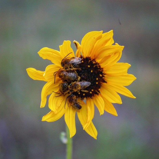 Five sleeping bees huddle together at the center of a wildflower. Photo by Karensa Short.
Protecting a Petite Prairie
On July 24th, we held a Queen Anne's lace removal event at Osmundson Prairie SNA, and it was great! Volunteer Outreach Specialist, Alex Miller, and Region 4 SNA Prairie Specialist, Brad Bolduan, led a team of six volunteers in hand-pulling this invasive species from the 6-acre site.
It was an incredibly hot day, though the group took frequent water breaks and rested often to prevent exhaustion. Luckily, there was a slight breeze that helped cool everyone off.
The group pulled every flowering plant that they could find at the site! Pulled plants were piled, with some of the volunteers taking a victorious seat on these piled “thrones.” The group then loaded the pulled plants into the back of Brad’s truck, to be disposed of off site. Everyone who came out had a good time, and it was truly a great day to get out and protect this remnant prairie!
Back to top

SNA Events
This fall we are excited to have several events lined up, both in-person and “self-guided!” Check out the SNA Events page for the most up-to-date event information.

|