The World According to Rocks
Final in a 50th anniversary story series highlighting natural features preserved on Minnesota Scientific and Natural Areas
Carrie Jennings, PhD, P.G. Research and Policy Director at Freshwater
Did you know that Minnesota’s Scientific and Natural Areas also protect fascinating geologic features in addition to unique ecosystems? The sites include landforms and records of significant events in the history of Earth as well as Minnesota. Here I retell that history through these sites from oldest to youngest, as well as a few other potential candidates for preservation.
However, the rock record is notoriously incomplete. Large stretches of time did not leave a trace or the evidence was eroded away. Yet, in Minnesota, there remain some very significant places that are worth protecting.
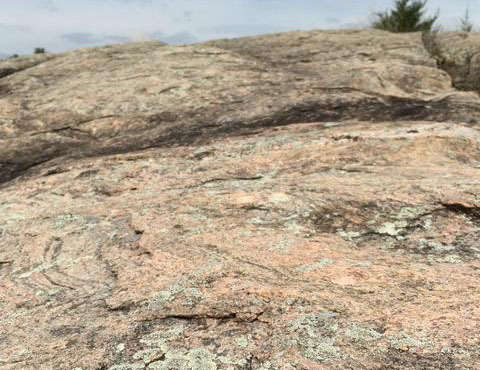
Gneiss at Morton Outcrops SNA. Photo by Kelly Randall.
“We’re Gneiss, don’t take us for Granite” announces the sign on the edge of Morton, in a punny way that helps with pronunciation. The gneiss or “rainbow rock” crops out conspicuously in town and buildings on the main intersection that are adorned with polished slabs. The long story of earth’s evolution begins with Morton Gneiss, once thought to be the oldest rock on the planet and now just slightly out-competed by rocks in Canada and South Africa. It is preserved at Morton Outcrops SNA and Gneiss Outcrops SNA and dates to 3.5 billion years.
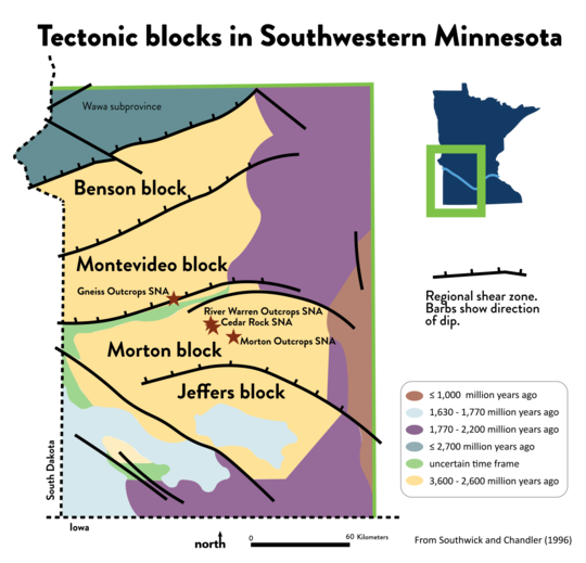
Nearby rock outcrops in the Minnesota River valley at Cedar Rock and River Warren Outcrops SNAs are slightly younger, subtly different outcrops that, together with the Morton Gneiss, provide clues to the early assembly of the North American craton—the stable interior of the continent. They are each in a mini-continent or block—Jeffers Block, Morton Block, Montevideo Block, and Benson Block—that were shingled up against one another as they careened around the globe more quickly than plates move today. The blocks still occasionally stir along their sutures, explaining the very low magnitude earthquakes felt (or not) in western part of Minnesota. The SNA program protects glimpses into the deep history of the assembly of the continent.
Tectonic map of southwestern Minnesota. The Minnesota River Valley subprovince consists of Benson, Montevideo, Morton, and Jeffers blocks. From Southwick and Chandler (1996).
An area slowly recovering after a forest fire on US Forest Service land near Gunflint Lake records a 2-billion-year-old catastrophic event that changed the world in minutes, but was only recently discovered by Minnesota Geological Survey geologist, Mark Jirsa. Imagine a shallow tidal pool hosting mounds of photosynthesizing algae. These stromatolites burbled oxygen into a sea rich with iron and silica. The layers of the Banded Iron Formation in this rock outcrop record red when oxygen “rusted” the iron, and black when oxygen was depleted. Suddenly a meteorite impact near Sudbury, Ontario formed a 150-mile-wide crater. The impact disrupted weak layers in the pool followed by a rain of ejected material that had melted on impact and hardened as it flew through the air. If that wasn’t enough, a tsunami followed. Wham, bang, and the course of the life on earth changed; iron formation ceased. Forest regrowth is obscuring the best outcrops but a few good exposures still exist.
 |
This 25-foot layer may represent one day of deposition during a 48 million-year time period.
About a billion years later, with an atmosphere now oxygen-saturated, Minnesota was nearly torn apart as a new ocean formed where Lake Superior now sits. Lava oozed out of cracks, cooling into black basalt and red rhyolite, similar to what is happening in Iceland today. These rocks of the Midcontinent Rift are exposed along the shores of Lake Superior and St. Croix River valley. Ancient volcanic features can be seen in Sugarloaf Point or Butterwort Cliffs SNAs. Lake Superior still gnaws away at these cliffs and rounds them into the pebbles on the rocky black and red beaches preserved at Iona's Beach SNA.
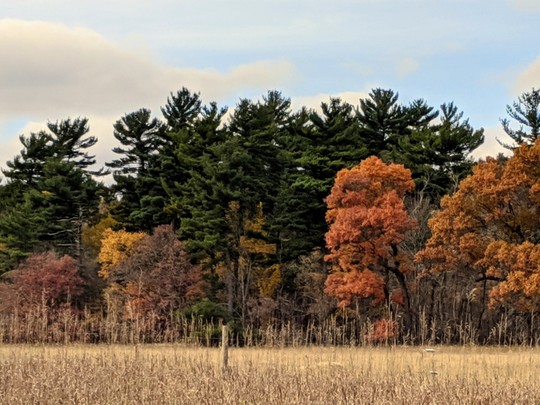
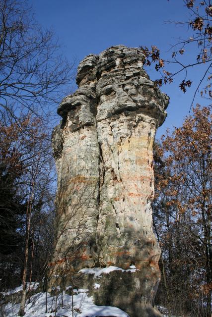
Ahhh, time to relax for a few hundred million years as warm oceans washed in and out as recorded in thick rock layers that were the former beaches (sandstone), offshore mucky waters (shale) and deep waters teeming with ancient shelly life (limestone and dolostone). These layers form the Paleozoic Plateau of southeastern Minnesota. Rivers flowing to the Mississippi slice through the layers, forming iconic remnants—isolated towers and bluffs. The limestone or dolostone layers protect softer sandstone and shale layers to create features like Chimney Rock, Brownsville Bluff and King's and Queen's Bluffs SNAs. The views created by the rivers and roads slicing through the rock also demonstrate how water has moved through certain layers preferentially, dissolving rock as it goes. Sinkholes dot the surface, hinting at a subsurface riddled with caves that can swallow streams, as demonstrated in Cherry Grove Blind Valley SNA.
Chimney Rock SNA. Photo by Madison Douthitt.
No SNAs exemplify the Cretaceous period (145-65 million years ago), but Hill Annex Mine State Park has mine spoil that is being studied for its fossil treasure like sharks’ teeth and bones of swimming dinosaurs. And a mine in New Ulm has turned up fossil ammonites with coiled shells as big as hubcaps, as well as delicate leaves preserved in tidal pool sediment.
The last 2 million years saw off-and-on glaciation; no part of Minnesota was spared. Even southeast Minnesota missed only the last couple of glaciations and is therefore not truly driftless. Rock outcrops in northeastern Minnesota would not be exposed if not for glaciation. The Minnesota River outcrops protected by SNAs were revealed by glacial floodwater. The rock towers and bluffs in the Paleozoic Plateau of southeastern Minnesota are a testament to the slower release of meltwater to the Mississippi by meltwater streams.
Sometimes a singular glacial landform gets special notice even though the entire surface of Minnesota is an example of something from the glacial period. The Ripley Esker and the Lost 40 SNAs both protect snakelike ridges that are the gravelly deposits of streams that flowed in tunnels beneath the ice. They would be mined if not protected. I remember a geologist from Illinois sadly reporting that there were no eskers left--they were spread on the roads of Chicago. The SNA program keeps some around for the geology students and citizens of the region.
The SNA program protects both the inanimate and animate. The DNR continues to work with geologists to find worthy sites so that geology of our state will continue to be both an educational and economic resource for the future.

Site Highlight: Minnesota Point Pine Forest SNA
AmberBeth VanNingen, NE Regional SNA Specialist
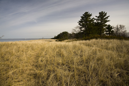
Four native plant communities. Up to thirteen listed rare species. Migratory bird habitat. Dynamic ecosystems. Unique geology. Good public access. Lake Superior. Minnesota Point Pine Forest SNA in Duluth checks a lot of the boxes for SNA designation. It’s not hard to see why so many people have been drawn to enjoy and protect this sand spit, one of the longest freshwater baymouths in the world, as it curves out between the St. Louis River Estuary and Lake Superior. There is nothing else like it in Minnesota.
The dune and sand beach communities found here, and only here in Minnesota, are part of the Lakeshore System of native plant communities. These communities are dynamic - growing, shrinking, and shifting in response to water levels and land use changes. Several of the listed species found along Minnesota Point are dune-specific species – beach heather, beach grass, and hairy-necked tiger beetle, for example. The pine forest, at the more stable center of the point, originated over 160 years ago. It is composed of towering white and red pine, with paper birch, blueberries, and plenty of poison ivy in the understory. Both the beach and forest are popular stopping points for migrating warblers, shorebirds, and raptors.
|
 |
This SNA features an old growth pine forest growing on a sand bar about a third of a mile wide. Photo © ColdSnap Photography
Protecting places like Minnesota Point takes another kind of community. In this case, it took neighbors, conservation partners, the landowners, and a legislative committee to partner with the DNR over several decades to create Minnesota Point Pine Forest SNA. Among the first calls for modern conservation of the area was in the 1930s by Dr. Olga Lakela, prominent botanist and founder of the herbarium named for her at the University of Minnesota-Duluth. By the 1970s it had come to the attention of the Commissioner’s Advisory Committee, who recommended it for the newly created SNA program. In 1996, the Park Point Community Club successfully applied for funding from the Legislative Commission on Minnesota Resources (now the Legislative-Citizen Commission on Minnesota Resources, LCCMR) to study and protect the old-growth pine forest. That same year, DNR staff completed an assessment of the old-growth and a project evaluation used to guide SNA designation. In 1998, the landowner, Superior Water, Light, and Power, donated land on the point that they were not using for pump houses to the Minnesota Land Trust (MLT). In turn, MLT put a conservation easement on the land to ensure its protection, no matter who ended up owning the land. MLT then gave the land to the DNR for designation as an SNA, which finally occurred in 2002.
Perpetuating the natural features of Minnesota Point is enhanced with a community of partners as well. The City of Duluth manages the land on either end of the SNA, and also the Park Point Hiking Trail that traverses the point past Sky Harbor Airport. The City and the 1854 Treaty Authority have both helped control invasive species in and around the SNA in recent years. Last year, the Park Point Community Club rallied volunteers to clean up an abandoned encampment on the SNA. MLT continues to hold and monitor its easement. LCCMR has again provided funding for the site, this time for a 10-acre addition to the SNA to be added after construction on the nearby airport runway is completed. The U.S. Army Corps of Engineers (ACOE) is conducting beach nourishment activities to help replace sand and sediment eroded by successive, historic storms battering the shorelines. ACOE takes dredged material from shipping lanes in the harbor and deposits it so that waves will bring it back to the point. All of this is in concert with the work of SNA, Minnesota Biological Survey, Nongame, and other DNR staff.
 |
Many of the pines here are between 120 and 200 years old. Photo by David Minor.
Because of its good access, location in Duluth, and uniqueness, Minnesota Point is one of the most visited SNAs in the northeast. From Canal Park, drive over the aerial lift bridge and follow Lake Avenue (which eventually becomes Minnesota Avenue) all the way to the end of the road. Park at the public parking lot just before you get to Sky Harbor Airport and follow the Park Point Hiking Trail ¾ of a mile to the edge of the SNA. The trail continues through the SNA, and all the way to the Superior Entry. Dogs are allowed on both the SNA and other lands, but please keep them on a leash, even on the beach. Bikes and motorized vehicles are not allowed. Poison ivy is prolific, so brush up on your plant ID before you head out. This is a popular and perfect spot for hiking, bird watching, photography, and just and sitting on the beach.
In Memory of Dale Bohlke
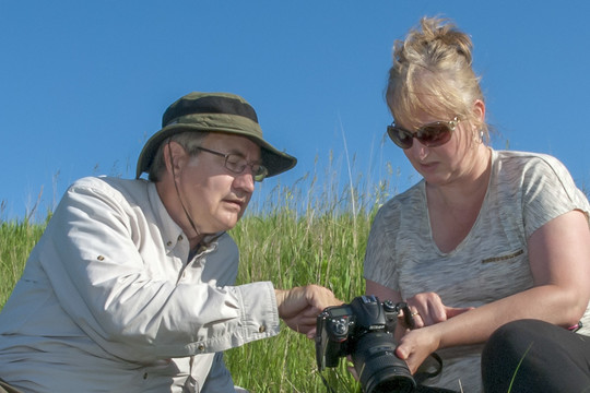
Dale Bohlke sharing his knowledge of nature photography with a workshop attendee at Cottonwood River Prairie SNA in 2014.
Dale Warren Bohlke M.D. of New Ulm, 68, died Sunday, October 20th, 2019 at his home of pancreatic cancer.
Dale was a passionate nature photographer, videographer, and a good friend of the Scientific and Natural Areas (SNA) Program. He traveled to natural places far and wide, capturing rare moments in the wild.
“I first met Dale in the late 1990s when I attended New Ulm Photo Club gatherings. Dale was active in that group and we shared an interest in nature photography. Later I saw some of Dale’s prairie images decorating the lobby of the New Ulm DNR office,” said Brad Bolduan, Scientific and Natural Areas Region 4 Specialist.
SNAs and other Department of Natural Resources lands were frequently a location of Dale’s work. You can watch many of his videos on his Vimeo and YouTube channels.
“Dale’s talents behind a camera were equaled by his humble generosity. He donated hundreds of spectacular images of Minnesota SNAs, and hundreds of hours as site steward and photography workshop instructor. He came to us with an idea to do ‘one minute video tours’ of some sites. The idea turned into stunning reality at nine sites,” said Kelly Randall, Scientific and Natural Areas Outreach Coordinator.
These short vignettes let you see the natural world through his eyes. You can appreciate the care and attention he paid in all of his work. He did camera-trap work on Cedar Mountain and other SNAs, which helped contribute to the understanding of the occurrences of animals on those sites. Dale served as a site steward for Cottonwood River Prairie SNA and led photography workshops on Scientific and Natural Areas.
“Over the past year he made several visits to Swedes Forest SNA to gather video of a cedar removal project. Dale filled a rather unique role for the SNA program in Southern Minnesota and statewide. He will certainly be missed,” Bolduan said. Randall concurred saying, “We will surely miss Dale, and our sincere sympathies go out to his friends and family”.
He was a frequent visitor of SNAs, and was a friend to all in the SNA Program.
Big Bluestem at Sunrise. Wild Indigo Prairie SNA. © Dale Bohlke.
You can see some of his work featured on web pages for:
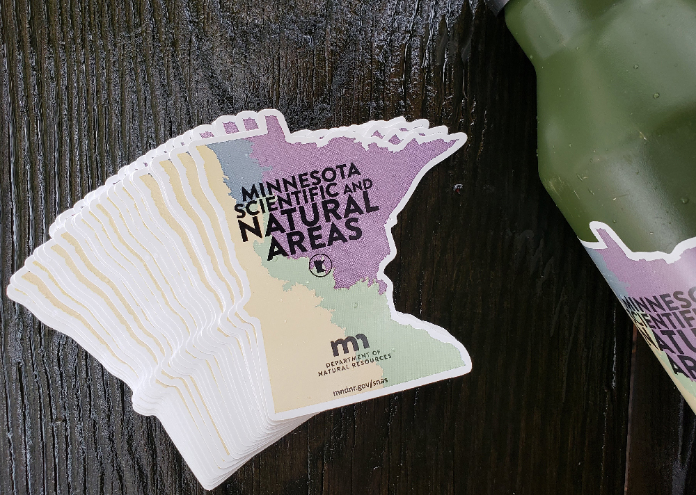
Show off your support for Scientific and Natural Areas!
Fill out this form and we will send you one of the new Minnesota shaped Scientific and Natural Areas stickers! They look great on water bottles, car bumpers, and coffee tumblers!

SNA Events
Brrrrr, winter is here alright! Hopefully you are staying nice and warm. But, don’t worry. There are still some SNA events coming up this season. Get out there and find the wild places! Be sure to check the website for an updated list.

Notes from Site Stewards
Site stewards monitor SNAs across Minnesota. Their observations provide valuable information to the SNA Program. Here are some interesting notes from recent reports.
- Janet Rith-Najarian, the site steward at Itasca Wilderness Sanctuary SNA, has been very busy this season documenting species on the site for the iNaturalist database. She is also continuing to develop educational virtual guided tours of the main trail into the SNA, using a panoramic 360-degree camera and taking a series of photos along the trail.
- Norma Malinowski and Martha McPheeters visited Kawishiwi Pines SNA, to check the boundary markers on October 31. They mentioned that this is the perfect time of year for a boundary marker check, because the “lack of leaves, lack of bugs, and slightly frozen ground made the bushwhacking almost pleasant and the swamps and marshes passable (with knee high boots!)”
- Site steward Marsha Kurka visited Boot Lake SNA, during prime fall colors on October 23, and noticed that “the tamaracks were a beautiful yellow, and the oaks were all shades of red and brown.” She also mentioned the lake was full of hundreds of ducks, which she said was pretty cool to see.
- Site steward Tom Rice led a volunteer brush removal event at Chamberlain Woods SNA in November. Students from a Conservation Biology class at Gustavus-Adolphus attended, as well as Master Naturalists. Tom said "We had a good turnout and got everything done I’d hoped.” Students were happy to get outside and tackle some invasives.
 |
Fall colors at Boot Lake SNA on October 23rd. Photo by Marsha Kurka.
Thanks for all the work you do, SNA stewards!

|


