An Insight into Hill’s Thistle Populations at Blanket Flower Prairie
By Kylie Jensen, Student at North Dakota State University
Hill’s thistle (Cirsium pumilum var. hillii) is a species with narrow habitat requirements and very limited range in Minnesota; it is dependent on well-drained dry prairies. This species has many ecosystem benefits, among them, providing a nectar source for pollinators, seed as food for birds, insects and small mammals, and seed head fibers used by various fauna. Yet, the continued loss of prairie has contributed to a decline in Hill’s thistle populations. Because of this decline and rarity, Hill’s thistle is listed as a species of special concern in Minnesota. The population at the Blanket Flower Prairie SNA is at the far western edge of its range.
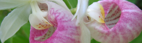
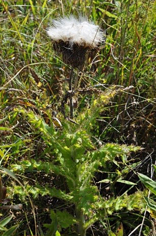 Hill’s thistle plant, including seed head. Photo by Linda Norland
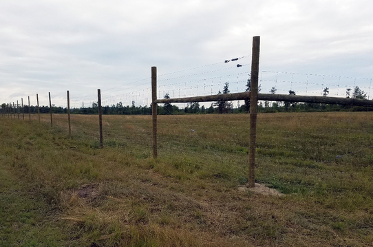
This fall semester (2017) at North Dakota State University (NDSU) my advisor Jack Norland and I developed a research project to monitor the Hill’s thistle population at Blanket Flower Prairie SNA. We developed a monitoring system to help identify changes in Hill’s thistle population over time at the SNA. I used past population counts and locations of this species for reference. I then used a randomized function to select 10 random locations to sample. Within these 10 locations, I created 50 meter transects in a GIS system, which were assigned geographic coordinates to the transect end points.
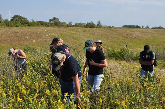
For the field portion of my research, my team and I used a GPS receiver to locate the end points of the 50 meter transects and marked them with flags. Next, we split into two to four person teams and walked each side of the transect from one flag to the next. This created a 4-meter-wide sample belt along the 50 meter transect. As we walked, we counted all individuals (rosettes and whole plants) that were found as I recorded the data.
The team searching for Hill’s thistle at Blanket Flower Prairie SNA. Photo by Linda Norland
After the data were recorded from each sample belt transect, I was able to calculate the population density for each location. Next, I compared thistle numbers to past population counts at each location. I learned that
thistle number had declined along all but three of the transects. This comparison used different sampling protocols, and so may not reflect the actual trend in population numbers. In the future, the surveys will use this newly created protocol to ensure better estimation of population trends.
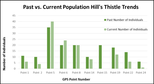 Individual Hill’s thistle plants per GPS point number.
Continued monitoring of Hill’s thistle at Blanket Flower Prairie SNA and throughout its native range is important to build a clear picture of how thistle populations are faring.
I would like to give a special thank you to my advisor Jack Norland and the NDSU Natural Resource Management Program for guidance throughout this project. I would also like to thank Linda Norland for sharing her pictures of the field day and the NDSU Natural Resource Management Club and volunteers for helping with the field work.
Brochure and Statewide Map Now Available
In the last issue of Nature Notes, we mentioned a forthcoming Scientific and Natural Area (SNA) brochure, noting that it and a statewide map would be printed soon. We are happy to report these publications are now available and we have begun distributing them across the state. If you are interested in getting copies for yourself or a supply for your organization please contact the DNR Information Center at 888-646-6367 or by email at info.dnr@state.mn.us.
The program hasn’t had a brochure for many years. It is hoped this communication tool will introduce the program to those unfamiliar with us. For those who know us already we’ve highlighted goals, program focus areas, and encouraged you to get involved.
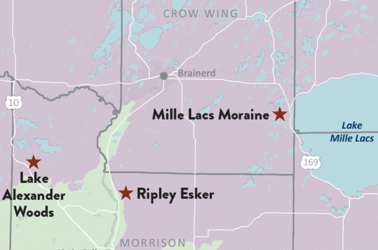 Sample of updated statewide SNA map showing sites in the Mille Lacs Lake/Brainerd area.
The statewide map is an redesigned update. It includes locations of all current sites, a new grid for finding SNAs, and directions to each site on the back of the map. You can also download a digital copy of the map.
We hope you find these publications useful and informative!
New State Forest Maps Available
You may be interested in one of six newly published state forest maps available in two options, a geoPDF and paper map. Users can download the geoPDF version of the map onto a mobile device using a variety of map apps, which will allow you to track your own location as a blue dot on the displayed map. The new user-friendly paper maps highlight the unique recreation features of each forest and include pop-out maps for popular campgrounds and day-use areas.
New geoPDF and paper maps are now available for:
Free paper maps of these, and other state forests, are available at local DNR offices or the DNR Information Center at 888-646-6367 or by email at info.dnr@state.mn.us.
Site Highlight: La Salle Lake SNA
By Shelby Bauer, SNA Web and Social Media Specialist
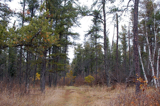
Just north of Itasca State Park, escape the crowds and take in the wild beauty of the Mississippi River at La Salle Lake Scientific and Natural Area.
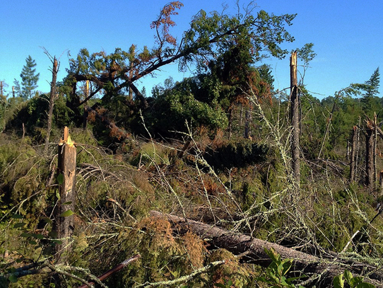
This Natural Area protects a rare jack pine woodland. However today you might not make this observation too quickly. A 2012 wind storm blew down much of the jack pine and nearly wiped the plant community off the landscape.
But, that was five year ago. Today you can walk down a rolling trail through the grass, lined with a few interpretive signs, and observe the restoration of this rare jack pine woodland. Here and there jack pine saplings tower over dense bracken fern and beaked hazelnut. Quaking aspen quiver in the wind and the sweet scent of lowbush blueberry and bush honeysuckle drift in a warm summer’s breeze.
The end of the trail takes you up a small hill, topped by a single old jack pine; where on hot summer days you can smell the pine’s sap as you gaze out over the Mississippi River.
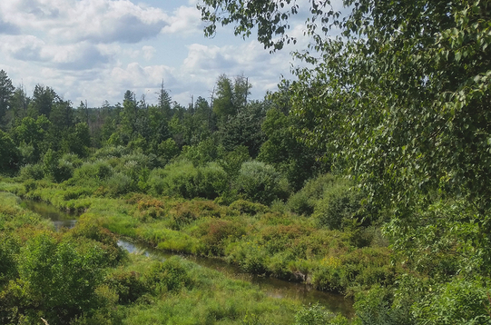 Overlooking the Mississippi River at La Salle Lake SNA. Photo by Shelby Bauer
SNA Events
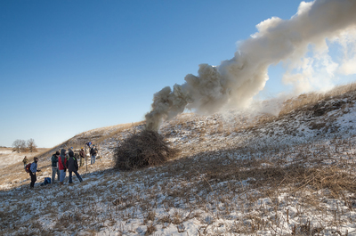
Events are a nearly year-round affair at Lost Valley Prairie SNA! In winter months the focus is on cutting and burning brush. Join in on one of these fun stewardship projects. A full list of fun is available on the SNA Events Calendar. Check back frequently as new events are added, including a winter exploration of Sugarloaf Point SNA!
Brush pile burning at Lost Valley Prairie SNA. Photo by Brett Whaley
Notes from Site Stewards
Site stewards monitor SNAs across Minnesota. Their observations provide valuable information to the SNA Program. Here are some interesting notes from recent reports:
- Site stewards Bill Marengo and Ester Gasik reported watching several birds October 17 and 18 at Mound Spring Prairie SNA. Their observation report included ruby-crowned kinglet, eastern bluebird, cedar waxwing, fox sparrow, and western meadowlark. They also saw a sharp-tailed grouse, which is very uncommon to see in southwestern Minnesota.
- On November 26, newly enrolled site steward Lee Lewis made some observations during his first visit to Black Lake Bog SNA. Noted were winter birds such as pileated woodpecker and snow buntings. There were also a few hunting parties seen on the road/trail to the SNA.
- Downed trees and invasive buckthorn were noted as items that need work at Quarry Park SNA. This assessment was based on a November 4 and December 3 visits by site steward Julie Snarland with assistance from Laura Kundrat.
Thanks for all the work you do for SNAs stewards!
Volunteer Opportunity
Do you love Minnesota winters? How about taking photographs? If you said yes to both, we have an opportunity for you! Volunteer to photograph Scientific and Natural Areas this winter and share them on the Minnesota SNA Flickr group!
More information about the types of photos we are looking for and which SNAs to take them at can be found online at DNR Volunteer Opportunities.
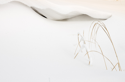
Winter grasses at Joseph A. Tauer Prairie SNA. Photo by Dale Bohlke
|