|
On June
22, 2016 top officials from the Federal Emergency Management Agency (FEMA)
recognized the City of Baltimore for its outstanding achievements in reducing
flood risks and increasing community resilience.
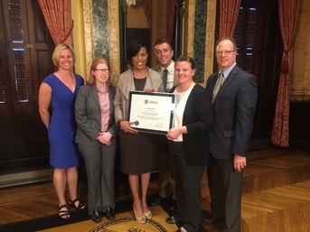
Mayor Stephanie Rawlings-Blake
accepted a plaque recognizing the city’s proactive floodplain management
program and community preparedness work. Baltimore City achieved a Class 5
designation under the National Flood Insurance Program (NFIP) Community Rating
System (CRS) certification. Baltimore’s score places it in the top 10 percent
of all CRS participating communities, and entitles City residents in the flood
zones to a 25 percent discount on flood insurance premiums.
CRS is a
voluntary incentive program that recognizes and encourages community floodplain
management activities that exceed the minimum NFIP requirements. By reducing
flood damage to insurable properties, strengthening and supporting the
insurance aspects of the NFIP, and encouraging a more comprehensive approach to
floodplain management, the City is eligible for discounted flood insurance
premium rates. Baltimore property owners pay almost $2.5 million collectively
in flood insurance annually. The CRS Class 5 designation will save them almost
half a million dollars every year, reducing property expenses while helping to mitigate costly flood damage.
 The CRS
uses a Class rating system to determine flood insurance premium reductions for
policyholders. For CRS participating communities, flood insurance premium rates
are discounted in increments of 5% (i.e., a Class 1 community would receive a
45% premium discount, while a Class 9 community would receive a 5% discount).
The CRS classes for local communities are based on 18 creditable activities,
organized under four categories:
- Public Information,
- Mapping and Regulations,
- Flood Damage Reduction, and
- Flood Preparedness.
The City
earned the distinction of a Class Five designation in part because of the
City’s demonstrated success building a strong community outreach and education
component into the flood preparedness efforts.
As the
impact of climate change grows, Baltimore faces an increasing number of
challenges stemming from severe tidal and riverine flooding. In 2003, Hurricane
Isabel caused $4.8 million in damages and left 70,000 residents without power.
In April 2014, four inches of rain fell in a few hours leading to massive
flooding citywide and overwhelming infrastructure systems. Through its
participation in the CRS rating system, Baltimore is better equipped to protect
people and property and make the city more resilient overall.
The CRS
program is managed by the Baltimore Office of Sustainability. More information
can be found at http://www.baltimoresustainability.org/crs/
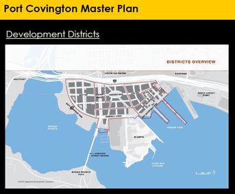
The
owners of Under Armour have purchased a 50-acre industrial site in Port
Covington for their Headquarters and campus. The site is home to the former
Wal-mart and Sam’s Club. In addition, Sagamore Development Company, owned
by Kevin Plank (founder and CEO of Under Armour), has purchased several parcels in
the broader Port Covington area for redevelopment. At 260 acres, this is projected to be one of the largest urban
redevelopment projects across the United States. The scale of this project will not only be
transformative for South Baltimore, but for the entire City.
The Draft Master Plan was presented to the Planning Commission on June 2, 2016 and made available for public comment. Comments collected have been posted to the Department of Planning's website.
On
June 23, 2016, the Planning Commission unanimously adopted the Port Covington Master
Plan. This plan sets the vision and framework for the many subsequent
land use and other actions needed for implementation of the Draft Master Plan. On July 14, the Planning Commission will review the repeal of the Urban Renewal Plan for the Port Covington area as well as Tax Increment Financing, or TIF, legislation.
For more information on the TIF legislation, follow the links below:
Council Bill 16-0669: Port Covington Development District
Council Bill 16-0670: Port Covington Bond Issuance
Council Bill 16-0671: Port Covington Special Taxing District
The Draft Master Plan and presentation may be viewed on the Department of Planning's website.
 |