High Water Report for April 5, 2025 at 10 a.m.
Latest updates regarding weather related closures
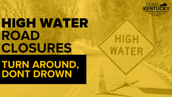
COVINGTON, Ky. (April 5, 2025) – High water is impacting numerous roads in KYTC District 6. These roads remain blocked due to flooding. New roads will be added to the closure list as updates are available.
High water remains possible even for roads not listed. Drivers are urged to check GoKY for traffic conditions before traveling. Never drive through a flooded roadway. Remember: Turn around. Don't drown.
KYTC will continue to provide updates as new closures are added and previous closures are cleared. Additional updates between press releases will be posted on the KYTC District 6 Facebook page.
List of roads in District 6 impacted by high water and/or mudslides:
Please note this list only includes state routes. Flooded roads added throughout the day will be listed as NEW. Roads in which water has receded are listed below as 𝗖𝗟𝗘𝗔𝗥 and will then be removed from the list during the next update.
Bracken County
- Neave Milford Road/Santa Fe Road (KY 539) (0.0 to 6.0 mile points)
- KY 19 in Milford between Neave Milford Road and Santa Fe Road (1.95 to 2.26 mile points)
Campbell County
- Pond Creek Road (KY 1936) at the corner Visalia Road (6.8 mile point)
- River Road (KY 445) at 1.6 mile point. This is located between Delta Ave. and Mary Ingles Highway (KY 6635)
- Oneonta Road (KY 1566) near Truesdell Road (0.8 to 1 mile points)
- Mary Ingles Highway (KY 6335) between River Road (KY 445) and Tower Hill Road (4.6 to 1.8 mile points) due to a mudslide.
Carroll County
- KY 36 from the railroad crossing to KY 47 (21.97 to 23.21 mile points)
Gallatin County
- KY 467 from Glencoe to Gallatin/Grant County line (7.9 to 9.9 mile points)
Grant County
- Warsaw Road (KY 467) near split with Elliston Mt. Zion Road (KY 1942) (1.9 mile point)
- Northbound lane on U.S. 25 at 1.9 mile point blocked due to high water.
- Elliston Mt. Zion Road (KY 1942) from Warsaw Road (KY 467) to Sipple Road (0.0 to 2.70 mile points)
Harrison County
- KY 3016 (0.0 to 1.9 mile points)
Kenton County
- NEW: Locust Pike (KY 1930) near Locust Pike Park (1.5 to 2.5 mile point)
- NEW: Decoursey Pike (KY 177) near Washboard Road between 3.8 and 4.7 mile points
- NEW: River Road (KY 8) between Amsterdam Road (KY 371) (0.01 mile point) and 1.20 mile point
- Fowler Creek Road (KY 1486) between Senour Road (KY 2047) and Sycamore Creek Drive (2.0 to 2.5 mile points)
- KY 14 (Rich Road) between Hempfling Road and Cruise Creek Road (6.4 to 6.8 mile points)
Owen County
-
NEW: KY 355 from Gratz to KY 227 near Worthville (6.5 to 18.9 mile points)
Pendleton County
-
NEW: KY 177 between KY 467 to Pendleton/Kenton County Line (9.15 to 9.59)
-
NEW: KY 177 at the railroad tunnel near Butler (5.3 mile point)
-
NEW: KY 22 between KY 159 and Milford Road (11.7 to 13 mile point)
- KY 177 between U.S. 27 to KY 609 (2.3 to 4.0 mile points)
- KY 330 from Tobacco Road to KY 1054 (3.96 to 7.13 mile points)
- KY 609 between Davis Road and Quail Run Road (1.91 to 4.0 mile points)
Robertson County
- KY 617 (Piqua Kentontown Road) between Waterworks Road and KY 165 (Blue Licks Pike) (4.09 to 5.36 mile points)
###
|