KYTC District 2 High Water Report for Feb. 18, 2025 at 12:30 p.m.
Road condition update
MADISONVILLE, Ky. (Feb. 18, 2025) – Changes to road conditions continue to happen quickly. Many roads are reopening as water levels drop, but there are still some roadways that are just closing this morning as flood waters move down stream into other areas.
Increased flooding along the Ohio River and Green River counties continues to be a possibility as rivers continue to climb as flood waters move downstream.
Caldwell County
KY 126 is blocked by high water at the 4.7 mile point (NEW)
KY 672 open with high water between U.S. 62 and KY 1627
KY 1627 blocked by high water between the 7-8 mile points
Christian County
KY 115 open with high water between the 0.8-1.0 mile points
KY 117 open with high water between the 7.0-11.5 mile points
KY 117 is blocked by high water at the 18.8 mile point
KY 345 blocked with high water between the 0-4, 6-7 and 9.2-9.5 mile points
KY 1338 blocked by high water at the Tradewater River
KY 1453 open with high water between 0-2 mile points
Daviess County
KY 140 open with high water between 1-3 mile points
KY 298 blocked by high water between the 2-3 and 5.5-6.5 mile points (UPDATE)
KY 298 open with high water between 4.5-5.2 mile points (NEWS)
KY 405 open with high water between 1-2 mile point
KY 554 open with high water at the 8.3 mile point
KY 661 blocked by high water at the 1.9 mile marker (Daviess-Hancock line)
KY 762 blocked by high water between the 0-1 mile (CLEAR)
KY 764 blocked by high water between the 1.2-1.3 mile points
KY 951 blocked due to a landslide at the 1.3 mile point
KY 1207 open with high water between the 1.4-5,4 mile point (CLEAR)
Hancock County
KY 334 blocked by high water between the 10-15 mile points
KY 1265 blocked by high water between the 4-5 mile points
KY 2181 open with high water between the 1-2 mile points
KY 2181 blocked by high water between the 4-5 mile points
Henderson County
KY 268 blocked by high water between the 7-7.8 mile points
KY 416 is open with high water between the 10.3-10.6 mile points
Hopkins County
U.S. 62 blocked by high water between the 20-22 mile point
KY 502 open with high water between the 1-4 mile points
KY 1220 is blocked by high water between the 2.5-3 mile points
McLean County
U.S. 431 is restricted to one lane due to a landslide slide at the 1.1 mile point
KY 85 is blocked by high water at the 6.7 mile point
KY 256 blocked by high water between the 5.8-8.8 mile points (NEW)
KY 1155 is blocked by high water at the 5.5 mile point (UPDATE)
Muhlenberg County
U.S. 62 blocked by high water at the Hopkins County line
KY 175 blocked by high water between the 22-24 mile point
KY 176 blocked by high water between the 3.5-4.4 mile points (CLEAR)
KY 1379 blocked by high water between the 0-2 mile points
KY 2590 blocked by high water between the 2-2.8 mile points
Ohio County
West Kentucky Parkway has an overnight lane restriction at the 7.8 mile points
KY 69 open with high water between the 15.3-15.9 mile points
KY 69 open with high water between the 18-19 mile points
KY 136 open with high water between the 4-4.2 mile points
KY 273 is open with high water between the 3-3.2 mile points
KY 369 is blocked by high water between the 0-1 mile points (NEW)
KY 505 is blocked by high water between the 14-15 mile points
Union County
Webster County
KY 132 blocked by high water between the 0-1 mile points
KY 138 blocked by high water between the 10.6-10.7 mile points (CLEAR)
KY 270 blocked by high water between the 6.8-8.3 mile points (CLEAR)
KY 494 blocked by high water between the 0-1 mile points (CLEAR)
KY 1832 open with high water between the 3-4 mile points (CLEAR)
KY 2837 blocked by high water between the 0.6-1.3 mile points (CLEAR)
Other weather related issues:
I-69 northbound at the 87 mm (near the Caldwell-Hopkins County line) remains restricted to one lane due to a rock slide. Traffic in the left lane is still moving. Due to weather conditions, the right lane remains closed at this time.
U.S. 431 in McLean County is restricted to one lane due to a landslide slide at the 1.1 mile point
Be aware of areas that frequently flood and proceed with caution
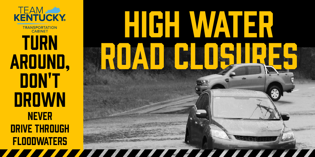
Turn around, don't drown.
+++
To get traffic advisories and alerts for KYTC Highway District 2 counties via email, please go to: https://public.govdelivery.com/accounts/KYTC/signup/13668 . Click on the District 2 counties you regularly drive through, or on any of the specialty corridors you travel. Please respond to your subscription request confirmation that will arrive via email. Check to make sure Gov Delivery is approved by your email spam filter.
Traffic alerts and advisories are available at www.Facebook.com/KYTCDistrict2 . Please LIKE and FOLLOW District 2. You do not have to be a Facebook member to access this page.
You may also get up-to-date traffic information at goky.ky.gov, or by using a map APP that includes traffic information.
###
|