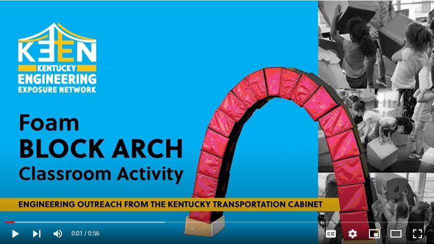
 Foam Block Arch Activity
By Michael Black
Arches appeared as early as the second millennium B.C. in Mesopotamian brick architecture. Their systematic use started with the ancient Romans, who were the first to apply the technique to a wide range of structures. They laid the groundwork for some of the most important advancements in architectural history by developing an arch capable of supporting huge amounts of weight. The arch became a vital feature of bridges, gates, sewers, and aqueducts, which in turn were integral to the modernization of cities.
Our foam Block Arch Classroom Activity is educational, engaging and most of all, it's fun! Students of all ages (including many adults) enjoy the process of building the arch structure that is made of numerous systematically shaped building blocks stacked in sequence to form a free-standing arch.
During this activity, students learn the value of teamwork, quickly realizing completion of the structure is not practical to achieve without assistance from other students. The life lesson of “working together” and basic geometric functionality are demonstrated with this hands-on activity. Of course, safely knocking the structure down is always FUN as well!
The foam block arch activity works best with groups of 4-8 students and can be completed in 15-20 minutes if background information and instruction is provided ahead of time. For larger group sizes, students can be grouped into smaller units and the activity be performed as a competition to see which smaller group can assemble the arch in the shortest time.
Follow Up for Students:
What is an arch?
Where and when did the arch originate?
What is a “keystone” in relation to an arch structure?
The SPARKS newsletter will be emailed periodically to subscribers with information about careers, STEM presentations, events and more. Please sign up below:
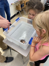
 KEEN Shows Up at Science Night
KYTC Highway Engineer Nick Beasmore and KYTC Environmental Coordinator Hunter Pace attended the Cardinal Valley Elementary Science Night held on November 10. They answered questions, provided information, displayed construction materials, and distributed giveaways to the school's 1st – 5th graders. The K’NEX Bridge Tester and building sets were setup to demonstrate how a KYTC activity and presentation would work in a classroom.
KEEN is a free KYTC program intended to spark an interest in engineering and invest in Kentucky’s future workforce.
KYTC engineers and professionals volunteer their time to introduce students of all ages to engineering career fields through fun activities in the classroom, engaging at career fairs, and attending youth groups and camps.
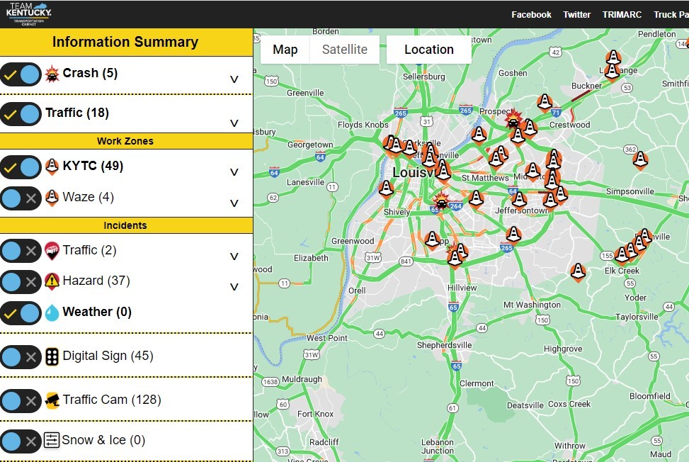 Where are we?
Geographic Information Systems (GIS) shows us!
By Will Holmes
Do you like finding patterns and solving puzzles? Do you enjoy "figuring out things" on a computer?
If so, then GIS (Geographic Information Systems) may be a fun tool for you. If you’ve ever used Google Maps to look something up or to navigate to a place, then you’ve used GIS.
Almost everything is tied to location. Your home, school, or favorite hamburger, waterslide, or place to visit have a “where” tied to them.
GIS uses location and time to figure out patterns hidden within data. We use it for everything from determining where would be a great new location for an amazing restaurant or deciding where to send help during an emergency flood, just like the Eastern Kentucky flood in August.
Within KYTC, GIS is used for everything from leadership meetings with local and state officials that are developing plans to build or improve roads, to where archaeologists need to survey, to field crews maintaining road signs.
GIS is used by our engineers, lawyers, archaeologists, biologists, accountants, and a variety of other professionals every day to help them make good decisions that keep Kentuckians moving. It is used in the office, in the field, and across the entire state.
Click the button to see downloadable and interactive maps that KYTC makes for people to use.
Talk to your science teacher. There may be opportunities to explore GIS in your school. Click the button below for more resources to explore.
Classroom GIS exercise
Today, you are a KYTC Transportation Engineer! Here is an exercise to discover how GIS works.
GIS can show many different kinds of data on one map, such as streets and buildings, but it can also show less obvious data about specific locations. An example we will explore in this activity is Annual Average Daily Traffic (AADT).
AADT is a measure of how much traffic travels on a specific road during a typical day. It is calculated by dividing the total annual count of vehicle traffic on a road by 365 days. KYTC uses AADT to plan transportation work, including building new roads or upgrading existing roads.
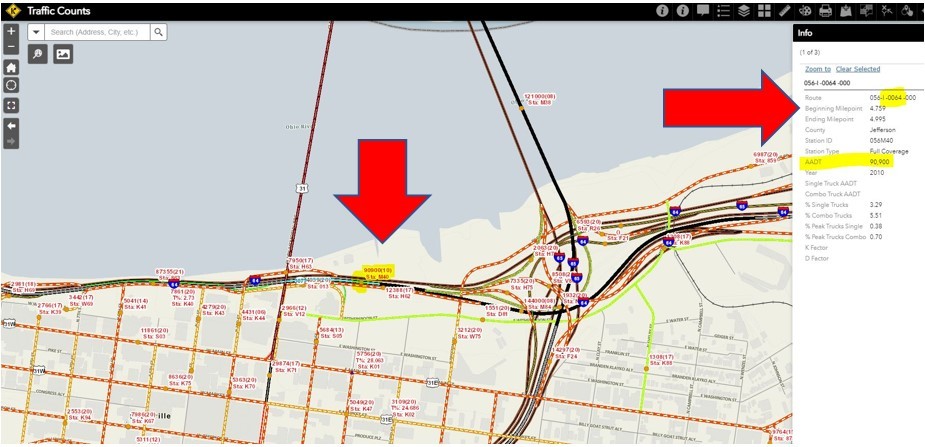
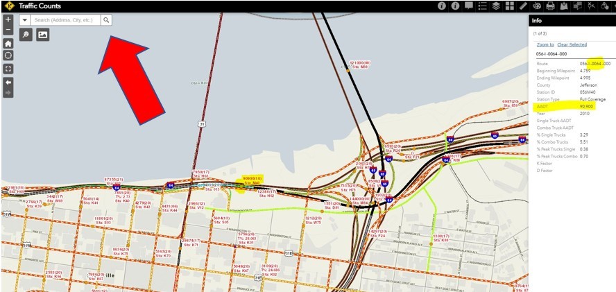
4. When you pick a road with a recorded traffic count, you will see an AADT pop up on the right side of the screen along with other information about the road. See an example of Interstate 64 in Louisville below.
 5. Now find your school's road by typing its address in the search.
 6. Check the AADT for your school's road and compare it to Interstate 64's AADT above.
a. Which road has more vehicles using it?
b. Why does one have more than the other?
It may have more lanes or higher speed limits. These things can impact how many vehicles use the road.
Having access to GIS data helps KYTC make better decisions by providing the raw information in an easily understandable format. All of the information KYTC records is tied to a map, so we can access the information when we need it.
7. Let’s look at those two roads again.
a. Should these roads have the same number of lanes?
b. What about their assigned speed limits, should they be the same?
c. What do you think KYTC should do to improve these roads given their AADTs?

SCHOLARSHIP NEWS
Hello everyone!
The application period is now open for our Civil Engineering, Construction Management, & Civil Engineering Technology scholarships. Interested students can apply by going to our website. Click the button to start the journey.
Once you click the link, it will take you to the page where you can read about the scholarship requirements. About halfway down the page, you will find the link to the application. Click it and the application will open. You can type your info directly into the page.
There is also a list of required items that will need to be submitted with the applications. The items may vary depending on whether the students are high school seniors or are already at a college/university.
The last action needed is to review and make sure they have all documents, then sign and send the application packet to my attention (Marianne Sullivan) postmarked by February 1, 2023.
If there are any questions, I am available at either Marianne.sullivan@ky.gov or by phone, 502-782-4970.
I look forward to meeting the new applicants!
Marianne Sullivan
Scholarship Program Coordinator
|