KY 15 to soon close in Breathitt County as floodwaters near crest of Panbowl Dam
Other closures reported in Estill, Powell, and Perry counties
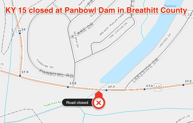
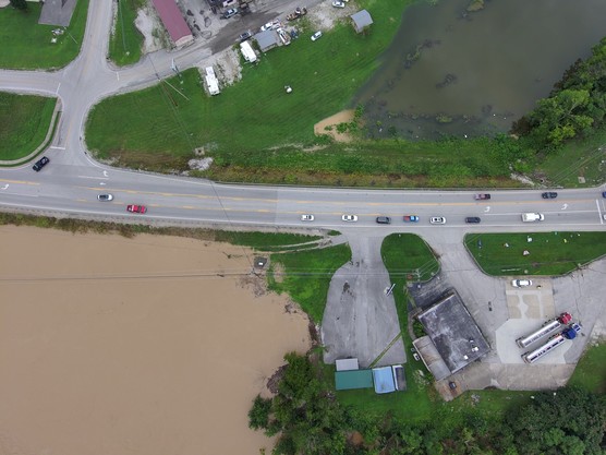
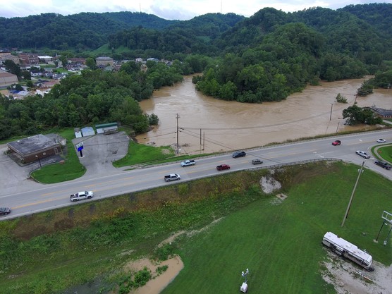
JACKSON, Ky. – KY 15, the major north-south thoroughfare linking the upper Kentucky River valley with the rest of the state, will be closed beginning at 9:30 tonight as a precaution as floodwaters from the North Fork of the Kentucky River approach the top of Panbowl Dam.
The closure is at milepoint 17.7 within the city limits of Jackson, between Lakeside Drive and the KY 15/KY 30 intersection. The highway traverses Panbowl Dam; the lake was impounded when this section of KY 15 was built in the early 1960s.
Kentucky Transportation Cabinet (KYTC) personnel will be at the site to monitor the situation overnight. Emergency response vehicles will be allowed to travel through the closure unless water from the river starts flowing across the embankment. Once the river crests, KYTC will assess the situation and reopen the road when it is safe.
In the meantime, any traffic from central Kentucky bound for Hazard should use alternate routes such as I-75 and the Hal Rogers Parkway through London and Manchester, or the Mountain Parkway, KY 114, US 23, and KY 80 through Prestonsburg.
Due to high water, KY 15 is also closed south of Jackson in Breathitt County at Lost Creek, near the KY 476 intersection. State routes feeding into KY 15 between Jackson and the Perry County line, including KY 30, KY 1098, KY 1812, KY 1110, KY 476, and KY 1278 are also affected by high water. Once floodwaters recede, KYTC personnel will be able to access those areas to assess damage. Drivers are urged to stay off those roads until they are free of flooding.
Other closures are being reported along the North Fork of the Kentucky River, including KY 28 and KY 451 at Chavies in Perry County. Other routes in Perry County have been affected by last night’s heavy rain. Some damage or flooding may not have been reported due to communications issues caused by the record rainfall.
River flooding has closed roads such as KY 1571 and KY 3328 in Estill County and KY 613 in Powell County. These locations are in flood-prone areas and the highways frequently close due to high water.
Motorists are urged not to drive through flooded areas, especially during overnight hours when hazards such as debris on the pavement or washed-out sections of roadway may not be visible.
###
|