|

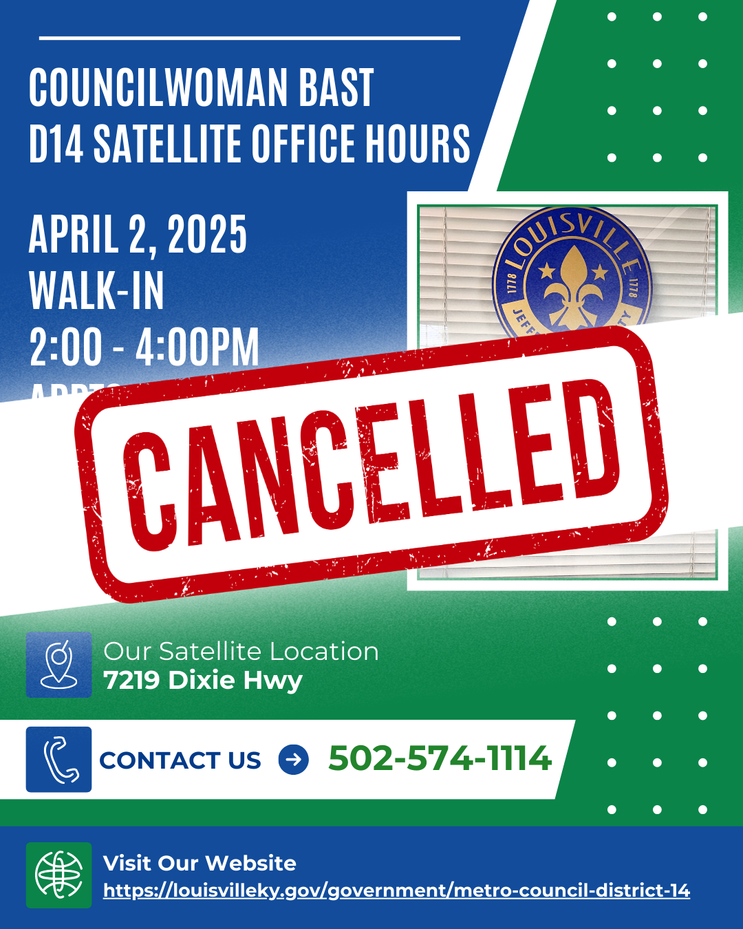
Due to the high-impact weather event predicted for our area, this has been cancelled. Please see weather alert updates below.

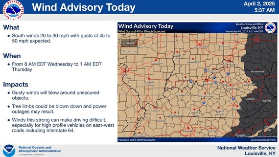
- A Wind Advisory is in effect for today. Wind gusts up to 50mph will be possible.
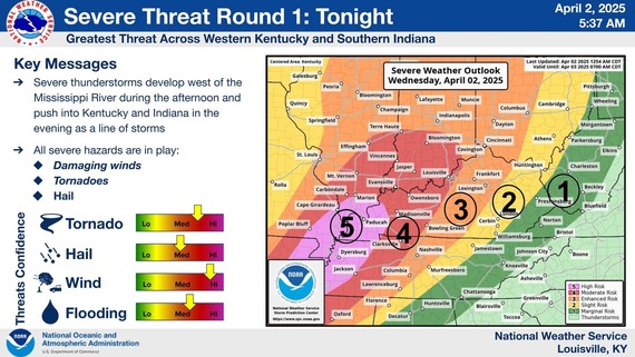
- Severe storms will move through the area this evening and into the overnight hours. All severe hazards will be expected, with significant wind and tornadoes possible.
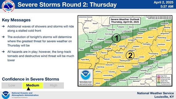
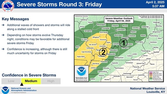
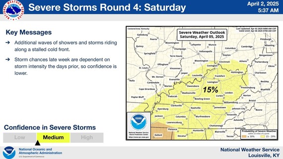
- Additional rounds of severe weather will be possible Thursday, Friday, and Saturday.
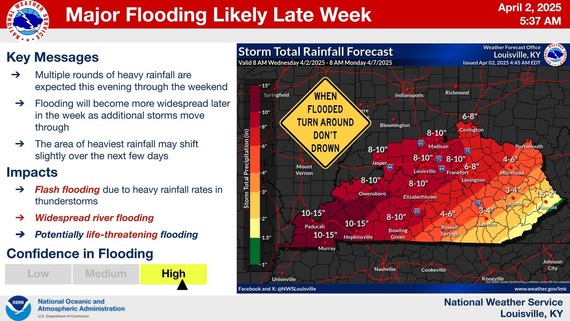
- Multiple rounds of rain will lead to major flash flooding and river flooding.
- Never drive through flooded roadways. Turn around, don't drown.
- Be prepared tonight and through the weekend having multiple ways to get warnings!
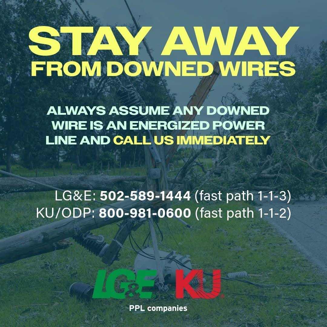
Severe thunderstorms are moving across portions of our service territory and are causing impacts to our system. Our crews are on standby to respond as soon as it is safe to do so. Remember to always treat any downed wire as an energized power line and stay away! Visit lge-ku.com/storm for important safety information and storm updates.
 |
After periods of rain in the Louisville Metro area, sewer overflows may be occurring. Water containing sewage may be discharged from sewers in the MSD service area and may be on the ground, in drainage ditches, or in nearby streams. You are advised to avoid contact with the Ohio River, creeks, streams and drainage ditches, as they may contain sewage and stormwater runoff contaminants that could make you sick. If you, your family or your pets do come in contact with possibly contaminated water, wash it off with warm, soapy water, especially before handling food. While its still raining and for 48 hours after it stops raining, DO NOT FISH, WADE or SWIM in outdoor waters!
|
|
|
|