Indiana Geographic Information Office - OCTOBER 2021

Geographic Information Office NEWS

Office of the GIO

GIS Logo
GIS Day 2021
NSGIC Award
Missing County Boundary

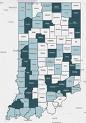
Submit your 2021 GIS Data for the Harvest


ESRI - BIM

GIS and BIM Take First Major Steps to Integration

Bringing everything from utilities information to site conditions out of a GIS map into a BIM usually requires cumbersome rework. That's now changing. - Geographic Information Systems and Building Information Modeling have developed side-by-side over a period of more than three decades, with civil engineers, architects and contractors using both types of data to better inform airport, transit, road and even general building projects. Article 


Butterfly


Oil Spill


What to Do When Fragile Infrastructure Fails: a GIS Emergency Response Playbook

In the early morning hours of Sunday, October 3, residents in the surfing town of Huntington Beach, California noticed the smell of oil. Thoughts of a leak at a nearby gas station were quickly replaced by a nightmare scenario
Read more.

Virtual Training

2021 ArcGIS Virtual Training Classes for State and Local Partners

The Geographic Information Office (GIO) is offering virtual training classes for state and local partners.  Hard copy training materials are shipped to your preferred location.  Students will access a virtual machine, loaded with the software, that will allow you to work through the hands-on labs.  The instructor (Irv Goldblatt) will be able to see your screen and help out with any issues during the class. Space is limited, register todayRegistration Training Portal


LiDAR

OpenTopography Fundraiser for new Indiana QL2 3DEP LiDAR Data Hosting

In 2020, new 2016-20 statewide Quality-Level-2 (QL2) LiDAR was completed for Indiana. This new statewide LiDAR data is twice as accurate, twice as detailed, and up to eight-years newer than Indiana’s original 2011-13 LiDAR.  IGIC is now conducting a fundraiser to raise a one-time investment of $50,000 to add this new 2016-20 statewide LiDAR dataset to our existing IndianaMap OpenTopography site.  DONATE


 https://content.govdelivery.com/accounts/INIOT/bulletins/2f94dba

 OCTOBER 2021

Megan Compton

Megan R.L. Compton
Indiana Geographic Information Officer (GIO)

IN Office of Technology
100 North Senate Ave.
Government Center North
Indianapolis, IN 46204

Office: (317) 234-5889
gio@iot.in.gov


IGIC 2021

IGIC - Indiana Government Geospatial Coordinator’s Forum

Join IGIC on October 27, 2021 for the Indiana Government Geospatial Coordinator’s Forum. This annual event takes place from 9:00 am to 3:00 pm eastern at the
The Pyramids
3500 DePauw Blvd
Indianapolis, IN 46268

2021 Esri Logo


MOOC- Massive Open Online Course: Spatial Data Science: The New Frontier in Analytics 

Work with powerful analytical tools in Esri's ArcGIS software and learn how to integrate popular open data science packages into your analyses. Register for MOOC


Deep Dive into Imagery Capabilities for State & Local Government

December 15, 2021
10:00 a.m.–10:45 a.m. (PT) 

The diversity and volume of imagery and remote sensing data are growing rapidly. Drone, aerial, and satellite imagery and other types of remotely sensed data are expanding opportunities in nearly every facet of government. Imagery can now provide communities with insights into nearly every aspect of operations, including urban planning, natural resource management, event management, and disaster response. The key is integrating imagery into GIS, making it possible to visualize analyze and share the data Register


Robert Downey Jr. and Jack Dangermond on Reshaping the World | Extended Interview

FootPrint Coalition's Downstream Channel - Robert Downey Jr. and Rachel Kropa discuss GEODESIGN with Jack Dangermond and Ryan Perkl.Listen

Downstream