Indiana Office of Technology sent this bulletin at 08/26/2020 03:29 PM EDT
Geographic Information Office NEWS
Office of the GIO
Join our GIS Team
The Indiana Geographic Information Office and Indiana Office of Technology are excited to share a new opportunity. We are seeking a highly motivated and skilled individual for the open position of GIS Program Director. Interested applicants can find details of this career opportunity and the position posting with the Indiana Office of Technology. Job Posting
State GIS Conference September 29 - October 1, 2020
Lt. Governor Suzanne Crouch will kick-off our virtual conference. The first two days of the conference will include the dynamic programming you've come to expect from the annual conference, while a portion of day three will feature our Geospatial Coordinator's Forum and an IGIC Board Meeting. Registration/Information
Esri Story Maps let you combine authoritative maps with narrative text, images, and multimedia content. They make it easy to harness the power of maps and geography to tell your story.
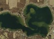
2020 Watershed Assessment & Planning Activities
IDEM assesses surface water each year through various programs and staff produce work plans for each year's activities. A story map was created to better reach more of the public about what they do to collect water quality and aquatic life data and how it is studied and assessed. Story Map
Indiana Marinas
A Boater’s Guide to Indiana’s Marinas provides the locations, services, amenities, hours, and contact information for designated Indiana Clean Marinas and other Indiana marina and boating facilities. Story Map
ForestIN
Indiana DNR is planting a million trees in five years. ForestIN, a program to increase the state's tree canopy. Indiana DNR's Division of Forestry will manage the program, provide seedlings, and coordinate with divisions, non-profits, businesses and the general public to bring more trees to the Hoosier state. Thus far, 220,200 trees have been planted around the state. Story Map
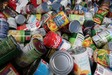
Map-Based Apps Help Fight Food Insecurity Caused by COVID-19
In response to the quickly spreading outbreak, the state of Indiana needed to assemble a team of experts, including FSSA and the GIO team, to create an online application that could connect residents to nearby food pantries, meal sites, and schools. Esri Case Study
Watch your email for a schedule of upcoming virtual GIS training opportunities from the GIO. STAY TUNED!
Esri Solutions
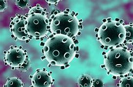
Esri released 11 new solutions, including new COVID-19 and the first racial equality solution. Details
Coronavirus Health Screening can be used by businesses, utilities, and government agencies to conduct coronavirus (COVID-19) health screenings before employees and visitors enter a facility, or location. Health Screening
Coronavirus Site Safety can be used by businesses, educational institutions, and government agencies to create coronavirus (COVID-19) health safety plans for their facilities, sites, and campuses; and monitor the health safety plans as locations reopen. Site Safety