Indiana Geographic Information Office - NEWS

Geographic Information Office NEWS

Office of the GIO

GIS Logo
Virus

Indiana COVID-19 Dashboard

Indiana State Department of Health dashboard that illustrates cases, fatalities and demographics. Indiana Data Hub


Food Assistance

Interactive map helps Hoosiers find food assistance

A new interactive map is helping Hoosiers find the food assistance they need near them. RTV6 News Map


Polis Center

Coronavirus Data Hub aims to help Indy locate most vulnerable neighborhoods

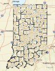
The Polis Center at IUPUI has created a new resource to help find areas of Indianapolis that are vulnerable to the coronavirus outbreak. Fox59 News Coronavirus Hub


USGS

USGS Flood Inundation Mapper

The FIM Mapper allows users to explore the full set of inundation maps that shows where flooding would occur given a selected stream condition. Mapper


Esri

Virtual Esri User Conference

Join Esri for the largest, virtual GIS event, July 13-15, 2020. Get access to online training, virtual networking, the Plenary Session, and much more. Registration


Having trouble viewing this email? View it as a Web page.

April 2020

Indiana GIS

Megan R.L. Compton
Indiana Geographic Information Officer (GIO)

Indiana Office of Technology
100 North Senate Ave.
N551 Government Center North
Indianapolis, IN 46204

Office: (317) 234-5889
gio@iot.in.gov


Census

2020 Census

The Census is happening now. The data collected by the Census Bureau impacts how we respond to pandemics like COVID-19. It’s important that Hoosiers are counted.
Census Indiana


Cartography MOOC

Learn from Esri experts and make beautiful maps using ArcGIS Pro. FREE
Esri MOOC
MOOC