Withlacoochee River System Update - 9/26/2022
Southwest Florida Water Management District sent this bulletin at 09/26/2022 09:39 AM EDTWater Levels High as Hurricane Approaches
Rainfall and Hurricane Ian:
- Substantial rainfall over the past couple months has increased river flows and filled area lakes.
- Now, with potential impacts from Hurricane Ian later this week, water levels could rise much higher.
- Heavy rainfall is expected Wednesday and Thursday of this week, and storm surge along the coast could be devastating.
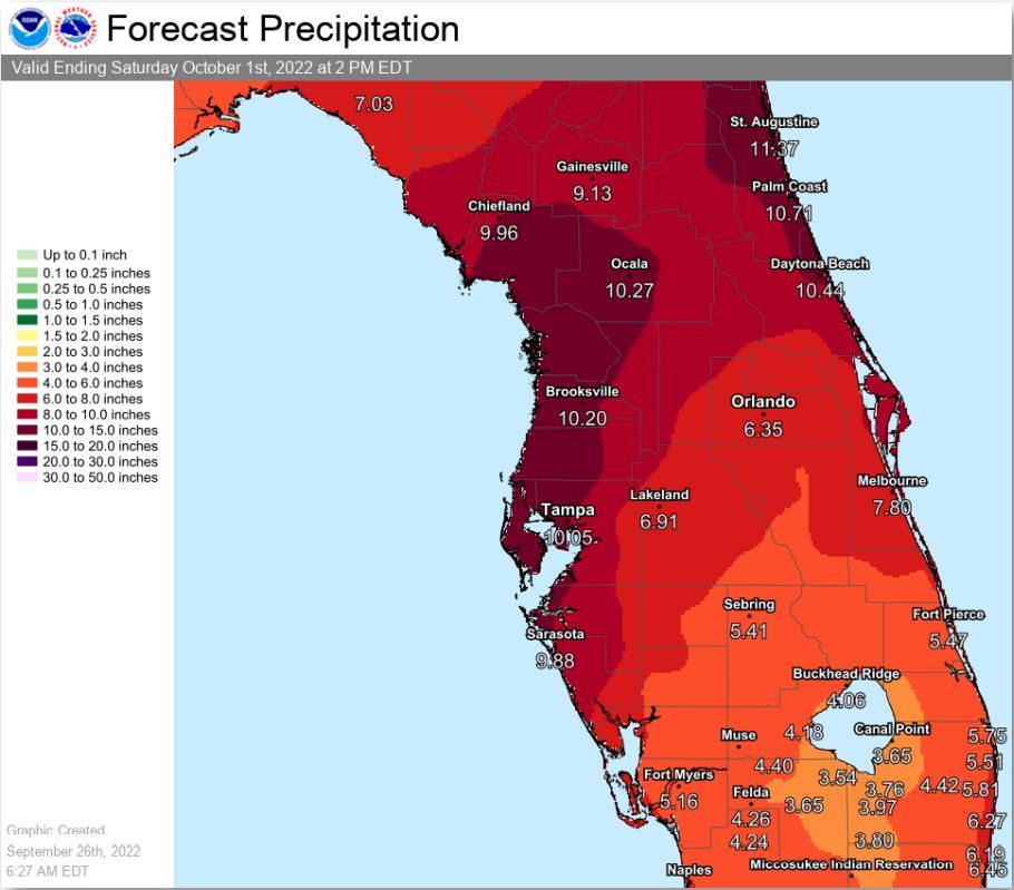
- The graphic below is the forecast precipitation from Hurricane Ian.
- Its still too early to tell exactly where the hurricane will make landfall and what the impacts will be, but now is the time to prepare!
- Continue to monitor weather forecasts over the next couple days because a lot can still change.
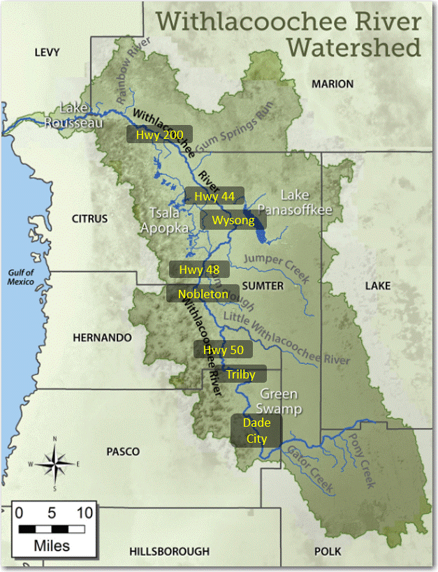
Withlacoochee River (from the Green Swamp downstream past Hwy 200):
- As Ian approaches, river levels are already high.
- Upstream areas along the Withlacoochee River (Green Swamp and Dade City) have recently crested from heavy rainfall in early September.
- Most other areas, from US 301 in Trilby all the way downstream past Hwy 200, are still rising from these late wet season rains that occurred over the past few weeks.
- With the river still peaking, if this forecasted heavy rainfall does occur, the Withlacoochee River could reach moderate flood stage in the coming days/weeks.
- The National Weather Service has a website that shows predicted levels at 4 locations along the Withlacoochee River (https://www.weather.gov/serfc/).
- These predictions are based on past rainfall and only the next 2 days of forecast rainfall.
- Since heavy rainfall from Ian is not forecasted until Wed/Thurs, there are currently no flood predictions for the Withlacoochee River, but that will likely change.
- If you live along the river, I strongly encourage you to keep an eye on these changing forecasts, especially in the next couple days and in the days after the storm.
- Now is the time to prepare for rising river waters if you live in a flood prone area.
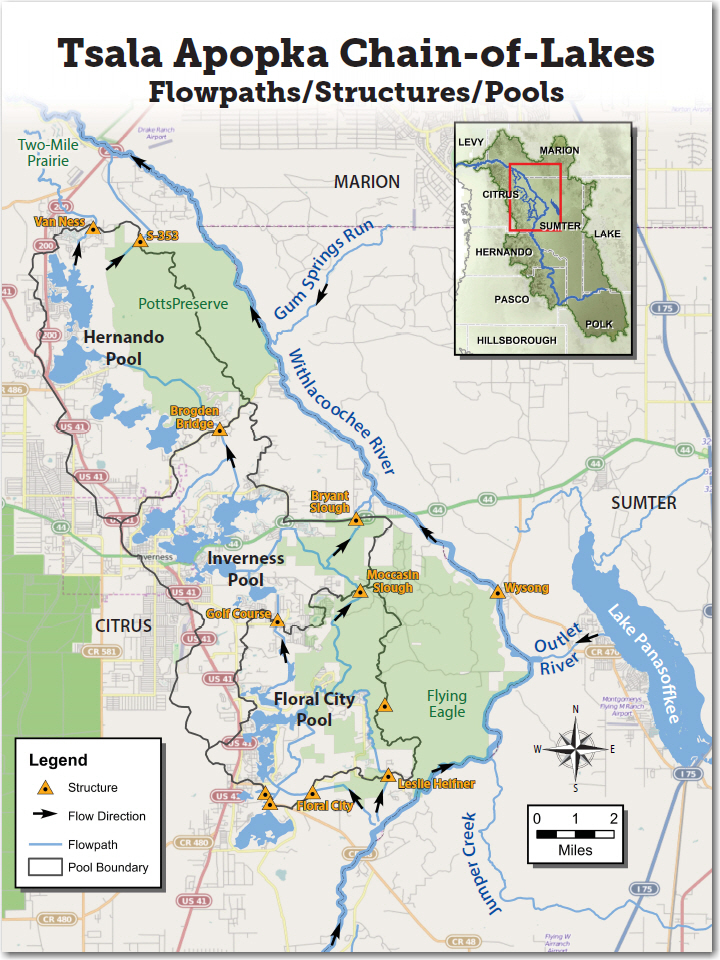
Tsala Apopka Chain of Lakes:
- As the wet season winds down, water levels in the Tsala Apopka Lake Chain had just about reached their normal high (target levels).
- The Hernando Pool has received much greater rainfall this summer and has been at or above its target level since mid-August. In fact, water has been released from the Hernando Pool on two separate occasions already this summer.
- The Floral City and Inverness Pools, which received much less rainfall this summer, are still slightly below their target levels.
- In preparation of Hurricane Ian, the S-353 structure was opened on Saturday, releasing a couple inches of water from the Hernando Pool to bring it back down to its target level.
- Additional structures will be opened today to move some water out of the Inverness and Floral City Pools.
- The current forecast calls for about 10 inches of rain on the lakes, which could match the peak lake levels experienced last summer.
- We are trying to create a few inches of storage in the lakes to help absorb these heavy rains that are forecasted with Hurricane Ian.

Lake Panasoffkee and Wysong:
- Lake Panasoffkee has risen over a foot in the past few weeks from normal wet season rainfall.
- Both inflows to the lake (from Little Jones Creek and Shady Brook) and outflows from the lake to the Withlacoochee River have increased over the past month.
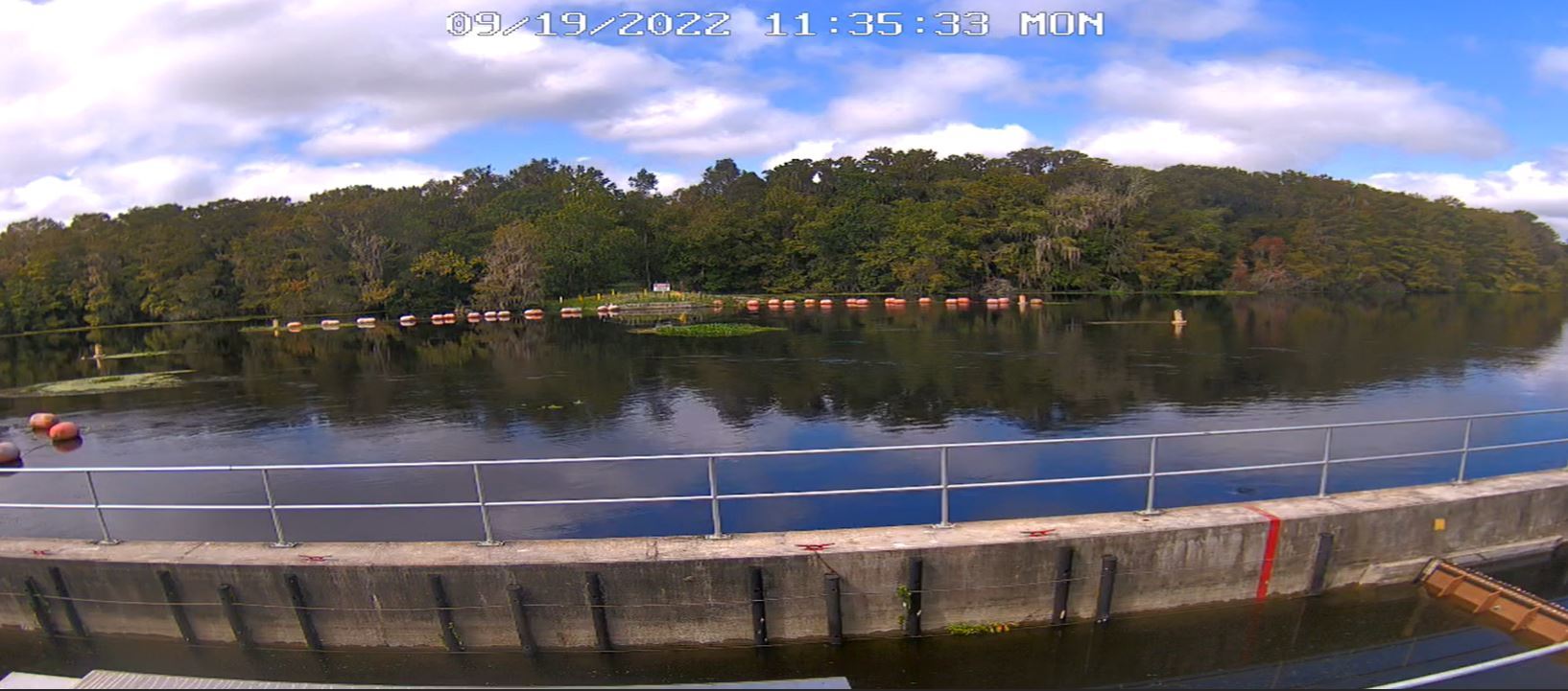
- In early September, we began lowering the Wysong structure, in response to naturally rising river levels.
- More than a week ago, the Wysong structure was fully lowered and the boat barriers that span the river were removed.
- Heavy rainfall from Hurricane Ian could cause Lake Pan to rise another foot, matching the peak level observed last summer.
- The Withlacoochee River will likely not peak from Ian rainfall for at least 2-3 weeks.
- Uncertainty remains and depending on where Ian makes landfall, the impacts could be very different.
Image of Wysong Structure Fully Lowered (9/19/2022)
Lake Rousseau and the Lower Withlacoochee River (from Dunnellon to the Gulf of Mexico):
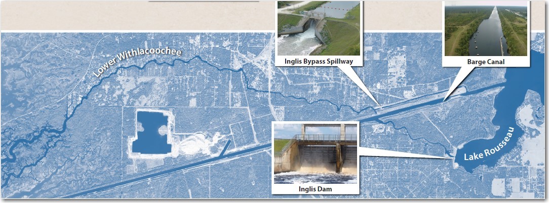
- Inflow to Lake Rousseau has more than doubled in the past month due to upstream rainfall from late August/early September.
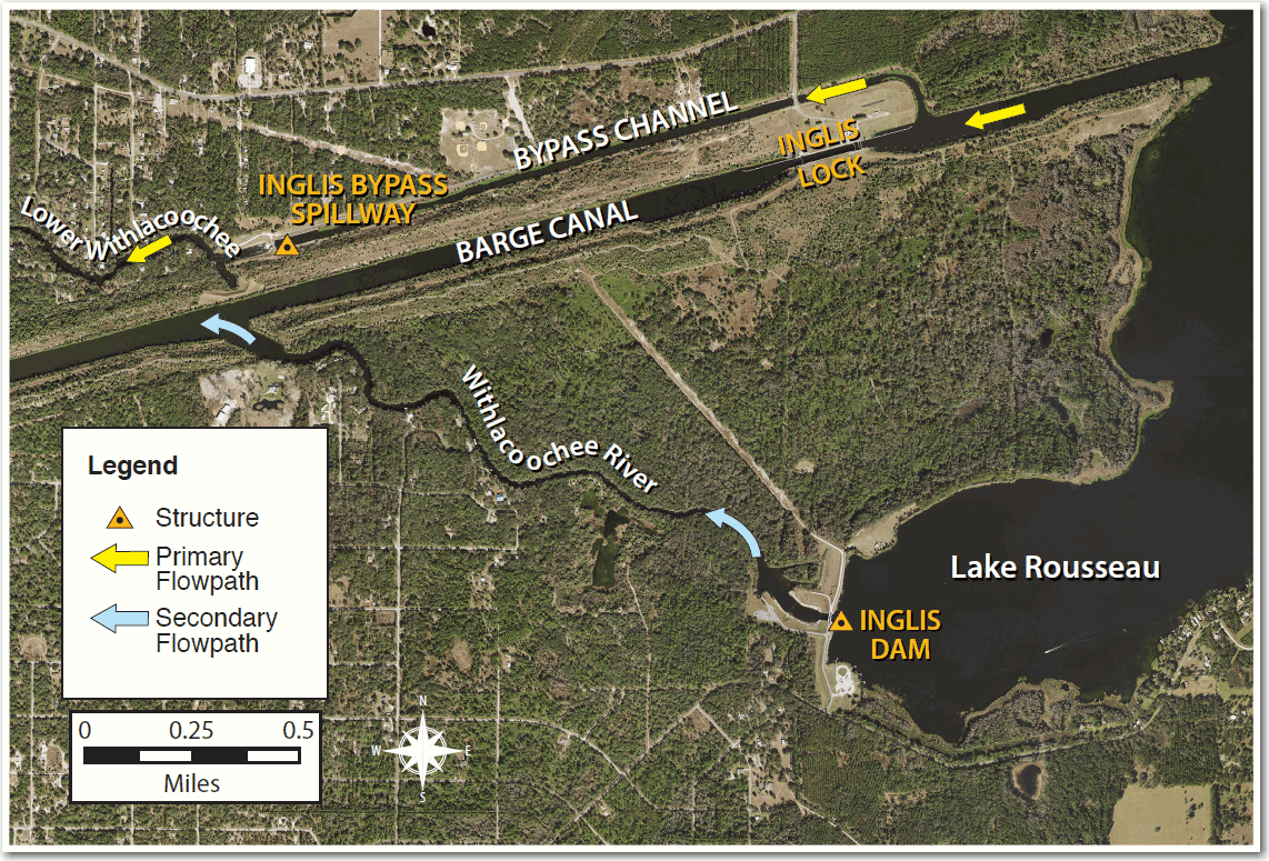
- For the past 2 weeks, the Inglis Bypass Structure has ben passing maximum flow to the Lower Withlacoochee River.
- The Inglis Man Dam has also been open since Sept 12th, sending excess flow to the Barge Canal and Gulf of Mexico.
- Starting this morning, the Inglis Dam is being opened further, lowering Lake Rousseau in preparation of Hurricane Ian.
- The goal is the lower the west end of Lake Rousseau by about 6 inches to help limit potential flooding near Dunnellon.
- Upstream of Dunnellon, the Inglis Dam has little to no impact on river levels during high flow conditions.
- If you live on the Lower Withlacoochee River or other coastal areas, please take the necessary precautions for a potentially high storm surge.
Be safe this week!
Mark
Mark Fulkerson, Ph.D., P.E.
Chief Professional Engineer
Water Resources Bureau
Southwest Florida Water Management District
(352) 269-6073 (office)
(352) 279-4493 (cell)

