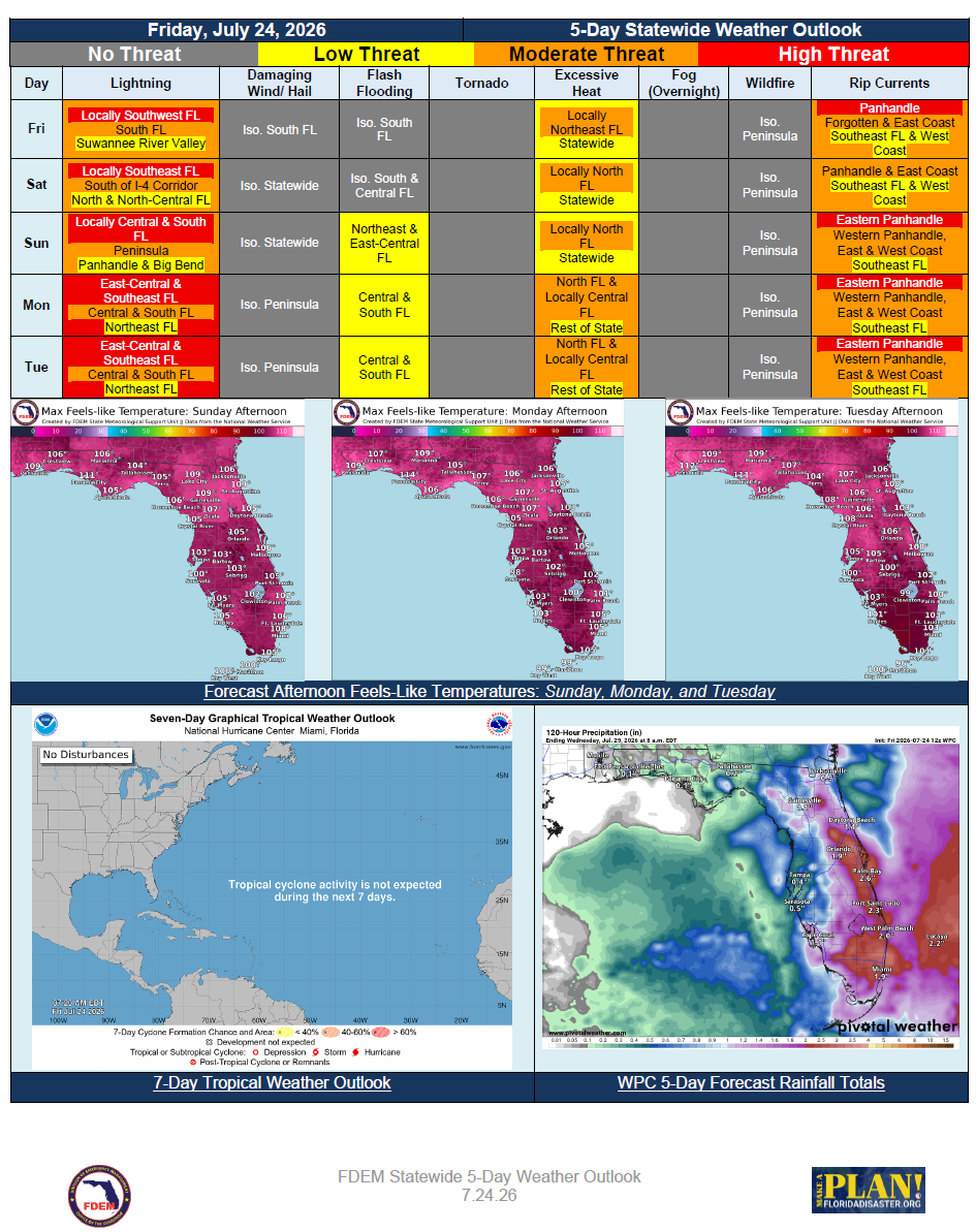
5 Day Statewide Weather Outlook for Fri. 7/24 to Tue. 7/28
Florida Division of Emergency Management sent this bulletin at 07/24/2026 12:27 PM EDT
This update is intended for government and emergency response officials, and is provided for informational and situational awareness purposes only. Forecast conditions are subject to change based on a variety of environmental factors. For additional information, or for any life safety concerns with an active weather event please contact your County Emergency Management or Public Safety Office or local National Weather Service forecast office.
You are subscribed to 5 Day Weather Outlook for Florida Division of Emergency Management. This information has recently been updated, and is now available.
…Persistent Heat and Humidity to Headline the Upcoming Forecast Period… Feels-Like
Temperatures in the Middle to Upper 100s Across North Florida… Localized Areas Reaching 110-
Degrees the First Half of Next Week; Heat Advisories Likely to be Issued… Increasing Chances of
Afternoon Showers and Storms Across North Florida this Weekend, Becoming Drier to Start Next
Week… Rounds of Showers and Storms Expected Each Day Across Portions of Central & South
Florida… Areas of Flooding Possible With Daily Heavy Downpours… Frequent Lightning and Gusty
Winds to Accompany any Strong Thunderstorm Activity… Moderate to High Risk for Rip Currents
for Most Statewide Beaches… No Tropical Cyclone Activity Expected in Next 7 Days…