5 Day Statewide Weather Outlook for Tue. 5/12 to Sat. 5/16
Florida Division of Emergency Management sent this bulletin at 05/12/2026 11:41 AM EDT
This update is intended for government and emergency response officials, and is provided for informational and situational awareness purposes only. Forecast conditions are subject to change based on a variety of environmental factors. For additional information, or for any life safety concerns with an active weather event please contact your County Emergency Management or Public Safety Office or local National Weather Service forecast office.
You are subscribed to 5 Day Weather Outlook for Florida Division of Emergency Management. This information has recently been updated, and is now available.
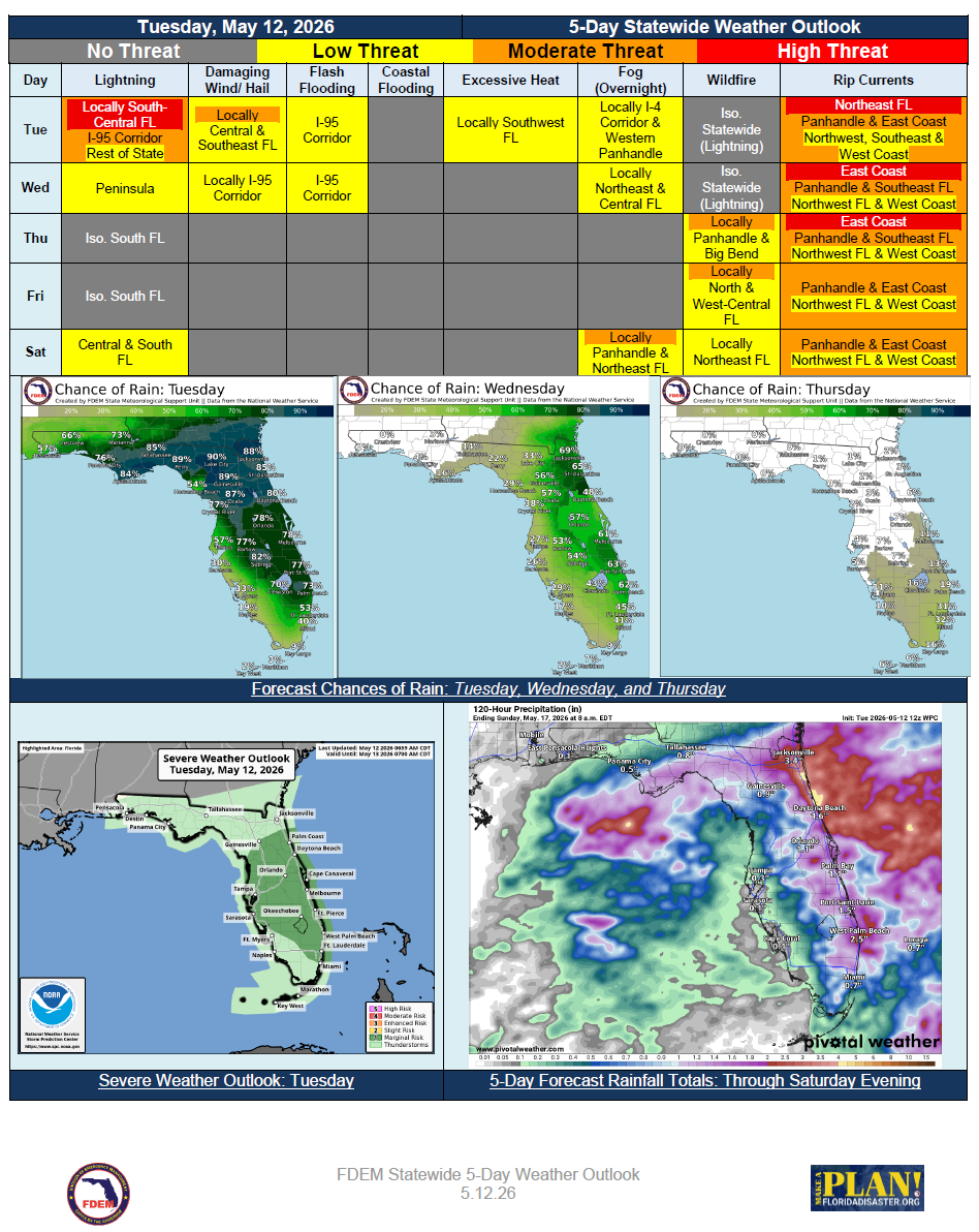
…Rainy Start to the Week Turns Dry in the Wake of the Cold Front Passage… Scattered Showers and Thunderstorms May Become Locally Strong to Severe Tuesday and Wednesday Over the Peninsula… Beneficial Rainfall Expected, Though Isolated Nuisance Flooding Possible in Urban Locations… Summerlike Temperatures Expected with Highs Returning to the 80s and 90s… Low Relative Humidities Return to North Florida Beginning Thursday… Moderate to High Risk for Rip Currents Along Panhandle and East Coast Beaches…