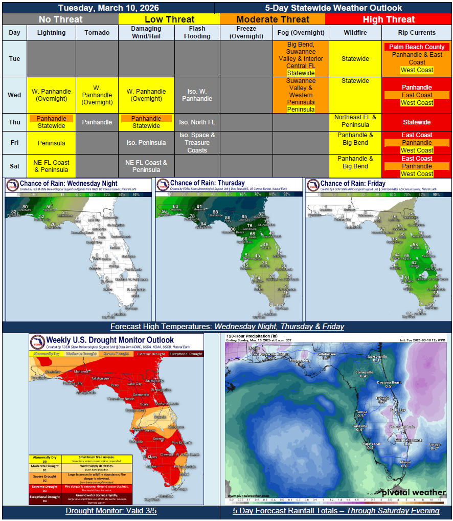
5 Day Statewide Weather Outlook for Tue. 3/10 to Sat. 3/14
Florida Division of Emergency Management sent this bulletin at 03/10/2026 12:07 PM EDT
This update is intended for government and emergency response officials, and is provided for informational and situational awareness purposes only. Forecast conditions are subject to change based on a variety of environmental factors. For additional information, or for any life safety concerns with an active weather event please contact your County Emergency Management or Public Safety Office or local National Weather Service forecast office.
You are subscribed to 5 Day Weather Outlook for Florida Division of Emergency Management. This information has recently been updated, and is now available.
…Foggy Mornings Through Midweek…Dry Conditions and Above Seasonal Normal Temperatures to Start Off the Forecast Period…Cold Front Moving In Wednesday Night and Thursday to Bring Rounds of Showers and Thunderstorms…Embedded Strong to Severe Thunderstorms Possible for the Panhandle Early Thursday Morning…Cooler Temperatures Near Seasonal Normals Expected At the End of the Week…Shower and Embedded Thunderstorm Activity to Continue Across the Peninsula Through the Weekend…