5 Day Statewide Weather Outlook for Tue. 2/24 to Sat. 2/28
Florida Division of Emergency Management sent this bulletin at 02/24/2026 12:40 PM EST
This update is intended for government and emergency response officials, and is provided for informational and situational awareness purposes only. Forecast conditions are subject to change based on a variety of environmental factors. For additional information, or for any life safety concerns with an active weather event please contact your County Emergency Management or Public Safety Office or local National Weather Service forecast office.
You are subscribed to 5 Day Weather Outlook for Florida Division of Emergency Management. This information has recently been updated, and is now available.
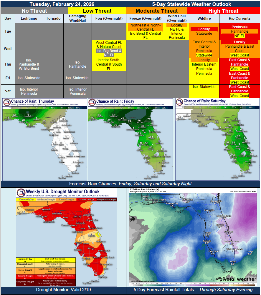
…Dry and Cold Start to the Forecast Period…Elevated Wildfire Conditions Statewide Tuesday…Temperatures Quickly Warm Up Midweek… Next Frontal System Moving Through To Bring Increasing Rain Chances Later this Week… Rain Chances Return to North Florida Thursday Then Expand Statewide Friday…Isolated Thunderstorms Possible At Times…Any Rainfall Will Help…Temperatures Could Reach 90-Mark for Interior Peninsula Friday and Saturday…Extreme Drought Conditions Now Covers Approximately 68% of the State…East Coast Beaches to See a High Risk for Rip Currents Each Day…