5 Day Statewide Weather Outlook for Tue. 1/13 to Sat. 1/17
Florida Division of Emergency Management sent this bulletin at 01/13/2026 03:14 PM EST
This update is intended for government and emergency response officials, and is provided for informational and situational awareness purposes only. Forecast conditions are subject to change based on a variety of environmental factors. For additional information, or for any life safety concerns with an active weather event please contact your County Emergency Management or Public Safety Office or local National Weather Service forecast office.
You are subscribed to 5 Day Weather Outlook for Florida Division of Emergency Management. This information has recently been updated, and is now available.
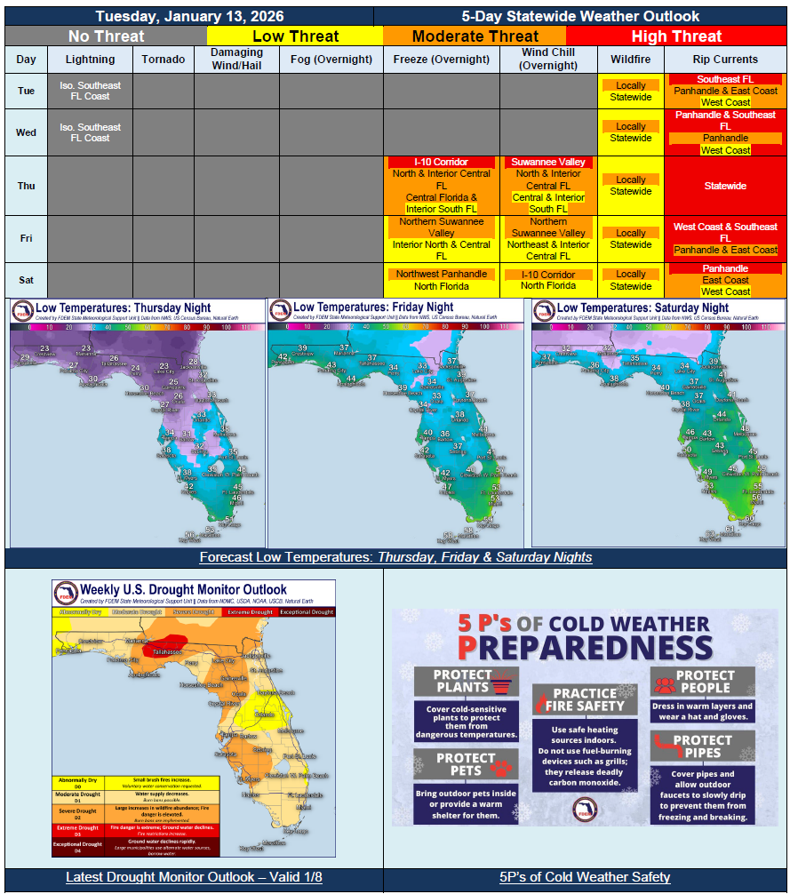
…Active Weather Pattern Leading to Below Normal Temperatures Across the State for The Next Few Days…Series of Cold Fronts Moving Through the State to Bring Cold Temperatures Far South Mid to Late Week…Sub-Freezing Temperatures to Extend To and Beyond I-4 Corridor Thursday Night; Widespread Freeze Warnings…Feels-Like Temperatures In the 20s and 30s to Extend To Lake Okeechobee Friday Morning; Cold Weather Advisories To Extend Well South…Fronts Could Bring Isolated Showers But Widespread Rainfall Not Expected…Drought Conditions Expanded Nearly Statewide…