5 Day Statewide Weather Outlook for Fri. 1/9 to Tue. 1/13
Florida Division of Emergency Management sent this bulletin at 01/09/2026 02:14 PM EST
This update is intended for government and emergency response officials, and is provided for informational and situational awareness purposes only. Forecast conditions are subject to change based on a variety of environmental factors. For additional information, or for any life safety concerns with an active weather event please contact your County Emergency Management or Public Safety Office or local National Weather Service forecast office.
You are subscribed to 5 Day Weather Outlook for Florida Division of Emergency Management. This information has recently been updated, and is now available.
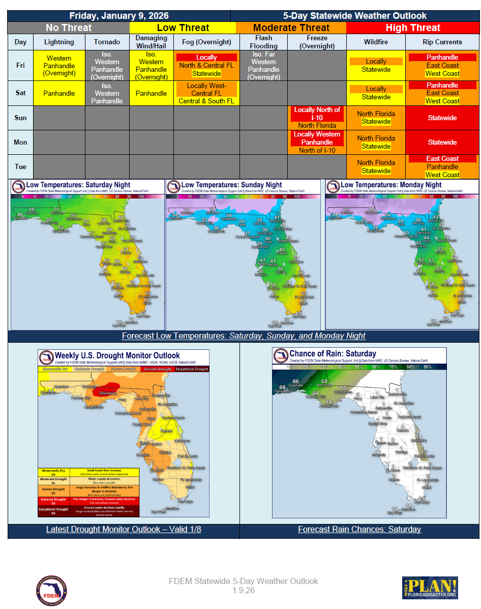
… Warmer than Normal Temperatures Persist to Start the Weekend… Areas of Dense Fog Develop Again Friday Night… Approaching Cold Frontal Passage Brings a Few Scattered Showers and Thunderstorms to the Panhandle Late Friday Night Through Saturday… A Few Storms Could be Locally Strong; An Isolated Severe Storm is Possible… Rainfall Totals Look to Remain Mostly Minimal… Cold Front Sweeps through the Rest of the Peninsula Sunday with Meager Rainfall Chances… Breezier Conditions Ahead of and in the Wake of the Frontal Passage… Locally Elevated Wildfire Conditions Return to North Florida Sunday… Temperatures Cool in the Wake of the Cold Front… Lows Dip to Near or Below Freezing Across the I-10 Corridor and Panhandle Sunday and Monday Night… Elevated Marine Conditions Return Late this Weekend and Early Next Week…