5 Day Statewide Weather Outlook
Florida Division of Emergency Management sent this bulletin at 12/16/2025 02:12 PM EST
This update is intended for government and emergency response officials, and is provided for informational and situational awareness purposes only. Forecast conditions are subject to change based on a variety of environmental factors. For additional information, or for any life safety concerns with an active weather event please contact your County Emergency Management or Public Safety Office or local National Weather Service forecast office.
You are subscribed to 5 Day Weather Outlook for Florida Division of Emergency Management. This information has recently been updated, and is now available.
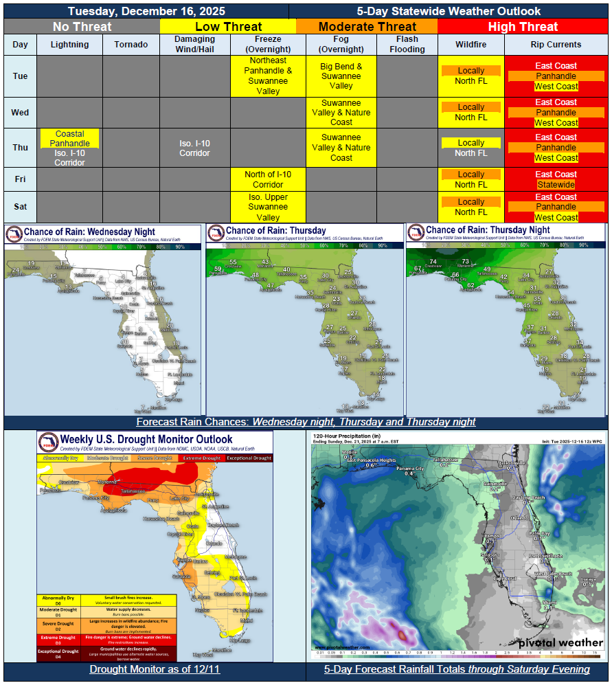
…Dry Conditions Across the State Through Wednesday With Light Sprinkles Along the East Coast…Rain Chances Return to North and Central Florida Thursday and Thursday Night; Best Chance of Rain to Remain Along the Panhandle and Big Bend…Embedded Rumbles of Thunder Closer Towards the Coast…Cold Front to Sweep Through the State Thursday and Thursday Night…Dry Conditions Return Friday and Saturday…Relative Humidity Values to Fall Below Critical Thresholds Across North Florida Friday and Saturday Afternoons…Patchy Fog Possible Tuesday and Wednesday Nights for the Big Bend and Nature Coast…Improvements Made to the Drought Monitor Courtesy of Widespread Rainfall…