5 Day Statewide Weather Outlook for Fri. 12/12 to Tue. 12/16
Florida Division of Emergency Management sent this bulletin at 12/12/2025 02:31 PM EST
This update is intended for government and emergency response officials, and is provided for informational and situational awareness purposes only. Forecast conditions are subject to change based on a variety of environmental factors. For additional information, or for any life safety concerns with an active weather event please contact your County Emergency Management or Public Safety Office or local National Weather Service forecast office.
You are subscribed to 5 Day Weather Outlook for Florida Division of Emergency Management. This information has recently been updated, and is now available.
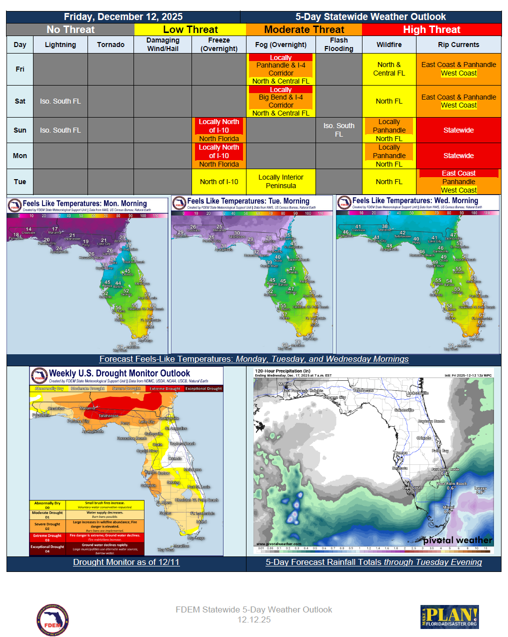
… Dry and Sunny Start to the Weekend as Surface High Pressure Remains Anchored Over the
State… Upper-Level Disturbance Approaches Southern Peninsula Saturday Night and Sunday
with Widely Scattered Showers… Patchy Dense Fog Possible Across Big Bend and Suwannee
Valley Saturday and Sunday Mornings…Potent Cold Front Passes Through North Florida
Sunday Bringing Little Rain but Breezy Winds Across the Panhandle… Marine Hazards
Increase Statewide Sunday… Arctic Chill Arrives Sunday Night with Wind Chills Approaching
Upper Teens to Lower 20s Across North Florida… Cooler and Dry Conditions Prevail to Start
Next Week…