5 Day Statewide Weather Outlook for Tue. 12/9 to Sat. 12/13
Florida Division of Emergency Management sent this bulletin at 12/09/2025 12:53 PM EST
This update is intended for government and emergency response officials, and is provided for informational and situational awareness purposes only. Forecast conditions are subject to change based on a variety of environmental factors. For additional information, or for any life safety concerns with an active weather event please contact your County Emergency Management or Public Safety Office or local National Weather Service forecast office.
You are subscribed to 5 Day Weather Outlook for Florida Division of Emergency Management. This information has recently been updated, and is now available.
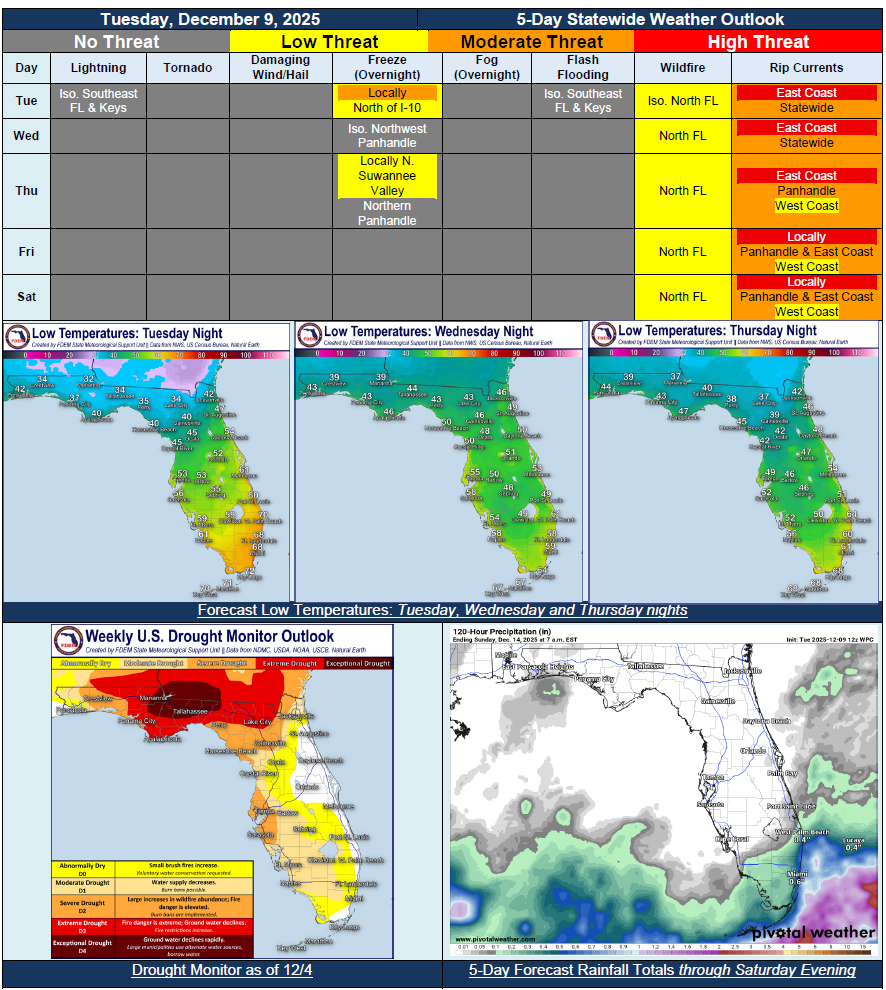
…Dry and Cool Start to the Forecasting Period With Lingering Showers Over South Florida and the Keys…Mostly Dry and Sunny Conditions Return Statewide Midweek…Frost Possibly Early Wednesday Morning North of the I-10 Corridor…Weak and Dry Cold Front to Push Through the State Wednesday and Thursday Helping to Reinforce Dry Conditions…Locally Sensitive Wildfire Conditions May Return to North Florida As Dry Conditions Return Over Longer Term Drought Conditions…Showers Possibly to Return Across South Florida on Saturday, But There Is Uncertainty…Recent Rainfall to Help Streamflow and Drought Conditions Across the Panhandle and West-Central Florida…