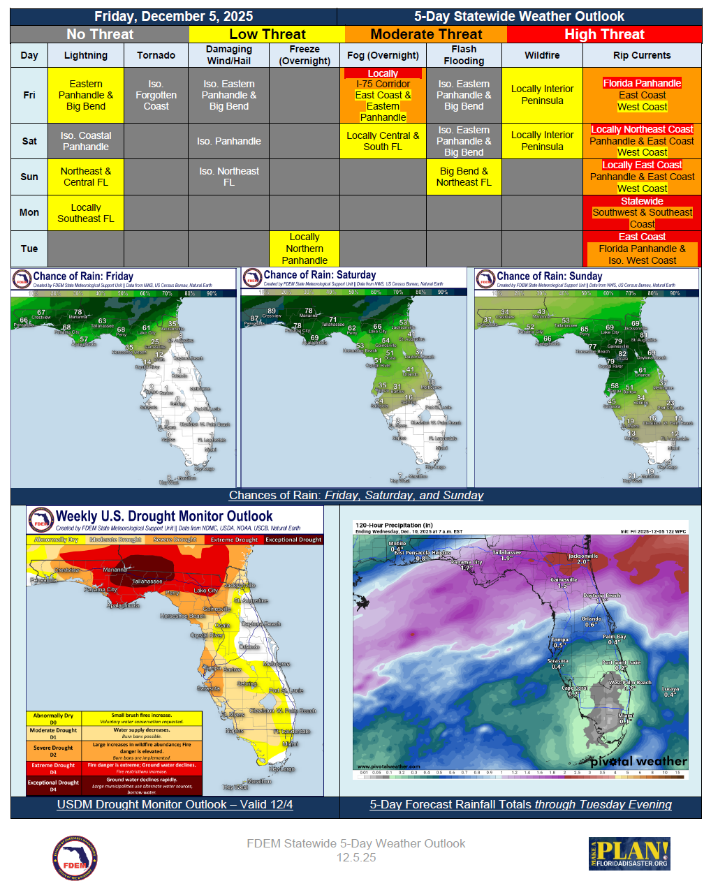
5 Day Statewide Weather Outlook for Fri. 12/5 to Tue. 12/9
Florida Division of Emergency Management sent this bulletin at 12/05/2025 03:23 PM EST
This update is intended for government and emergency response officials, and is provided for informational and situational awareness purposes only. Forecast conditions are subject to change based on a variety of environmental factors. For additional information, or for any life safety concerns with an active weather event please contact your County Emergency Management or Public Safety Office or local National Weather Service forecast office.
You are subscribed to 5 Day Weather Outlook for Florida Division of Emergency Management. This information has recently been updated, and is now available.
…Stalled Frontal Boundary Focuses Numerous Rounds of Showers and Embedded
Thunderstorms Across North Florida Through the Weekend… Locally Heavy Rainfall and Flash
Flooding Possible… A Few Thunderstorms Could be Locally Strong… Front Sags Southward
Towards Central and South Florida Sunday and Monday… Rainfall Keeps Wildfire Risk Low,
Though Ongoing Drought May Still Lead to Sensitive Conditions Across the Interior Peninsula
this Weekend… Cooler and Drier Conditions Return in the Wake of the Front Early Next
Week… Frost and Freeze Potential Returns to Northern Panhandle Tuesday Night…