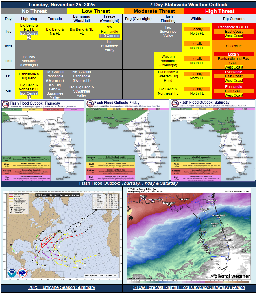
5 Day Statewide Weather Outlook for Tue 12/2 to Sat. 12/6
Florida Division of Emergency Management sent this bulletin at 12/02/2025 03:44 PM EST
This update is intended for government and emergency response officials, and is provided for informational and situational awareness purposes only. Forecast conditions are subject to change based on a variety of environmental factors. For additional information, or for any life safety concerns with an active weather event please contact your County Emergency Management or Public Safety Office or local National Weather Service forecast office.
You are subscribed to 5 Day Weather Outlook for Florida Division of Emergency Management. This information has recently been updated, and is now available.
…Wet Morning Across Panhandle and North Florida on Tuesday Before Shower Activity Becomes More Isolated Later in the Day…Cold Front to Sweep Through the State Tuesday and into Wednesday Morning Allowing Dry Conditions to Return…Brief Lull in Activity Between Frontal Systems…Next Frontal System Approaches From the West Thursday…Widespread Rainfall to Spread Eastward Through the End of the Week and Weekend With this Next Frontal System Across North Florida…Locally Heavy Rainfall Possible, Which is Much Needed to Help with Ongoing Drought Conditions…Isolated Strong to Severe Thunderstorms Possible Closer Towards the Panhandle Coast Friday and Saturday with Frontal System…Still Lots of Uncertainty About Next Frontal System…2025 Hurricane Season Comes to an End…