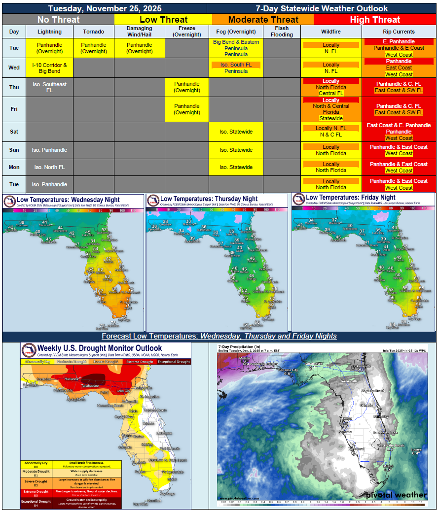
5 Day Statewide Weather Outlook for Tue. 11/25 to Tue. 12/2
Florida Division of Emergency Management sent this bulletin at 11/25/2025 03:56 PM EST
This update is intended for government and emergency response officials, and is provided for informational and situational awareness purposes only. Forecast conditions are subject to change based on a variety of environmental factors. For additional information, or for any life safety concerns with an active weather event please contact your County Emergency Management or Public Safety Office or local National Weather Service forecast office.
You are subscribed to 5 Day Weather Outlook for Florida Division of Emergency Management. This information has recently been updated, and is now available.
…Cold Front Bringing Isolated Chance for Showers and Thunderstorms to the Panhandle and Big Bend Tuesday Night into Wednesday…Severe Weather Possible for the Panhandle – All Hazards Possible…Chance for Brief Showers Continues Across Portions of South Florida Through Thursday As the Front Moves Through…Elevated Wildfire Danger Returns to North and Central Florida Thursday With Very Low Relative Humidity Values and Breezy Winds…Patchy Frost or Light Freeze Possible Overnight Thursday and Into Friday Morning With Temperatures Falling Near or Just Below Freezing Across North Florida…Gradual Warming Trend Returns this Weekend…Next Chance of Rain Possible Late this Weekend and Early Next Week with Next Frontal System, But There Remains A Lot of Uncertainty…