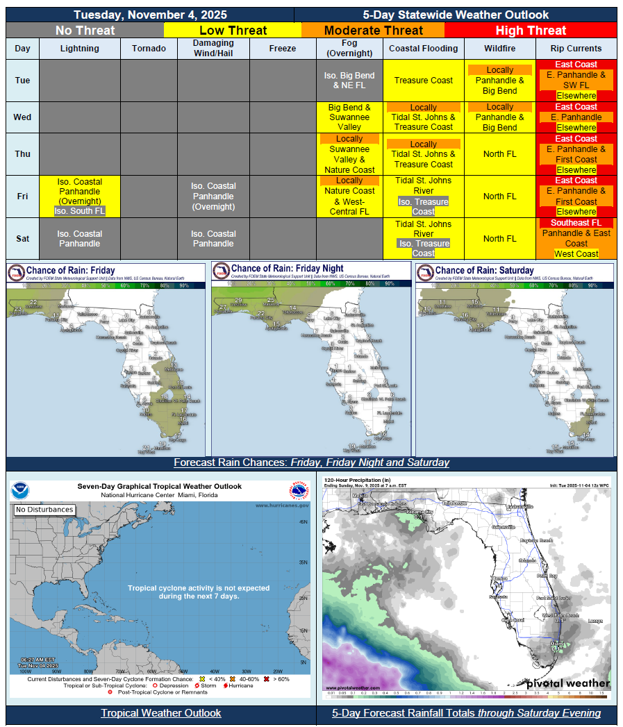
5 Day Statewide Weather Outlook for Tue. 11/4 to Sat. 11/8
Florida Division of Emergency Management sent this bulletin at 11/04/2025 03:01 PM EST
This update is intended for government and emergency response officials, and is provided for informational and situational awareness purposes only. Forecast conditions are subject to change based on a variety of environmental factors. For additional information, or for any life safety concerns with an active weather event please contact your County Emergency Management or Public Safety Office or local National Weather Service forecast office.
You are subscribed to 5 Day Weather Outlook for Florida Division of Emergency Management. This information has recently been updated, and is now available.
…Near-Zero Chance of Rain Across the Sunshine State Through Midweek At Least…Breezy Winds Across Peninsula on Tuesday Before Calming Down…Sensitive Wildfire Conditions Persist Throughout Northern Florida Given Worsening Drought Conditions…Patchy Fog Possible Each Night Through End of the Week…Possible Chance for Showers Or Maybe Thunderstorms Along Panhandle At End of the Week; Showers Possibly Returning to South Florida Too…Temperatures On a Warming Trend Throughout the Week In Wake of Cold Front Earlier in the Week…No Tropical Cyclone Activity Expected During Next 7 Days in the Atlantic Basin…