5 Day Statewide Weather Outlook for Tue. 10/14 to Sat. 10/18
Florida Division of Emergency Management sent this bulletin at 10/14/2025 03:37 PM EDT
This update is intended for government and emergency response officials, and is provided for informational and situational awareness purposes only. Forecast conditions are subject to change based on a variety of environmental factors. For additional information, or for any life safety concerns with an active weather event please contact your County Emergency Management or Public Safety Office or local National Weather Service forecast office.
You are subscribed to 5 Day Weather Outlook for Florida Division of Emergency Management. This information has recently been updated, and is now available.
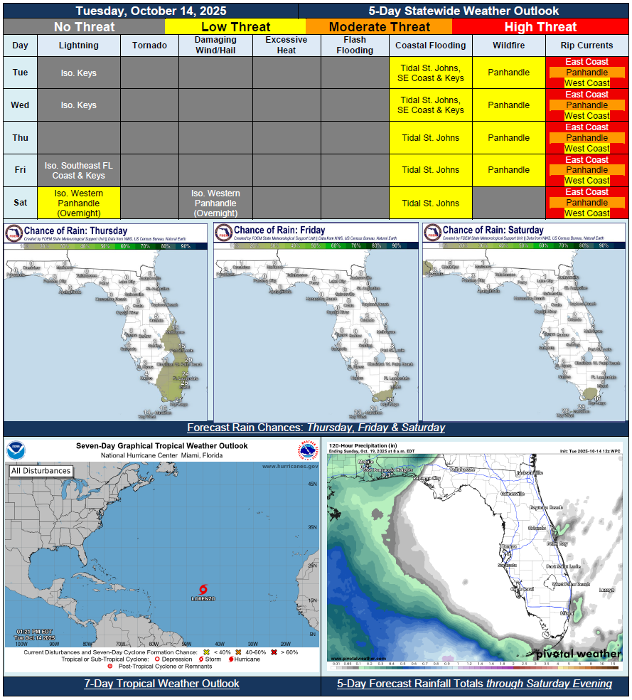
…Mostly Dry and Pleasant Conditions Across the State Through the Rest of the Week…Fresh Round of Northeasterly Winds Return Mid-to-Late Week for Eastern Coastline…Onshore Winds Could Bring Brief Showers Onshore for Portions of East Coast and Keys…Weak Front Moving Along Eastern Peninsula to Reinforce Dry Conditions…Showers and Embedded Rumbles of Thunder Possible Overnight Saturday for Western Panhandle Ahead of Next Frontal System Approaching Later this Weekend…Increasing Wildfire Conditions for Panhandle Given Lack of Rainfall, Warm Conditions and Relative Humidity Values Falling Near Critical Thresholds…Minor Coastal Flooding to Continue Along St. Johns River and Northeast Florida Coast Through the Week…