5 Day Statewide Weather Outlook
Florida Division of Emergency Management sent this bulletin at 10/07/2025 04:06 PM EDT
This update is intended for government and emergency response officials, and is provided for informational and situational awareness purposes only. Forecast conditions are subject to change based on a variety of environmental factors. For additional information, or for any life safety concerns with an active weather event please contact your County Emergency Management or Public Safety Office or local National Weather Service forecast office.
You are subscribed to 5 Day Weather Outlook for Florida Division of Emergency Management. This information has recently been updated, and is now available.
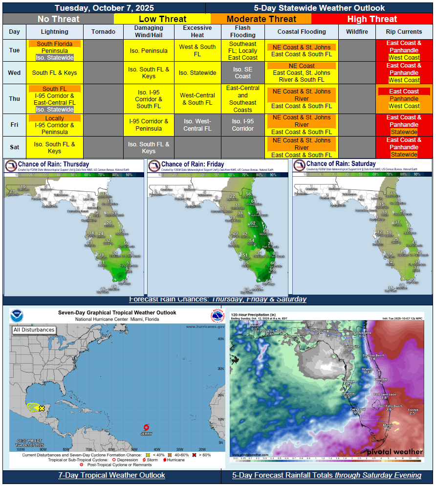
…Drier Conditions Across North Florida With the Help of High Pressure…Wet and Unsettled Pattern Continues Across South Florida…Weak Fall Cold Front to Push Through State Mid-to-Late Week…Breezy Northeasterly Winds Return In Wake of Front…Onshore Winds Keep Shower Activity Ongoing for Much of East Coast and South Florida Throughout Week…Non-Tropical Low Pressure to Develop Off Florida East Coast and Move Northward…Gusty Winds Developing Along Northeast Coast – Wind Advisories Possible Thursday…Front Pushes Offshore Saturday Bringing Taste of Fall Across State…Low Temperatures Fall Into 60s Overnight Across North Florida Friday and Saturday…Additional Coastal Flooding Anticipated Along East Coast (St. Johns River) and South Florida; Coastal Flood Watches/Warnings Likely Midweek…Significant Beach Erosion Possible for Vulnerable Northeast Beaches…