5 Day Statewide Weather Outlook for Tue. 9/30 to Sat. 10/4
Florida Division of Emergency Management sent this bulletin at 09/30/2025 04:54 PM EDT
This update is intended for government and emergency response officials, and is provided for informational and situational awareness purposes only. Forecast conditions are subject to change based on a variety of environmental factors. For additional information, or for any life safety concerns with an active weather event please contact your County Emergency Management or Public Safety Office or local National Weather Service forecast office.
You are subscribed to 5 Day Weather Outlook for Florida Division of Emergency Management. This information has recently been updated, and is now available.
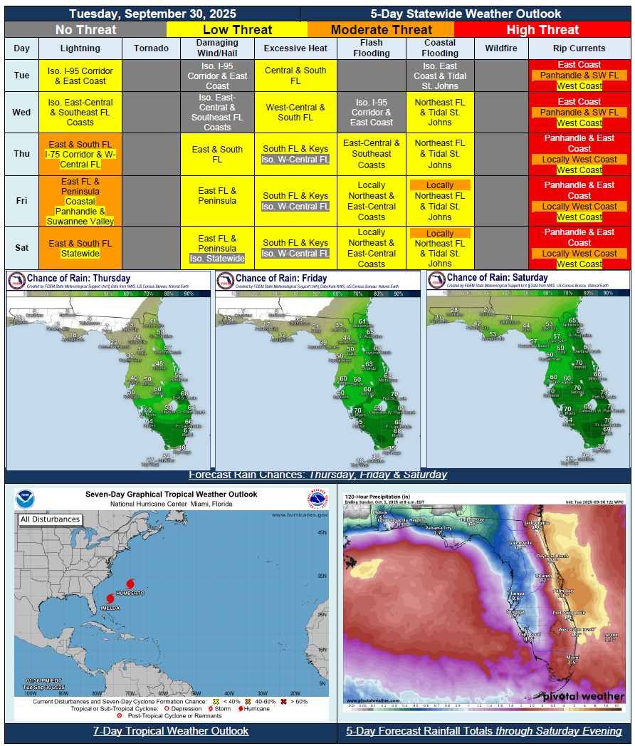
…Breezy Winds from Distant Imelda to Continue Through Midweek Along East Coast; Bring Isolated Showers Onshore…Drier Air Through Midweek Leading to Spotty Rain Chances For Much of Rest of State…Increasing Wet and Active Weather Pattern Returns Heading Into Late Week and Weekend…Breezy and Gusty Winds to Continue Across Eastern Florida Through Latter Portions of the East- Wind Advisories Possible for Northeast Coast…Possible Flash Flooding Along Portions of East Coast and I-95 Corridor Beginning Thursday…Heat Index Values Remaining Below Critical Thresholds for Much of State…Hazardous Beach and Boating Conditions Continue for East Coast Throughout the Week…Instances Minor to Locally Moderate Coastal Flooding Anticipated Along St. Johns River and Northeast Florida Coast…Dangerous Rip Current Risk for Most Beaches Statewide By End of Week…