5 Day Statewide Weather Outlook for Tue. 9/16 to Sat. 9/20
Florida Division of Emergency Management sent this bulletin at 09/16/2025 03:21 PM EDT
This update is intended for government and emergency response officials, and is provided for informational and situational awareness purposes only. Forecast conditions are subject to change based on a variety of environmental factors. For additional information, or for any life safety concerns with an active weather event please contact your County Emergency Management or Public Safety Office or local National Weather Service forecast office.
You are subscribed to 5 Day Weather Outlook for Florida Division of Emergency Management. This information has recently been updated, and is now available.
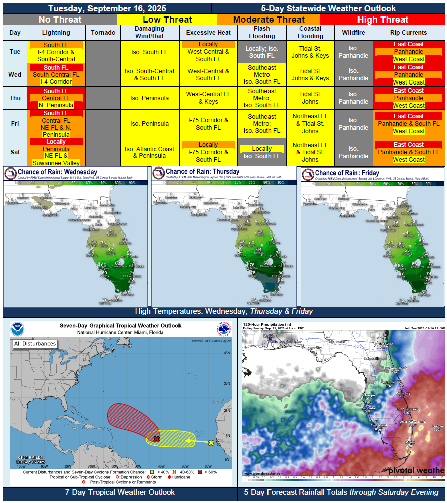
…Little Chances for Rainfall and Mostly Sunny Skies Across Much of North Florida Through the Week…Locally Sensitive Wildfire Conditions To Return for Panhandle Given Lack of Rainfall Over Last Couple of Weeks and No Relief This Week…Moisture Gradually Pushing Northward Each Day From South Florida and Into Peninsula…Wet and Active Weather Pattern For Rest of Work Week Across South Florida…Marginal Risk (Level 1 of 4) for Flash Flooding Along Southeast Metro and Coastline Beginning Wednesday Through Friday…Scattered Showers and Thunderstorms Returning to Central Florida and Atlantic Coast Mid-to-Late Week…Heat Index Values Could Briefly Reach 100-degrees for Portions of South Florida By Saturday…Instances of Minor Coastal and Tidal Flooding Within St. Johns River Basin Due to Trapped Tides and Onshore Winds…St. Johns River at Astor Remains Within Moderate Flood Stage…