5 Day Statewide Weather Outlook for Fri. 9/12 to Tue. 9/16
Florida Division of Emergency Management sent this bulletin at 09/12/2025 03:08 PM EDT
This update is intended for government and emergency response officials, and is provided for informational and situational awareness purposes only. Forecast conditions are subject to change based on a variety of environmental factors. For additional information, or for any life safety concerns with an active weather event please contact your County Emergency Management or Public Safety Office or local National Weather Service forecast office.
You are subscribed to 5 Day Weather Outlook for Florida Division of Emergency Management. This information has recently been updated, and is now available.
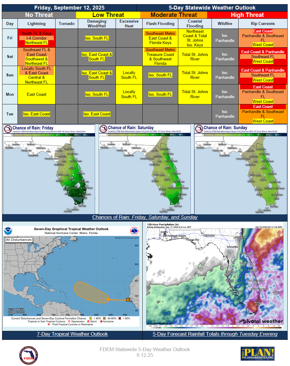
…Rainy Conditions Persist Over South Florida and East Coast as Lingering Frontal Boundary Remains Draped Over Region… Slight Risk (level 2 of 4) for Flash Flooding Over Southeast Florida Friday and Saturday… Rain Chances Decrease to Start Next Week… Northeasterly Winds Keep the Panhandle Dry Through the Forecast Period… Localized Wildfire Threat Increasing Across Panhandle… Heat Index Values Remain Seasonal Through Tuesday Statewide…Minor River Flooding Persists for St. Johns River at Astor…Elevated Surf and Breezy Onshore Winds Leading to High Risk for Rip Currents for East Coast and Panhandle Beaches Through Forecast Period… Minor Coastal Flooding Expected Along Tidal St. Johns River Due to Elevated and Trapped Tides…