5 Day Statewide Weather Outlook for Tue. 9/9 to Sat. 9/13
Florida Division of Emergency Management sent this bulletin at 09/09/2025 03:57 PM EDT
This update is intended for government and emergency response officials, and is provided for informational and situational awareness purposes only. Forecast conditions are subject to change based on a variety of environmental factors. For additional information, or for any life safety concerns with an active weather event please contact your County Emergency Management or Public Safety Office or local National Weather Service forecast office.
You are subscribed to 5 Day Weather Outlook for Florida Division of Emergency Management. This information has recently been updated, and is now available.
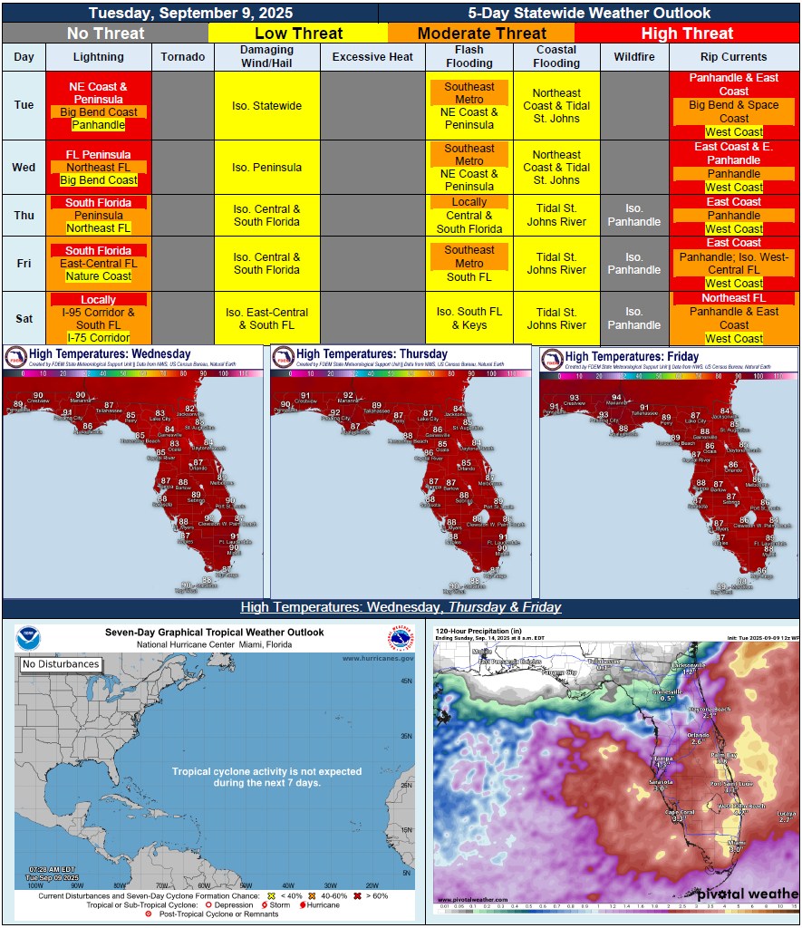
…Wet and Active Weather Conditions Persist Throughout Peninsula Due to Lingering Frontal Boundary…Daily Showers and Thunderstorms Expected Peaking In Afternoon and Evening…Rain Chances Begin to Decrease From North to South Friday and Saturday…Marginal Risk (Level 1 of 4) for Flash Flooding Each Day Through Friday Throughout Most of Peninsula…Mostly Dry Conditions Across the Panhandle Becoming Drier Later this Week…Heat Index Values Near or At Triple Digits Continue for Portions of South Florida…Minor River Flooding for St. Johns River at Astor…Elevated Surf and Onshore Winds Leading to High Risk for Rip Currents for Numerous East Coast Beaches Throughout the Week…Elevated and Trapped Tides and Elevated Surf Leading to Minor Coastal Flooding Along Northeast Coast and Tidal St. Johns River…