5 Day Statewide Weather Outlook for Fri. 9/5 to Tue. 9/9
Florida Division of Emergency Management sent this bulletin at 09/05/2025 03:13 PM EDT
This update is intended for government and emergency response officials, and is provided for informational and situational awareness purposes only. Forecast conditions are subject to change based on a variety of environmental factors. For additional information, or for any life safety concerns with an active weather event please contact your County Emergency Management or Public Safety Office or local National Weather Service forecast office.
You are subscribed to 5 Day Weather Outlook for Florida Division of Emergency Management. This information has recently been updated, and is now available.
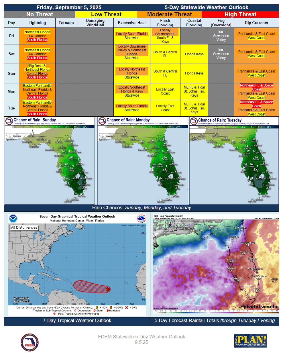
…Stalled Frontal Boundary Remains Draped Over South Florida Bringing Persistent Wet and Unsettled Weather Dry Conditions Continue Across Panhandle…Fresh Cold Front Arrives Across North and Central Florida Sunday Rainfall Chances Increase for Northeast Florida Next Week… Warming Trend Continues Into the Weekend… Triple Digit Heat Index Values Return Nearly Statewide Before Diminishing Monday… First King Tides Develop this Weekend; Instances of Minor Coastal and Tidal Flooding Possible for Florida Keys… Low Pressure Develops Off Northeast Florida Monday; Breezy Conditions Return Along First Coast… Coastal Flood Advisories Likely for Tidal St. Johns River and Coastal NE Florida… Tropical Wave Over Central Atlantic Has High (70%) Chance for Development Over Next 7 Days – No Threat to Florida At This Time…