5 Day Statewide Weather Outlook for Tue. 9/2 to Sat. 9/6
Florida Division of Emergency Management sent this bulletin at 09/02/2025 04:03 PM EDT
This update is intended for government and emergency response officials, and is provided for informational and situational awareness purposes only. Forecast conditions are subject to change based on a variety of environmental factors. For additional information, or for any life safety concerns with an active weather event please contact your County Emergency Management or Public Safety Office or local National Weather Service forecast office.
You are subscribed to 5 Day Weather Outlook for Florida Division of Emergency Management. This information has recently been updated, and is now available.
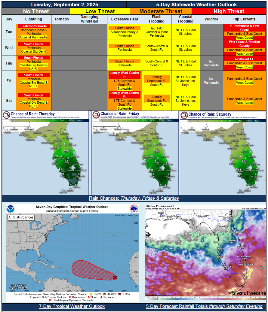
…Dry Conditions Return Across Panhandle; Isolated Activity Limited to Sea Breeze Pinned Along the Coast…Stalled Frontal Boundary and Upper-Level Disturbance To Create Wet and Active Weather Pattern Throughout the Peninsula Each Day…Marginal Risk for Flash Flooding Begins Wednesday and Continues Through Saturday Across South Florida…Shifts In the Front Could Shift Rain Chances North or South…General Warming Trend Expected Throughout the Week; Triple Digit Heat Index Values Return Nearly Statewide By Saturday…King Tides Developing Later This Week Ahead of Next Full Moon; Instances of Minor Coastal and Tidal Flooding Possible During Times of High Tide…Coastal Flood Advisories Already In Place for Tidal St. Johns River Due to Trapped Tides…Next Tropical Wave Moving Off African Coast Has High (70%) Chance for Development Over Next 7 Days – No Threat to Florida At This Time…