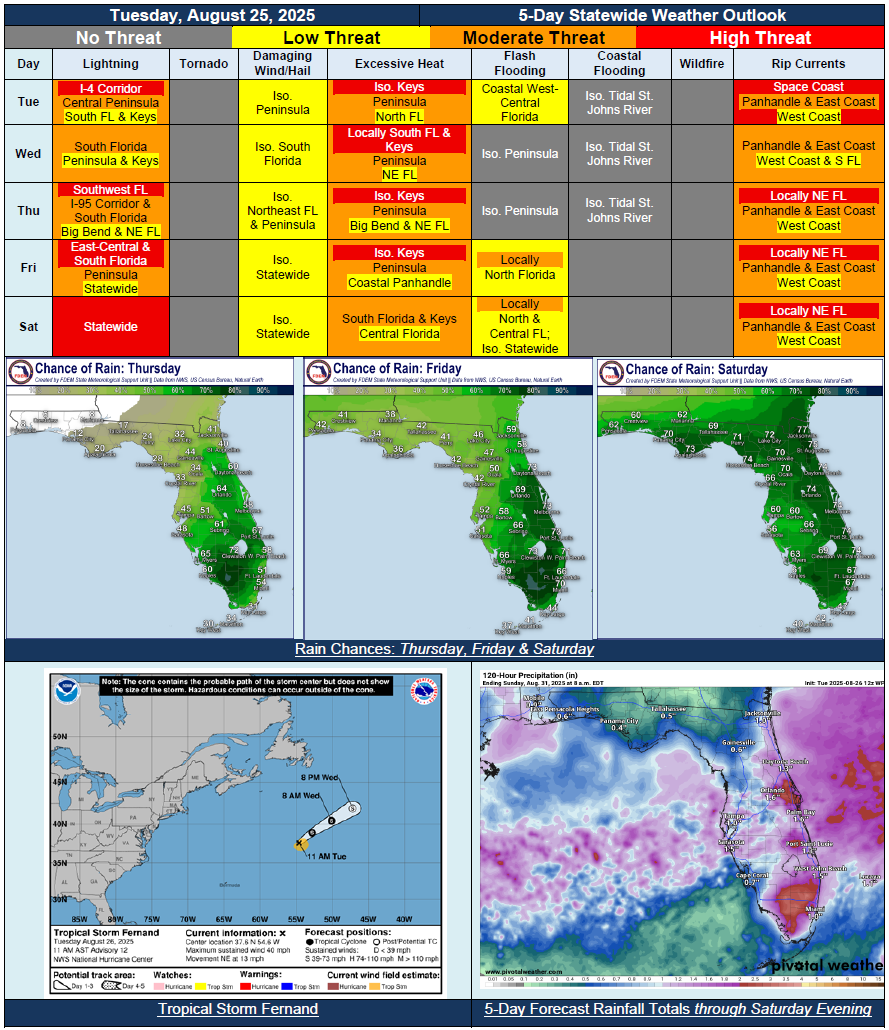
5 Day Statewide Weather Outlook for Tue. 8/26 to Sat. 8/30
Florida Division of Emergency Management sent this bulletin at 08/26/2025 04:23 PM EDT
This update is intended for government and emergency response officials, and is provided for informational and situational awareness purposes only. Forecast conditions are subject to change based on a variety of environmental factors. For additional information, or for any life safety concerns with an active weather event please contact your County Emergency Management or Public Safety Office or local National Weather Service forecast office.
You are subscribed to 5 Day Weather Outlook for Florida Division of Emergency Management. This information has recently been updated, and is now available.
…Dry Conditions Return Through Midweek Across North Florida In Wake of Passing Cool Front…Shower and Thunderstorm Activity to Remain Mostly Concentrated Along and South of I-4 Corridor Through Wednesday and Thursday…Another Front Approaches and Moves Into the State Friday and Saturday…Increasing Moisture Will Allow for Rain Chances to Expand Northward Through End of the Week…Widespread Rainfall Anticipated Statewide By Saturday…Heat Index Values Fall Below Triple Digits Across North Florida this Week; Triple Digits Continue for Portions of Peninsula this Week…Flash Flood Chances Increasing Friday and Saturday Throughout North and Central Florida With Increase Rain Chances…Football Forecasts Return…