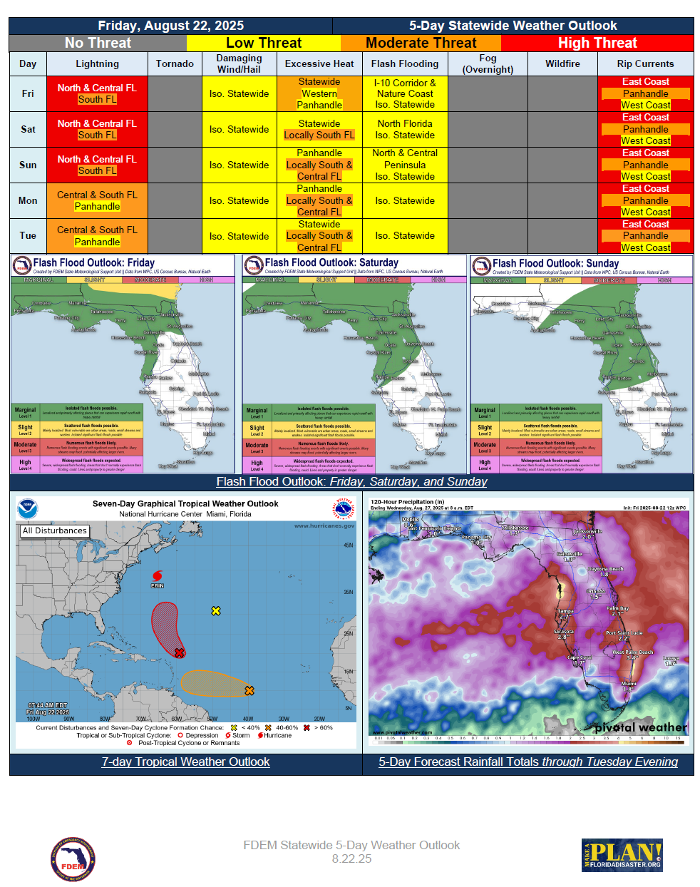
5 Day Statewide Weather Outlook for Fri. 8/22 to Tue 8/26
Florida Division of Emergency Management sent this bulletin at 08/22/2025 01:32 PM EDT
This update is intended for government and emergency response officials, and is provided for informational and situational awareness purposes only. Forecast conditions are subject to change based on a variety of environmental factors. For additional information, or for any life safety concerns with an active weather event please contact your County Emergency Management or Public Safety Office or local National Weather Service forecast office.
You are subscribed to 5 Day Weather Outlook for Florida Division of Emergency Management. This information has recently been updated, and is now available.
...Stalled Front in the Wake of Erin to Bring Wet and Unsettled Weather Across the State… Flash
Flooding Possible Over North Florida and I-10 Corridor Through the Weekend… Front Slowly
Drifts South Early Next Week Along With Greatest Rainfall Chances… Warm and Muggy
Conditions Persist Through Sunday… Possible Late Summer Cold Front Approaches North
Florida Monday Bringing Some Relief From Heat and Rainfall to Start Next Week… Dangerous
Rip Current Threat and Elevated Surf Remains from Distant Hurricane Erin…